184.2.225.1 - IP Lookup: Free IP Address Lookup, Postal Code Lookup, IP Location Lookup, IP ASN, Public IP
Country:
Region:
City:
Location:
Time Zone:
Postal Code:
IP information under different IP Channel
ip-api
Country
Region
City
ASN
Time Zone
ISP
Blacklist
Proxy
Latitude
Longitude
Postal
Route
Luminati
Country
Region
tn
City
jonesborough
ASN
Time Zone
America/New_York
ISP
BRSPD-PUBLIC
Latitude
Longitude
Postal
IPinfo
Country
Region
City
ASN
Time Zone
ISP
Blacklist
Proxy
Latitude
Longitude
Postal
Route
IP2Location
184.2.225.1Country
Region
tennessee
City
johnson city
Time Zone
America/New_York
ISP
Language
User-Agent
Latitude
Longitude
Postal
db-ip
Country
Region
City
ASN
Time Zone
ISP
Blacklist
Proxy
Latitude
Longitude
Postal
Route
ipdata
Country
Region
City
ASN
Time Zone
ISP
Blacklist
Proxy
Latitude
Longitude
Postal
Route
Popular places and events near this IP address
East Tennessee State University
Public university in Johnson City, Tennessee, US
Distance: Approx. 1805 meters
Latitude and longitude: 36.30333,-82.36917
East Tennessee State University (ETSU) is a public research university in Johnson City, Tennessee. It was historically part of the State University and Community College System of Tennessee under the Tennessee Board of Regents, but since 2016, the university has been transitioning to governance by its own board of trustees. As of May 2017, it is the fourth largest university in the state and has off-campus centers in nearby Kingsport, Elizabethton, and Sevierville.

ETSU/Mountain States Health Alliance Athletic Center
Distance: Approx. 1904 meters
Latitude and longitude: 36.30361111,-82.37083333
ETSU Athletics Center, previously known as the Memorial Center, and popularly referred to as the "Mini-Dome", is an 8,539-seat multi-purpose arena on the campus of East Tennessee State University in Johnson City, Tennessee. Until 2014, it hosted ETSU's men's and women's basketball teams. It also serves as the indoor venue for tennis and track.
TVA Credit Union Ballpark
Distance: Approx. 1277 meters
Latitude and longitude: 36.31861111,-82.34083333
TVA Credit Union Ballpark is a stadium in Johnson City, Tennessee. It is primarily used for baseball, and is the home field of Johnson City Doughboys in the summer collegiate Appalachian League. It was previously home to the Johnson City Cardinals Minor League Baseball team of the Appalachian League.
Mountain Home, Tennessee
Distance: Approx. 1796 meters
Latitude and longitude: 36.31055556,-82.37333333
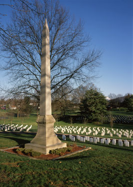
Mountain Home, zip code 37684, is a separate postal zone consisting of the grounds of the James H. Quillen VA hospital and Mountain Home National Cemetery, which also includes classrooms and administrative buildings of the East Tennessee State University James H. Quillen College of Medicine. It is entirely contained inside the city of Johnson City.
East Tennessee State University James H. Quillen College of Medicine
Public medical school in Johnson City, Tennessee, US
Distance: Approx. 1918 meters
Latitude and longitude: 36.3,-82.36666667
The James H. Quillen College of Medicine is a medical school and a part of East Tennessee State University, which is located in Johnson City, Tennessee. It is one of two public medical schools in Tennessee, the other being the University of Tennessee College of Medicine at the University of Tennessee Health Science Center in Memphis. It was named for Congressman Jimmy Quillen, who led the fight to open a second public medical school in Tennessee.
Science Hill High School
Public high school in Johnson City, Tennessee, United States
Distance: Approx. 1933 meters
Latitude and longitude: 36.32555556,-82.36944444
Science Hill High School is a public high school in Johnson City, Tennessee, United States.

Aquone
Historic house in Tennessee, United States
Distance: Approx. 1925 meters
Latitude and longitude: 36.32694444,-82.3675
Aquone (pronounced uh-KWAN-nee) is the home in Johnson City, Tennessee, where Tennessee jurist and historian Samuel Cole Williams lived in retirement. The home is listed on the National Register of Historic Places. Aquone was built in 1925.

Thankful Baptist Church (Johnson City, Tennessee)
Historic church in Tennessee, United States
Distance: Approx. 680 meters
Latitude and longitude: 36.31944444,-82.35111111
Princeton Free Will Baptist Church, formerly Thankful Baptist Church, is a historic church building at 104 Water Street in Johnson City, Tennessee. The brick church was built in 1912 to serve Thankful Baptist Church, an African-American congregation. Thankful Baptist Church moved to a new location on Watauga Avenue in 1975.
Thomas Stadium
College baseball stadium in Tennessee, U.S.
Distance: Approx. 1028 meters
Latitude and longitude: 36.310024,-82.364218
Thomas Stadium is a baseball venue in Johnson City, Tennessee, United States. It is home to the East Tennessee State Buccaneers baseball team of the NCAA Division I Southern Conference. Opened in 2012, the facility has a listed capacity of 1,000 spectators.

Mountain Branch, National Home for Disabled Volunteer Soldiers
United States historic place
Distance: Approx. 1796 meters
Latitude and longitude: 36.31055556,-82.37333333
The Mountain Branch, National Home for Disabled Volunteer Soldiers was an old soldiers' home opened in 1904 in Mountain Home, Johnson City, Tennessee. Its site has since been taken over by the United States Department of Veterans Affairs, and is home to the Mountain Home National Cemetery and the James H. Quillen VA Center. Also known as the Mountain Home, its campus was designated a National Historic Landmark District in 2011, as a well-preserved example of an early 20th-century veterans care facility.

Shelbridge
United States historic place
Distance: Approx. 1787 meters
Latitude and longitude: 36.32722222,-82.36444444
Shelbridge is a historic three-story mansion in Johnson City, Tennessee, U.S.. It serves as the official residence of the president of East Tennessee State University.
Archives of Appalachia
Distance: Approx. 1639 meters
Latitude and longitude: 36.3026,-82.3657
The Archives of Appalachia are located on the campus of East Tennessee State University (ETSU) in Johnson City, Tennessee. Containing books, rare manuscripts, photographs, and audio and moving-image recordings, the archives serve as a resource for scholarly and creative projects dealing with life in southern Appalachia.
Weather in this IP's area
overcast clouds
-3 Celsius
-3 Celsius
-4 Celsius
-2 Celsius
1021 hPa
77 %
1021 hPa
949 hPa
10000 meters
100 %

