Country:
 USA
USARegion:
City:
Latitude and Longitude:
Time Zone:
Postal Code:
IP information under different IP Channel
ip-api
Country
Region
City
ASN
Time Zone
ISP
Blacklist
Proxy
Latitude
Longitude
Postal
Route
IPinfo
Country
Region
City
ASN
Time Zone
ISP
Blacklist
Proxy
Latitude
Longitude
Postal
Route
MaxMind
Country
Region
City
ASN
Time Zone
ISP
Blacklist
Proxy
Latitude
Longitude
Postal
Route
Luminati
Country
USRegion
va
City
rockymount
ASN
Time Zone
America/New_York
ISP
SHENTEL
Latitude
Longitude
Postal
db-ip
Country
Region
City
ASN
Time Zone
ISP
Blacklist
Proxy
Latitude
Longitude
Postal
Route
ipdata
Country
Region
City
ASN
Time Zone
ISP
Blacklist
Proxy
Latitude
Longitude
Postal
Route
Popular places and events near this IP address
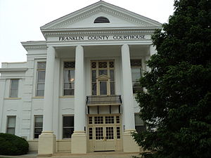
Franklin County, Virginia
County in Virginia, United States
Distance: Approx. 530 meters
Latitude and longitude: 36.99,-79.88
Franklin County is a county located in the Blue Ridge foothills of the Commonwealth of Virginia. As of the 2020 census, the population was 54,477. Its county seat is Rocky Mount.
Rocky Mount, Virginia
Town in Virginia, United States
Distance: Approx. 1213 meters
Latitude and longitude: 36.99555556,-79.88888889
Rocky Mount is a town in and the county seat of Franklin County, Virginia, United States. The town is part of the Roanoke Metropolitan Statistical Area, and had a population of 4,903 as of the 2020 census. It is located in the Roanoke Region of Virginia.
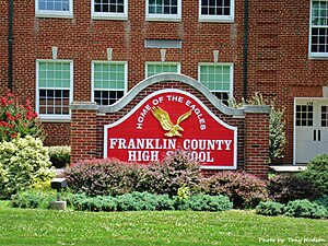
Franklin County High School (Rocky Mount, Virginia)
Public high school
Distance: Approx. 2085 meters
Latitude and longitude: 37.00422222,-79.87858333
Franklin County High School(FCHS) is located in Rocky Mount, Virginia. Approximately 2000 students attend Franklin County High School, which was founded in 1950. Since its founding, Franklin County High School, commonly known as FCHS, has grown to the largest school in the state west of Richmond.
Bald Knob (Franklin County, Virginia)
Summit in Franklin County, Virginia
Distance: Approx. 1473 meters
Latitude and longitude: 36.999,-79.88163889
Bald Knob is a summit located in Franklin County, Virginia. The summit has an elevation of 1400 feet and is a familiar landmark overlooking the county seat, Rocky Mount.
Grassy Hill Natural Area Preserve
Distance: Approx. 3992 meters
Latitude and longitude: 37.006,-79.9199
Grassy Hill Natural Area Preserve is a 1,440-acre (5.8 km2) Natural Area Preserve located in Franklin County, Virginia, just to the west of the town of Rocky Mount. The site is composed of rocky slopes with various hardwood species and patches of Virginia pine. Shallow basic soils, typified by heavy clay, are found among bedrock outcrops rich in magnesium.
Henry Fork, Virginia
Census-designated place in Virginia, United States
Distance: Approx. 2485 meters
Latitude and longitude: 36.96472222,-79.87361111
Henry Fork is an unincorporated community and census-designated place (CDP) in Franklin County, Virginia, United States, just south of Rocky Mount. The population as of the 2010 census was 1,234.
Redwood, Virginia
Unincorporated community in Virginia, United States
Distance: Approx. 7360 meters
Latitude and longitude: 37.02,-79.81194444
Redwood is an unincorporated community in Franklin County, Virginia, United States. Redwood is located on Virginia State Route 40 4.7 miles (7.6 km) east-northeast of Rocky Mount. Redwood has a post office with ZIP code 24146, which opened on August 9, 1880.

Greer House
Historic house in Virginia, United States
Distance: Approx. 1051 meters
Latitude and longitude: 36.99486111,-79.88611111
Greer House is a historic home located at Rocky Mount, Franklin County, Virginia. It is a two-story, three-bay, frame dwelling in the Greek Revival style. It has a low hipped roof and is sheathed on weatherboard.

Woods–Meade House
Historic house in Virginia, United States
Distance: Approx. 1288 meters
Latitude and longitude: 36.99666667,-79.88777778
Woods–Meade House, is a historic home located at Rocky Mount, Franklin County, Virginia. The original section was built about 1830, and is the brick, one cell, front section. It features a molded brick cornice, fine jack arches, and curious half-round brick pilasters and round brick porch supports.

The Farm (Rocky Mount, Virginia)
Historic house in Virginia, United States
Distance: Approx. 975 meters
Latitude and longitude: 36.98916667,-79.89291667
The Farm is a historic home located at Rocky Mount, Franklin County, Virginia. The house was probably built during the late-18th century, expanded in the 1820s, and heavily remodeled in the Greek Revival style around 1856. It is a two-story, frame dwelling sheathed in weatherboard with a single-pile, central-passage-plan.

Washington Iron Furnace
United States historic place
Distance: Approx. 823 meters
Latitude and longitude: 36.98694444,-79.89194444
Washington Iron Furnace is an historic iron furnace, located in Rocky Mount, Franklin County, Virginia. The granite furnace was built around 1770, and measures 30 feet high on its south face. It helped establish industry in the county, and was listed on the National Register of Historic Places in 1973.
Rocky Mount Historic District
Historic district in Virginia, United States
Distance: Approx. 1354 meters
Latitude and longitude: 36.99694444,-79.88888889
Rocky Mount Historic District is a national historic district located at Rocky Mount, Franklin County, Virginia. It encompasses 211 contributing buildings, 2 contributing sites (Mary Elizabeth Park and High Street Cemetery), 1 contributing site, and 2 contributing objects in the central business district and surround residential areas of Rocky Mount, county seat of Franklin County. It includes residential, commercial, institutional, and governmental buildings dated from the early- to mid-19th through early 20th centuries.
Weather in this IP's area
moderate rain
20 Celsius
20 Celsius
19 Celsius
21 Celsius
1013 hPa
96 %
1013 hPa
978 hPa
10000 meters
0.43 m/s
0.58 m/s
18 degree
11 %
07:05:20
19:21:03