Country:
 USA
USARegion:
City:
Latitude and Longitude:
Time Zone:
Postal Code:
IP information under different IP Channel
ip-api
Country
Region
City
ASN
Time Zone
ISP
Blacklist
Proxy
Latitude
Longitude
Postal
Route
IPinfo
Country
Region
City
ASN
Time Zone
ISP
Blacklist
Proxy
Latitude
Longitude
Postal
Route
MaxMind
Country
Region
City
ASN
Time Zone
ISP
Blacklist
Proxy
Latitude
Longitude
Postal
Route
Luminati
Country
USASN
Time Zone
America/Chicago
ISP
YAHOO-1
Latitude
Longitude
Postal
db-ip
Country
Region
City
ASN
Time Zone
ISP
Blacklist
Proxy
Latitude
Longitude
Postal
Route
ipdata
Country
Region
City
ASN
Time Zone
ISP
Blacklist
Proxy
Latitude
Longitude
Postal
Route
Popular places and events near this IP address

AOL
American internet portal
Distance: Approx. 14 meters
Latitude and longitude: 40.7308,-73.9914
AOL (stylized as Aol., formerly a company known as AOL Inc. and originally known as America Online) is an American web portal and online service provider based in New York City, and a brand marketed by Yahoo! Inc.

Astor Place station
New York City Subway station in Manhattan
Distance: Approx. 110 meters
Latitude and longitude: 40.72972222,-73.99166667
The Astor Place station, also called Astor Place–Cooper Union on signs, is a local station on the IRT Lexington Avenue Line of the New York City Subway. Located at Fourth Avenue, Cooper Square, and Astor Place between the East Village and NoHo, it is served by 6 trains at all times, <6> trains during weekdays in the peak direction, and 4 trains during late night hours. The Astor Place station was constructed for the Interborough Rapid Transit Company (IRT) as part of the city's first subway line, which was approved in 1900.

Alamo (sculpture)
Sculpture at Astor Place in Manhattan, New York, U.S.
Distance: Approx. 85 meters
Latitude and longitude: 40.73,-73.99111111
Alamo, also known as the Astor Place Cube or simply The Cube, is an outdoor sculpture by Tony Rosenthal, located on Astor Place, in the East Village neighborhood of Manhattan in New York City. It is a black cube, 8 feet (2.4 m) long on each side, mounted on a corner. The cube is made of Cor-Ten steel and weighs about 1,800 pounds (820 kg).
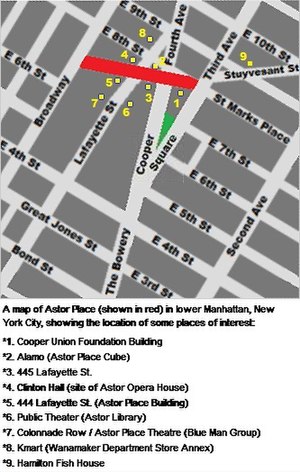
Astor Place
Street in Manhattan, New York
Distance: Approx. 94 meters
Latitude and longitude: 40.729861,-73.991434
Astor Place is a one-block street in NoHo/East Village, in the lower part of the New York City borough of Manhattan. It runs from Broadway in the west (just below East 8th Street) to Lafayette Street. The street encompasses two plazas at the intersection with Cooper Square, Lafayette Street, Fourth Avenue, and Eighth Street – Alamo Plaza and Astor Place Station Plaza.

Eighth Street–New York University station
New York City Subway station in Manhattan
Distance: Approx. 82 meters
Latitude and longitude: 40.730543,-73.992448
The Eighth Street–New York University station (sometimes shortened as 8th Street–NYU) is a local station on the New York City Subway's BMT Broadway Line. Located at the intersection of Eighth Street and Broadway in Greenwich Village, Manhattan, it is served by the R train at all times except late nights, the W train on weekdays, the N train during late nights and weekends, and the Q train during late nights. It serves the main campus of New York University.

Astor Place Riot
1849 theatre-related riot in Manhattan
Distance: Approx. 81 meters
Latitude and longitude: 40.729999,-73.991244
The Astor Place Riot occurred on May 10, 1849, at the now-demolished Astor Opera House in Manhattan and left between 22 and 31 rioters dead, and more than 120 people injured. It was the deadliest to that date of a number of civic disturbances in Manhattan, which generally pitted immigrants and nativists against each other, or together against the wealthy who controlled the city's police and the state militia. The riot resulted in the largest number of civilian casualties due to military action in the United States since the American Revolutionary War, and led to increased police militarization (for example, riot control training and larger, heavier batons).
Hetrick-Martin Institute
US non-profit organization for LGBTQ youth
Distance: Approx. 127 meters
Latitude and longitude: 40.730056,-73.992748
The Hetrick-Martin Institute (HMI) is a US non-profit organization devoted to serving the needs of lesbian, gay, bisexual, transgender, or questioning (LGBTQ) youth between the ages of 13 and 24, and their families.

St. Ann Church (Manhattan)
Former church in Manhattan, New York
Distance: Approx. 89 meters
Latitude and longitude: 40.73,-73.992
St. Ann’s Church was the name of a former Roman Catholic parish church at 110-120 East 12th Street between Fourth and Third Avenues in the East Village neighborhood of Manhattan, New York City.

Astor Opera House
Former theater in Manhattan, New York
Distance: Approx. 68 meters
Latitude and longitude: 40.73013889,-73.99180556
The Astor Opera House, also known as the Astor Place Opera House and later the Astor Place Theatre, was an opera house in Manhattan, New York City, located on Lafayette Street between Astor Place and East 8th Street. Designed by Isaiah Rogers, the theater was conceived by impresario Edward Fry, the brother of composer William Henry Fry, who managed the opera house during its entire history.

Sinclair House (Manhattan hotel)
Demolished hotel in Manhattan, New York
Distance: Approx. 89 meters
Latitude and longitude: 40.73,-73.992
Sinclair House was a 19th-century hotel which stood at 754 Broadway and Eighth Street in Manhattan, New York City. It was demolished in 1908.

770 Broadway
Commercial building in Manhattan, New York
Distance: Approx. 17 meters
Latitude and longitude: 40.7307,-73.9913
770 Broadway is a 1,200,000-square-foot (110,000 m2) landmarked mixed-use commercial office building in NoHo, Manhattan, in Lower Manhattan, New York City, occupying an entire square block between 9th Street on the north, Fourth Avenue to the east, 8th Street to the south, and Broadway to the west. The building is owned and managed by Vornado Realty Trust. It was completed in 1907 and renovated in 2000 per a design by Hugh Hardy.

51 Astor Place
Office building in Manhattan, New York
Distance: Approx. 113 meters
Latitude and longitude: 40.73027778,-73.99027778
51 Astor Place is an office building on Astor Place in the East Village neighborhood of Manhattan, New York City. It was developed by Edward J. Minskoff Equities. It is the headquarters of IBM's IBM Watson Group division.
Weather in this IP's area
clear sky
12 Celsius
12 Celsius
10 Celsius
13 Celsius
1014 hPa
80 %
1014 hPa
1013 hPa
10000 meters
3.09 m/s
290 degree
06:30:23
19:16:56