184.164.19.20 - IP Lookup: Free IP Address Lookup, Postal Code Lookup, IP Location Lookup, IP ASN, Public IP
Country:
 USA
USARegion:
City:
Location:
Time Zone:
Postal Code:
ISP:
ASN:
language:
User-Agent:
Proxy IP:
Blacklist:
IP information under different IP Channel
ip-api
Country
Region
City
ASN
Time Zone
ISP
Blacklist
Proxy
Latitude
Longitude
Postal
Route
db-ip
Country
Region
City
ASN
Time Zone
ISP
Blacklist
Proxy
Latitude
Longitude
Postal
Route
IPinfo
Country
Region
City
ASN
Time Zone
ISP
Blacklist
Proxy
Latitude
Longitude
Postal
Route
IP2Location
184.164.19.20Country
usRegion
michigan
City
moline
Time Zone
America/Detroit
ISP
Language
User-Agent
Latitude
Longitude
Postal
ipdata
Country
Region
City
ASN
Time Zone
ISP
Blacklist
Proxy
Latitude
Longitude
Postal
Route
Popular places and events near this IP address

Dorr Township, Michigan
Township in Michigan, United States
Distance: Approx. 4392 meters
Latitude and longitude: 42.73611111,-85.71694444
Dorr Township is a civil township of Allegan County in the southwest of the U.S. state of Michigan. The population was 7,922 at the 2020 census.
Leighton Township, Michigan
Township in Michigan, United States
Distance: Approx. 4209 meters
Latitude and longitude: 42.72833333,-85.61361111
Leighton Township is a civil township of Allegan County in the U.S. state of Michigan. The population was 7,001 at the 2020 census, up from 4,934 at the 2010 census.

Wayland, Michigan
City in Michigan, United States
Distance: Approx. 7319 meters
Latitude and longitude: 42.67388889,-85.64472222
Wayland is a city in Allegan County in the U.S. state of Michigan. The population was 4,435 at the 2020 census. The city is located at the northwest corner of Wayland Township, but is politically independent.

Byron Township, Michigan
Civil township in Michigan, United States
Distance: Approx. 9640 meters
Latitude and longitude: 42.8125,-85.72388889
Byron Township is a civil township of Kent County in the U.S. state of Michigan. The population was 26,927 at the 2010 census, an increase from 20,317 at the 2010 census. Byron Township is part of the Grand Rapids metropolitan area and is located just southwest of the city of Grand Rapids.

Byron Center, Michigan
Census-designated place & unincorporated community in Michigan, United States
Distance: Approx. 9567 meters
Latitude and longitude: 42.81222222,-85.72277778
Byron Center is an unincorporated community and census-designated place (CDP) in Kent County in the U.S. state of Michigan. The population was 7,431 at the 2020 census, which is a significant increase from a population of 5,822 at the 2010 census. Byron Center is located within Byron Township.
WGRD-FM
Rock radio station in Grand Rapids, Michigan
Distance: Approx. 6540 meters
Latitude and longitude: 42.796,-85.649
WGRD-FM (97.9 MHz) is a mainstream rock radio station in Grand Rapids, Michigan. The station is owned by Townsquare Media. It is the flagship station of The Free Beer and Hot Wings Show, a comedy/talk program, on weekday mornings.
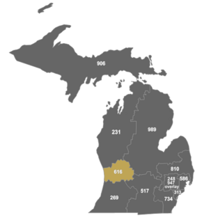
Area code 616
Area code for Western Michigan
Distance: Approx. 7209 meters
Latitude and longitude: 42.75,-85.75
Area code 616 is the telephone area code in the North American Numbering Plan (NANP) for Grand Rapids, Michigan and all or part of six surrounding counties. The numbering plan area comprises all of Kent and Ottawa counties, and parts of Allegan, Barry, Ionia and Montcalm counties. Besides Grand Rapids, it also serves the cities of Holland, Greenville, and Grand Haven.
WCSG
Radio station in Grand Rapids, Michigan
Distance: Approx. 6540 meters
Latitude and longitude: 42.796,-85.649
WCSG 91.3 MHz is a radio station in Grand Rapids, Michigan, United States, that broadcasts a Christian adult contemporary format. The station is part of Cornerstone Radio, a broadcast outreach ministry of Cornerstone University. WCSG typically competes for the most-listened station in the Grand Rapids radio market, according to Nielsen data.

WOOD (AM)
Radio station in Michigan, United States
Distance: Approx. 2066 meters
Latitude and longitude: 42.75611111,-85.65666667
WOOD (1300 kHz) is a commercial AM radio station in Grand Rapids, Michigan, serving West Michigan and owned by iHeartMedia, Inc. It has a news/talk radio format and is simulcast on co-owned WOOD-FM in Muskegon at 106.9 MHz. The studios and offices are at 77 Monroe Center in Downtown Grand Rapids.
South Christian High School
Private christian school in Byron Center, Michigan, United States
Distance: Approx. 9469 meters
Latitude and longitude: 42.81916667,-85.62777778
South Christian High School (SCHS) is a private Christian high school in Byron Center, Michigan. It offers classes from the 9th through 12th grade. SCHS is affiliated with Moline Christian School, Byron Center Christian School, Dutton Christian School, Legacy Christian School, all of which provide K-8 Education.

Wayland Downtown Historic District
Historic district in Michigan, United States
Distance: Approx. 7343 meters
Latitude and longitude: 42.67388889,-85.64333333
The Wayland Downtown Historic District is primarily commercial historic district located on Main and Superior Streets, between Maple and Pine Streets and between Church and Forest Streets in Wayland, Michigan. It was added to the National Register of Historic Places in 2011.
Calkins Field
Public use airport in Wayland, Michigan
Distance: Approx. 5328 meters
Latitude and longitude: 42.69166667,-85.64805556
Calkins Field (FAA LID: 41C) is a privately owned, public use airport located 1 mile north of Wayland, Michigan. The airport sits on 105 acres at an elevation of 740 feet. The airport is named for the Calkins Family, which has lived in the Wayland area for generations.
Weather in this IP's area
overcast clouds
-4 Celsius
-11 Celsius
-5 Celsius
-4 Celsius
1023 hPa
69 %
1023 hPa
993 hPa
10000 meters
7.72 m/s
100 degree
100 %