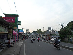
Country:
Region:
City:
Latitude and Longitude:
Time Zone:
Postal Code:
IP information under different IP Channel
ip-api
Country
Region
City
ASN
Time Zone
ISP
Blacklist
Proxy
Latitude
Longitude
Postal
Route
IPinfo
Country
Region
City
ASN
Time Zone
ISP
Blacklist
Proxy
Latitude
Longitude
Postal
Route
MaxMind
Country
Region
City
ASN
Time Zone
ISP
Blacklist
Proxy
Latitude
Longitude
Postal
Route
Luminati
Country
ASN
Time Zone
Asia/Jakarta
ISP
PT Jala Lintas Media
Latitude
Longitude
Postal
db-ip
Country
Region
City
ASN
Time Zone
ISP
Blacklist
Proxy
Latitude
Longitude
Postal
Route
ipdata
Country
Region
City
ASN
Time Zone
ISP
Blacklist
Proxy
Latitude
Longitude
Postal
Route
Popular places and events near this IP address

Depok
City in Java, Indonesia
Distance: Approx. 4974 meters
Latitude and longitude: -6.394,106.8225
Depok (Sundanese: ᮓᮨᮕᮧᮊ᮪) is a landlocked city in West Java province. It is located directly south of Jakarta, it is the third largest urban centre in the Greater Jakarta metropolitan area after Jakarta and Bekasi and it has an area of 199.91 km2. It had a population of 1,738,600 at the 2010 census and 2,056,400 at the 2020 census; the official estimate as at mid 2023 was 2,145,400 (comprising 1,080,541 males and 1,064,859 females), resulting in a density of 10,731.8 people per km2.

Cimanggis
District in Java, Indonesia
Distance: Approx. 6484 meters
Latitude and longitude: -6.364455,106.859138
Cimanggis is an administrative district (kecamatan) within the city of Depok, in the province of West Java, Indonesia. Cimanggis is located in the north of Depok, immediately south of Jakarta. It covers an area of 21.78 km2 and had a population of 241,979 at the 2010 Census and 252,000 at the 2020 Census; the latest official estimate (as at mid 2023) is 252,370.

Depok railway station
Railway station in Indonesia
Distance: Approx. 4860 meters
Latitude and longitude: -6.404422,106.817086
Depok Station (DP) is a railway station located in Pancoran Mas, Pancoran Mas, Depok, West Java. This station is commonly known as Depok Lama (Old Depok), to distinguish with Depok Baru (lit. 'New Depok') Station. The station is one of the oldest station in Jakarta metropolitan area.
Panus Bridge
Distance: Approx. 3765 meters
Latitude and longitude: -6.40038707,106.83138973
Panus Bridge (Indonesian: Jembatan Panus) is a bridge over the Ciliwung river in Depok, West Java, Indonesia, which connected Bogor and Batavia in the Dutch period in Indonesia in order for people from Depok to be able to work in Jakarta.
Merpati Stadium
Stadium in Depok, West Java
Distance: Approx. 6684 meters
Latitude and longitude: -6.38944444,106.80666667
Merpati Stadium is a football stadium in the city of Depok, West Java, Indonesia. The stadium has a capacity of 10,000 people. It is the home base of Persikad Depok.
Citayam railway station
Railway station in Indonesia
Distance: Approx. 6693 meters
Latitude and longitude: -6.44883333,106.80252778
Citayam Station (CTA) is a railway station located in West Java, Indonesia; right on the border between Bojong Pondok Terong, Cipayung, Depok and Pabuaran, Bojong Gede, Bogor Regency. The station, which is located at an altitude of +120 m amsl, is owned by Operation Area I Jakarta of Kereta Api Indonesia (KAI). The north side of the station is a part of Depok, making it the southernmost station in the city, while the south side is a part Bogor Regency, making it the northernmost one in the regency.

Gunung Putri railway station
Railway station in Indonesia
Distance: Approx. 6507 meters
Latitude and longitude: -6.4719,106.8887
Gunung Putri Station is an inactive railway station located in Gunung Putri, Bogor Regency, West Java, Indonesia. The station is located at an elevation of +115 m. It is included in the Operation Area I Jakarta.

Cibinong railway station
Railway station in Indonesia
Distance: Approx. 4651 meters
Latitude and longitude: -6.4642,106.8525
Cibinong Station (CBN) is a railway station located in Pabuaran, Cibinong, Bogor Regency, West Java.The station is located at an altitude of +121 meters, and is included in the Operation Area I Jakarta. Not far from the station (6 km) is located an international Pakansari Stadium. The origins of the construction of this station can be traced to the master plan for the construction of the Jakarta Outer Ring Railway line made by the Ministry of Transportation of the Republic of Indonesia in the early 1990s.

Pondok Rajeg railway station
Railway station in Indonesia
Distance: Approx. 5526 meters
Latitude and longitude: -6.4607,106.8249
Pondok Rajeg Station (PDRG) is a railway station located on Jatimulya, Cilodong, Depok City in West Java, Indonesia. The station, which is located at an altitude of +121 meters, is included in Operational Area I Jakarta.
Sukmajaya
Town and District in West Java, Indonesia
Distance: Approx. 4290 meters
Latitude and longitude: -6.385337,106.847338
Sukmajaya is a town and an administrative district (kecamatan) within the city of Depok, in the province of West Java, Indonesia, within the Jakarta metropolitan area. It covers an area of 17.37 km2 and had a population of 232,308 at the 2010 Census and 252,500 at the 2020 Census; the official estimate as at mid 2023 is 256,060. It is one of the most densely populated areas in Depok.

Mahakam Stadium
Football stadium in West Java, Indonesia
Distance: Approx. 4300 meters
Latitude and longitude: -6.38527778,106.84722222
Mahakam Stadium is the second-largest stadium in the city of Depok. It is home to Depok United and is still under construction.
Indonesian International Islamic University
Public university in Depok, West Java, Indonesia
Distance: Approx. 3898 meters
Latitude and longitude: -6.388,106.862
Indonesian International Islamic University (Indonesian: Universitas Islam Internasional Indonesia, abbreviated as UIII) is an Islamic international public university located in the City of Depok, West Java, Indonesia. The university was initiated by the President of Indonesia, Joko Widodo—through Presidential Regulation No. 57 of 2016.
Weather in this IP's area
scattered clouds
30 Celsius
33 Celsius
28 Celsius
31 Celsius
1014 hPa
64 %
1014 hPa
1002 hPa
6000 meters
3.09 m/s
240 degree
42 %
05:29:04
17:45:19
