181.79.223.144 - IP Lookup: Free IP Address Lookup, Postal Code Lookup, IP Location Lookup, IP ASN, Public IP
Country:
Region:
City:
Location:
Time Zone:
Postal Code:
IP information under different IP Channel
ip-api
Country
Region
City
ASN
Time Zone
ISP
Blacklist
Proxy
Latitude
Longitude
Postal
Route
Luminati
Country
Region
01
City
guatemalacity
ASN
Time Zone
America/Guatemala
ISP
IFX18747
Latitude
Longitude
Postal
IPinfo
Country
Region
City
ASN
Time Zone
ISP
Blacklist
Proxy
Latitude
Longitude
Postal
Route
IP2Location
181.79.223.144Country
Region
guatemala
City
guatemala city
Time Zone
America/Guatemala
ISP
Language
User-Agent
Latitude
Longitude
Postal
db-ip
Country
Region
City
ASN
Time Zone
ISP
Blacklist
Proxy
Latitude
Longitude
Postal
Route
ipdata
Country
Region
City
ASN
Time Zone
ISP
Blacklist
Proxy
Latitude
Longitude
Postal
Route
Popular places and events near this IP address

Guatemala Department
Department of Guatemala
Distance: Approx. 124 meters
Latitude and longitude: 14.64138889,-90.51305556
Guatemala Department is one of the 22 departments of Guatemala. The capital is Guatemala City, which also serves as the national capital. The department consists of Guatemala City, its suburbs and other municipalities.

Roman Catholic Archdiocese of Santiago de Guatemala
Roman Catholic archdiocese in Guatemala
Distance: Approx. 180 meters
Latitude and longitude: 14.6416,-90.5123
The Archdiocese of Santiago de Guatemala is a Latin Church ecclesiastical territory or archdiocese of the Catholic Church in Guatemala. It is a primatial metropolitan see with six suffragan dioceses in its ecclesiastical province.

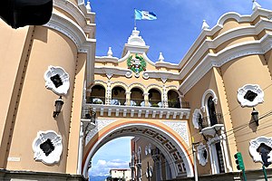
National Palace (Guatemala)
Government building in Guatemala
Distance: Approx. 294 meters
Latitude and longitude: 14.64294167,-90.51322778
The Palacio Nacional de la Cultura (National Palace of Culture), also known colloquially as "Palacio Verde", is identified as Guatemala City's symbol in its architectural context. It was the most important building in Guatemala and was the headquarters of the president of Guatemala. The building is the origin of all the roads in the Republic and has a spot known as Kilometro Cero (Kilometer Zero).

Centro Cultural Miguel Ángel Asturias
Cultural Center in Guatemala City, Guatemala
Distance: Approx. 1550 meters
Latitude and longitude: 14.62708889,-90.51784167
The Centro Cultural Miguel Ángel Asturias, commonly called Teatro Nacional, is a cultural center in Guatemala City, Guatemala. It is located in the Centro Cívico (Civic Center) of the city and was built in the same place of the old Fuerte de San José. Its form, which emulates a seated jaguar, stands out from the adjacent buildings.

Guatemala Post Office Building
Guatemala post office building
Distance: Approx. 369 meters
Latitude and longitude: 14.637,-90.513
The Guatemala Post Office Building is a building in Guatemala City, Guatemala. It is the management centre of postal services in Guatemala. It was constructed between 1937 and 1940.

Cathedral of Guatemala City
Metropolitan cathedral in Guatemala City
Distance: Approx. 210 meters
Latitude and longitude: 14.6417,-90.512
The Holy Church Cathedral Metropolitan Basilica of Santiago de Guatemala also Metropolitan Cathedral, officially Catedral Primada Metropolitana de Santiago, is the main church of Guatemala City and of the Archdiocese of Guatemala (Archidioecesis Guatimalensis). It is located at the Parque Central in the center of the city. Its massive structure incorporates baroque and classical elements and has withstood numerous earthquakes.

2010 Guatemala City sinkhole
Sinkhole in Guatemala City
Distance: Approx. 1541 meters
Latitude and longitude: 14.65211111,-90.50583333
The 2010 Guatemala City sinkhole was a disaster on 30 May 2010, in which an area approximately 20 m (65 feet) in diameter and 90 m (300 feet) deep collapsed in Guatemala City's Zona 2, swallowing a three-story factory. The sinkhole occurred because of a combination of reasons, including Tropical Storm Agatha, the Pacaya Volcano eruption, and leakage from sewer pipes. The sinkhole resulted in 1 death.

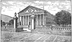
Carrera Theater (Guatemala)
Theater in Guatemala City, Guatemala
Distance: Approx. 307 meters
Latitude and longitude: 14.6430556,-90.51333333
The Carrera Theater (also called Colón Theater after the Liberal Reform of 1871) was a majestic classic Greek style theater built by president Captain General Rafael Carrera y Turcios in Guatemala City, Guatemala in 1852. The building was in the Old Central Square and after the liberal revolution of 1871 it was called National Theater. Towards the end of general Manuel Lisandro Barillas Bercián government, the building was remodeled to celebrate the Discovery of America fourth centennial anniversary.

San José Castle (Guatemala City)
Building in Guatemala Guatemala City
Distance: Approx. 383 meters
Latitude and longitude: 14.643,-90.5155
San José Castle -also known as Castillo de San José in Spanish- was opened to the public on 25 May 1846 on the «Buena Vista Hill» on the southeast of Guatemala City by general Rafael Carrera government; it was also known as «Carrera Castle». San José Fort was located where later Guatemalan administrations built a new city Hall, a National Theater and part of the Bolivar Avenue. The fort had a shooting range for the soldiers, ammunition warehouses, horses, diners and a small pond that was called "Soldier's Pond".
Instituto Normal Central para Señoritas Belén
Institution of secondary education
Distance: Approx. 623 meters
Latitude and longitude: 14.636,-90.5096
Instituto Normal Central para Señoritas Belén or Instituto Belén is an institution of secondary education in Guatemala, specializing in the training of teachers in urban primary education. It was established on 20 January 1875, and is based in Guatemala City.
Loyola College Guatemala
Private primary and secondary school in Guatemala City, Guatemala
Distance: Approx. 750 meters
Latitude and longitude: 14.64305556,-90.50694444
Loyola College Guatemala is a private Catholic pre-school, primary and secondary school, located in Guatemala City, Guatemala. The Jesuit-run school traces its origins to 1958 at the elementary school at La Merced Catholic church.

Supreme Court of Justice of Guatemala
Distance: Approx. 1483 meters
Latitude and longitude: 14.62697436,-90.51323064
The Supreme Court of Justice of Guatemala (La Corte Suprema de Justicia), or CSJ, is the highest court within Guatemala's judiciary branch. As the highest Court in Guatemala, it has jurisdiction over all legal matters that may arise in the country. The Court sits in the Palace of Justice, in Zone 1 of Guatemala City.
Weather in this IP's area
few clouds
18 Celsius
18 Celsius
18 Celsius
18 Celsius
1021 hPa
72 %
1021 hPa
853 hPa
10000 meters
13.38 m/s
10 degree
20 %