181.64.202.30 - IP Lookup: Free IP Address Lookup, Postal Code Lookup, IP Location Lookup, IP ASN, Public IP
Country:
Region:
City:
Location:
Time Zone:
Postal Code:
ISP:
ASN:
language:
User-Agent:
Proxy IP:
Blacklist:
IP information under different IP Channel
ip-api
Country
Region
City
ASN
Time Zone
ISP
Blacklist
Proxy
Latitude
Longitude
Postal
Route
db-ip
Country
Region
City
ASN
Time Zone
ISP
Blacklist
Proxy
Latitude
Longitude
Postal
Route
IPinfo
Country
Region
City
ASN
Time Zone
ISP
Blacklist
Proxy
Latitude
Longitude
Postal
Route
IP2Location
181.64.202.30Country
Region
moquegua
City
ilo
Time Zone
America/Lima
ISP
Language
User-Agent
Latitude
Longitude
Postal
ipdata
Country
Region
City
ASN
Time Zone
ISP
Blacklist
Proxy
Latitude
Longitude
Postal
Route
Popular places and events near this IP address

Ilo, Peru
City in Moquegua, Peru
Distance: Approx. 1097 meters
Latitude and longitude: -17.64585833,-71.34531389
Ilo is a port city in southern Peru, with 66,118 inhabitants. It is the second largest city in the Moquegua Region and capital of the Ilo Province.

Ilo province
Province in Moquegua, Peru
Distance: Approx. 807 meters
Latitude and longitude: -17.63333333,-71.33333333
Ilo is one of three provinces that make up the Moquegua Region in Peru. The province is the largest mining center in all of southern Peru.
El Algarrobal District
District in Moquegua, Peru
Distance: Approx. 7557 meters
Latitude and longitude: -17.6229,-71.2684
El Algarrobal District is one of three districts of the province Ilo in Peru.
Ilo District
District in Moquegua, Peru
Distance: Approx. 934 meters
Latitude and longitude: -17.6475,-71.3398
Ilo District is one of three districts of the province Ilo in Peru.
Pacocha District
District in Moquegua, Peru
Distance: Approx. 3108 meters
Latitude and longitude: -17.6116,-71.3402
Pacocha District is one of three districts of the province Ilo in Peru.

El Algarrobal
Village in Moquegua, Peru
Distance: Approx. 3360 meters
Latitude and longitude: -17.61666667,-71.31666667
El Algarrobal is a village in the Moquegua Region in Peru.
Estadio Mariscal Nieto
Distance: Approx. 312 meters
Latitude and longitude: -17.6366,-71.3373
Estadio Mariscal Nieto is a multi-use stadium in Ilo, Peru. It is currently used mostly for football matches and is the home stadium of Deportivo Enersur and Mariscal Nieto of the Copa Perú. The stadium holds 3,000 spectators.

Osmore River
River in Moquegua Region, Peru
Distance: Approx. 8613 meters
Latitude and longitude: -17.71666667,-71.33333333
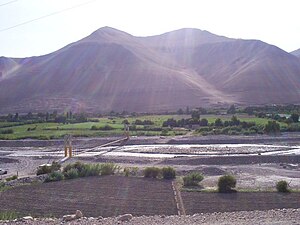
Osmore River (also Moquegua, Ilo, or Tumilaca) system flows northeast to southwest in the Moquegua Region of southern coastal Peru. The river has its origin in the snow peaks of the Chuqi Ananta and Arundane mountains, at an elevation of 5,100 metres (16,700 ft) above sea level. It changes names as it descends from the Andes: From its origin it is called the Moquegua, then Osmore in the middle valley as Rio Coscori and Rio Tumilaca including where the river disappears into subterranean channels, and further down in the lower reaches as Rio Ilo.
Weather in this IP's area
clear sky
23 Celsius
24 Celsius
23 Celsius
23 Celsius
1015 hPa
69 %
1015 hPa
981 hPa
10000 meters
4.63 m/s
170 degree