Country:
Region:
City:
Latitude and Longitude:
Time Zone:
Postal Code:
IP information under different IP Channel
ip-api
Country
Region
City
ASN
Time Zone
ISP
Blacklist
Proxy
Latitude
Longitude
Postal
Route
Luminati
Country
Region
sj
City
sanjose
ASN
Time Zone
America/Costa_Rica
ISP
Instituto Costarricense de Electricidad y Telecom.
Latitude
Longitude
Postal
IPinfo
Country
Region
City
ASN
Time Zone
ISP
Blacklist
Proxy
Latitude
Longitude
Postal
Route
db-ip
Country
Region
City
ASN
Time Zone
ISP
Blacklist
Proxy
Latitude
Longitude
Postal
Route
ipdata
Country
Region
City
ASN
Time Zone
ISP
Blacklist
Proxy
Latitude
Longitude
Postal
Route
Popular places and events near this IP address

Inter-American Court of Human Rights
Autonomous judicial institution
Distance: Approx. 2740 meters
Latitude and longitude: 9.93043889,-84.05693889
The Inter-American Court of Human Rights (I/A Court H.R.) is an international court based in San José, Costa Rica. Together with the Inter-American Commission on Human Rights, it was formed by the American Convention on Human Rights, a human rights treaty ratified by members of the Organization of American States (OAS). Pursuant to American Convention, the Inter-American Court works with the Inter-American Commission to uphold and promote basic rights and freedoms.
Calle de la Amargura
Street in San José, Costa Rica
Distance: Approx. 2531 meters
Latitude and longitude: 9.93333333,-84.05083333
The Calle de la Amargura ("Bitterness Street") is a four-block-long street located in San Pedro district, Montes de Oca canton, and is one of the best-known zones near San José city. La Calle, as it is often called, is very close to the University of Costa Rica (UCR) and other important higher education centers.

Curridabat
District in Curridabat canton, San José province, Costa Rica
Distance: Approx. 384 meters
Latitude and longitude: 9.9160278,-84.0347619
Curridabat is a district of the Curridabat canton, in the San José province of Costa Rica.
San Pedro, Costa Rica
District in Montes de Oca canton, San José province, Costa Rica
Distance: Approx. 2305 meters
Latitude and longitude: 9.9331667,-84.0469973
San Pedro is a district of the Montes de Oca canton, in the San José province of Costa Rica.

Curridabat (canton)
Canton in San José province, Costa Rica
Distance: Approx. 1075 meters
Latitude and longitude: 9.9163367,-84.0282798
Curridabat is the eighteenth canton in the San José province of Costa Rica. The head city the homonymous Curridabat. The canton forms a suburb of the national capital of San José, lying on the southeast edge of the city.
Zapote
District in San José canton, San José province, Costa Rica
Distance: Approx. 2428 meters
Latitude and longitude: 9.9203408,-84.0592286
Zapote the fifth district of the San José canton, in the San José province of Costa Rica. It is one of the administrative units surrounding San José downtown (officially composed of the districts of El Carmen, Merced, Hospital and Catedral). The district is primarily residential, although there are some government buildings, standing out the Presidential House, seat of the government.
San Francisco de Dos Ríos
District in San José canton, San José province, Costa Rica
Distance: Approx. 2328 meters
Latitude and longitude: 9.9082933,-84.0581714
San Francisco de Dos Ríos is the sixth district of the San José canton, in the San José province of Costa Rica. It is one of the administrative units surrounding San José downtown (officially composed by the districts of El Carmen, Merced, Hospital and Catedral). The district is primarily residential and industrial.

Tirrases
District in San José, Costa Rica
Distance: Approx. 1506 meters
Latitude and longitude: 9.9015151,-84.0340513
Tirrases is a district of the Curridabat canton, in the San José province of Costa Rica.
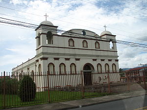
Parroquia San Antonio de Padua
Distance: Approx. 83 meters
Latitude and longitude: 9.91416667,-84.03722222
The Parroquia San Antonio de Padua, commonly known as the Iglesia de Curridabat is a church located in Curridabat, Costa Rica.
San Antonio District, Desamparados
District in Desamparados canton, San José province, Costa Rica
Distance: Approx. 1994 meters
Latitude and longitude: 9.898993,-84.0470021
San Antonio is a district of the Desamparados canton, in the San José province of Costa Rica.
Granadilla District
District in Curridabat canton, San José province, Costa Rica
Distance: Approx. 2432 meters
Latitude and longitude: 9.9309202,-84.023276
Granadilla is a district of the Curridabat canton, in the San José province of Costa Rica.
Sánchez District
District in Curridabat canton, San José province, Costa Rica
Distance: Approx. 2323 meters
Latitude and longitude: 9.9130792,-84.0167642
Sánchez is a district of the Curridabat canton, in the San José province of Costa Rica.
Weather in this IP's area
light rain
22 Celsius
23 Celsius
22 Celsius
23 Celsius
1013 hPa
82 %
1013 hPa
882 hPa
10000 meters
4.63 m/s
290 degree
75 %
05:28:31
17:11:26

