Country:
 Costa Rica
Region:
City:
Latitude and Longitude:
Time Zone:
Postal Code:
IP information under different IP Channel
ip-api
Country
Region
City
ASN
Time Zone
ISP
Blacklist
Proxy
Latitude
Longitude
Postal
Route
IPinfo
Country
Region
City
ASN
Time Zone
ISP
Blacklist
Proxy
Latitude
Longitude
Postal
Route
MaxMind
Country
Region
City
ASN
Time Zone
ISP
Blacklist
Proxy
Latitude
Longitude
Postal
Route
Luminati
Country
CRRegion
sj
City
sanjose
ASN
Time Zone
America/Costa_Rica
ISP
Instituto Costarricense de Electricidad y Telecom.
Latitude
Longitude
Postal
db-ip
Country
Region
City
ASN
Time Zone
ISP
Blacklist
Proxy
Latitude
Longitude
Postal
Route
ipdata
Country
Region
City
ASN
Time Zone
ISP
Blacklist
Proxy
Latitude
Longitude
Postal
Route
Popular places and events near this IP address

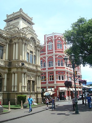
San José, Costa Rica
Capital and largest city of Costa Rica
Distance: Approx. 1390 meters
Latitude and longitude: 9.9325,-84.08
San José (Spanish: [saŋ xoˈse]; meaning "Saint Joseph") is the capital and largest city of Costa Rica, and the capital of San José Province. It is in the center of the country, in the mid-west of the Central Valley, within San José Canton. San José is Costa Rica's seat of national government, focal point of political and economic activity, and major transportation hub.

Greater Metropolitan Area (Costa Rica)
Conurbation in Costa Rica
Distance: Approx. 1095 meters
Latitude and longitude: 9.933,-84.083
The Greater Metropolitan Area of Costa Rica (Spanish: Gran Área Metropolitana, GAM) is the largest urban agglomeration in the country, comprising areas of high population density surrounding the capital, San José, which geographically corresponds to the Central Valley and extended to include the Guarco Valley, where some of the cantons of the Cartago province are located. The proper definition and delimitation corresponds to the National Institute of Statistics and Census of Costa Rica (INEC) and could vary over time. According to the 2011 census, the GAM had a population of 3.1 million inhabitants (about 60% of Costa Rica's population) in an area of 2,044 km² (3.84% of the country's area).
Merced (district)
District in San José canton, San José province, Costa Rica
Distance: Approx. 240 meters
Latitude and longitude: 9.9399591,-84.0883582
Merced is a district of the San José canton, in the San José province of Costa Rica. It is one of the four administrative units that form San José downtown (casco central) properly. This division is merely commercial, but covers an important part of "josefino" life and activities.
Hospital (district)
District in San José canton, San José province, Costa Rica
Distance: Approx. 1450 meters
Latitude and longitude: 9.9265555,-84.0890355
Hospital is a district of the San José canton, in the San José province of Costa Rica. It is one of the four administrative units that form San José downtown properly. The district houses, along with Merced district, the main commercial activity of the city, and is the most populous of the four central districts.

1996 San Juan de Dios radiotherapy accident
Radiotherapy accident at San Juan de Dios Hospital, San Jose, Costa Rica
Distance: Approx. 1004 meters
Latitude and longitude: 9.9325,-84.08472222
The radiotherapy accident in Costa Rica occurred within the Alcyon II radiotherapy unit at San Juan de Dios Hospital in San José, Costa Rica. It was related to a cobalt-60 source that was being used for radiotherapy in 1996. An accidental overexposure of radiotherapy patients treated during August and September 1996 was detected.

San José Central Market
Distance: Approx. 1070 meters
Latitude and longitude: 9.934702,-84.082045
San José Central Market (Spanish: Mercado central) is the largest market of the city of San José, Costa Rica. Established in 1880, it occupies an entire block on Avenida Central, 250m northwest of the Parque Central. The market contains a complex of narrow alleys with over 200 shops, stalls, and cheap restaurants called sodas.

Metropolitan Cathedral of San José
Distance: Approx. 1490 meters
Latitude and longitude: 9.9327,-84.0788
The Metropolitan Cathedral of San José Spanish: Catedral Metropolitana is a cathedral in San José, Costa Rica, located on Calle Central and Avenues 2 and 4. The original cathedral was built in 1802 but was destroyed by an earthquake.
Hospital Nacional de Niños
Hospital in San José, Costa Rica
Distance: Approx. 651 meters
Latitude and longitude: 9.934394,-84.08761
Hospital Nacional de Niños is a national pediatric hospital in San José, Costa Rica. It has provided medical care to children in the country since its founding in 1845. In 1945 and as one of the events to celebrate the centennial of the San José Hospital, a new ward opened with a capacity of 140 beds.
Directorate General of Civil Aviation (Costa Rica)
Civil aviation authority of Costa Rica
Distance: Approx. 1043 meters
Latitude and longitude: 9.93333333,-84.08333333
The Directorate General of Civil Aviation (Spanish: Dirección General de Aviación Civil, DGAC), is the civil aviation authority of Costa Rica. It oversees all aspects of civil aviation operations and infrastructure within the country. The body was created by law on 26 October 1949.
Edificio Herdocia
Distance: Approx. 1250 meters
Latitude and longitude: 9.93583333,-84.07972222
The Edificio Herdocia is a four-story property located in San Jose, Costa Rica. It was built in 1945 by Catalan architect Luis Llach Llagostera. It is located on the corner of 2nd Street and Avenue 3 of the Central American capital, north of the Edificio Correos, with which it forms one of the most recognized architectural ensembles of the Josefino neighborhood.
Cinco Esquinas
District in Tibás canton, San José province, Costa Rica
Distance: Approx. 1140 meters
Latitude and longitude: 9.9467372,-84.0831462
Cinco Esquinas is a district of the Tibás canton, in the San José province of Costa Rica.
Gimnasio Nacional
Distance: Approx. 1143 meters
Latitude and longitude: 9.93305556,-84.09861111
The Eddy Cortés National Gymnasium (Spanish: Gimnasio Nacional Eddy Cortés), better known as National Gymnasium (Spanish: Gimnasio Nacional), is a sports arena located in La Sabana Metropolitan Park, San José, Costa Rica. Its capacity is over 4,000.
Weather in this IP's area
fog
20 Celsius
20 Celsius
19 Celsius
20 Celsius
1014 hPa
96 %
1014 hPa
889 hPa
10000 meters
2.06 m/s
280 degree
75 %
05:24:33
17:23:14