Country:
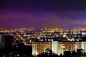
 Costa Rica
Region:
City:
Latitude and Longitude:
Time Zone:
Postal Code:
IP information under different IP Channel
ip-api
Country
Region
City
ASN
Time Zone
ISP
Blacklist
Proxy
Latitude
Longitude
Postal
Route
IPinfo
Country
Region
City
ASN
Time Zone
ISP
Blacklist
Proxy
Latitude
Longitude
Postal
Route
MaxMind
Country
Region
City
ASN
Time Zone
ISP
Blacklist
Proxy
Latitude
Longitude
Postal
Route
Luminati
Country
CRRegion
sj
City
escazu
ASN
Time Zone
America/Costa_Rica
ISP
Instituto Costarricense de Electricidad y Telecom.
Latitude
Longitude
Postal
db-ip
Country
Region
City
ASN
Time Zone
ISP
Blacklist
Proxy
Latitude
Longitude
Postal
Route
ipdata
Country
Region
City
ASN
Time Zone
ISP
Blacklist
Proxy
Latitude
Longitude
Postal
Route
Popular places and events near this IP address
Escazú (canton)
Canton in San José province, Costa Rica
Distance: Approx. 1463 meters
Latitude and longitude: 9.9167075,-84.1532395
Escazú is the second canton in the province of San José in Costa Rica. The canton lies west of the San José Canton, and its whole territory is part of the Greater Metropolitan Area. The canton was one of the country's earliest, established on December 7, 1848.

Partido de Nicoya
Distance: Approx. 1123 meters
Latitude and longitude: 9.91666667,-84.15
The Partido de Nicoya was a major part of what is now the Guanacaste province in Costa Rica. Originally the territory was bounded on the northeast by the La Flor river and Lake Cocibolca, or Lake Nicaragua, on the south by Costa Rica (Gulf of Nicoya, Tempisque River, Salto River), and on the east by a line that joins the northernmost part of the Gulf of Nicoya to the mouth of the San Juan River.
Mata Redonda
District in San José canton, San José province, Costa Rica
Distance: Approx. 3680 meters
Latitude and longitude: 9.935246,-84.1105741
Mata Redonda is a district of the San José canton, in the San José province of Costa Rica.

Pavas
District in San José canton, San José province, Costa Rica
Distance: Approx. 3300 meters
Latitude and longitude: 9.9495224,-84.1391744
Pavas is the ninth district of the San José canton, in the San José province of Costa Rica. The district comprises Tobías Bolaños International Airport, San José's domestic airport.
Hospital CIMA
Hospital in San José, Costa Rica
Distance: Approx. 2293 meters
Latitude and longitude: 9.940158,-84.144093
Hospital CIMA San Jose is a hospital in San José, Costa Rica. The hospital opened in 2000. Hospital CIMA is a tertiary level, acute care hospital.
Hospital Nacional Psiquiátrico
Hospital in San José, Costa Rica
Distance: Approx. 3891 meters
Latitude and longitude: 9.954812,-84.138483
Hospital Nacional Psiquiátrico is a psychiatric hospital in San José, Costa Rica.

Escazú (district)
District in Escazú canton, San José province, Costa Rica
Distance: Approx. 749 meters
Latitude and longitude: 9.9159843,-84.1458602
Escazú is a district of the Escazú canton, in the San José province of Costa Rica.

Colegio Humboldt (Costa Rica)
German international school in Costa Rica
Distance: Approx. 3172 meters
Latitude and longitude: 9.9437,-84.1244
Colegio Humboldt (German: Humboldt-Schule) is a German international school in Pavas, San José, Costa Rica, serving a student body that includes preschool through Abitur. The German School of Costa Rica was founded in 1912, initially only offering classes in kindergarten and primary school levels. The school closed during the two world wars, but with the support from the local German community in Costa Rica, was able to reopen in 1956 as the "Colegio Humboldt - Schule", and expanded to include secondary school classes in 1975 with the addition of the "Nueva Secundaria".

San Antonio District, Escazú
District in Escazú canton, San José province, Costa Rica
Distance: Approx. 3260 meters
Latitude and longitude: 9.8906435,-84.1416704
San Antonio is a district of the Escazú canton, in the San José province of Costa Rica.
San Rafael District, Escazú
District in Escazú canton, San José province, Costa Rica
Distance: Approx. 3114 meters
Latitude and longitude: 9.9448051,-84.1532395
San Rafael is a district of the Escazú canton, in the San José province of Costa Rica.
San Felipe District, Alajuelita
District in Alajuelita canton, San José province, Costa Rica
Distance: Approx. 3093 meters
Latitude and longitude: 9.9124787,-84.1131195
San Felipe is a district of the Alajuelita canton, in the San José province of Costa Rica.
Apostolic Nunciature to Costa Rica
Diplomatic Mission of the Holy See in Costa Rica
Distance: Approx. 3912 meters
Latitude and longitude: 9.93938889,-84.11061111
The Apostolic Nunciature to Costa Rica the diplomatic mission of the Holy See to Costa Rica. It is located in San José. The current Apostolic Nuncio is Archbishop Mark Miles, who was named to the position by Pope Francis on 9 July 2024.
Weather in this IP's area
thunderstorm with light rain
21 Celsius
22 Celsius
20 Celsius
21 Celsius
1013 hPa
95 %
1013 hPa
893 hPa
10000 meters
2.57 m/s
330 degree
75 %
05:24:59
17:17:54