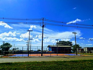
Country:
Region:
City:
Latitude and Longitude:
Time Zone:
Postal Code:
IP information under different IP Channel
ip-api
Country
Region
City
ASN
Time Zone
ISP
Blacklist
Proxy
Latitude
Longitude
Postal
Route
Luminati
Country
Region
pr
City
telemacoborba
ASN
Time Zone
America/Sao_Paulo
ISP
NICFIBRA TELECOM
Latitude
Longitude
Postal
IPinfo
Country
Region
City
ASN
Time Zone
ISP
Blacklist
Proxy
Latitude
Longitude
Postal
Route
db-ip
Country
Region
City
ASN
Time Zone
ISP
Blacklist
Proxy
Latitude
Longitude
Postal
Route
ipdata
Country
Region
City
ASN
Time Zone
ISP
Blacklist
Proxy
Latitude
Longitude
Postal
Route
Popular places and events near this IP address

Telêmaco Borba
Municipality in Southern, Brazil
Distance: Approx. 3438 meters
Latitude and longitude: -24.35,-50.61666667
Telêmaco Borba is a municipality in the state of Paraná in the Southern Region of Brazil. Telêmaco Borba is known as the "capital of paper" (Capital do Papel) and "capital of wood" (Capital da Madeira) due to the importance of paper and wood production to the local economy, with reforestation for growing pine and eucalyptus that reaches 90% of the agricultural area of the municipality.

Telêmaco Borba Airport
Airport
Distance: Approx. 4084 meters
Latitude and longitude: -24.31638889,-50.65222222
Telêmaco Borba Airport - Monte Alegre Airport (IATA: TEC, ICAO: SSVL), formerly SBTL is the airport serving Telêmaco Borba, Brazil. It is operated by Indústrias Klabin S/A under the supervision of Aeroportos do Paraná (SEIL).

Faculdade de Telêmaco Borba
Distance: Approx. 3362 meters
Latitude and longitude: -24.33488889,-50.64055556
Faculdade de Telêmaco Borba (abbreviated FATEB) is a Brazilian Higher Education institution, based in Telêmaco Borba, Paraná (state). It was founded in 2000.
Harmonia River
River in Brazil
Distance: Approx. 1265 meters
Latitude and longitude: -24.31666667,-50.6
The Harmonia River is a river of Paraná state in southern Brazil. It is a tributary of the Tibagi River.

Triângulo, Telêmaco Borba
Place in South, Brazil
Distance: Approx. 8665 meters
Latitude and longitude: -24.37825,-50.66802778
Triângulo is a neighbourhood in the rural area of Telêmaco Borba, Brazil.

Telêmaco Borba Cable Car
Gondola lift service operating in the entral region of Telêmaco Borba
Distance: Approx. 532 meters
Latitude and longitude: -24.3188,-50.6173
Telêmaco Borba Cable Car is a gondola lift service operating in the entral region of Telêmaco Borba, Paraná, Brazil. The cable car runs between Telêmaco Borba and Harmonia (neighborhood). Is managed by the company Klabin.
Weather in this IP's area
broken clouds
19 Celsius
20 Celsius
19 Celsius
19 Celsius
1011 hPa
91 %
1011 hPa
937 hPa
10000 meters
0.81 m/s
0.98 m/s
118 degree
73 %
05:27:10
18:49:03