181.189.133.223 - IP Lookup: Free IP Address Lookup, Postal Code Lookup, IP Location Lookup, IP ASN, Public IP
Country:
Region:
City:
Location:
Time Zone:
Postal Code:
ISP:
ASN:
language:
User-Agent:
Proxy IP:
Blacklist:
IP information under different IP Channel
ip-api
Country
Region
City
ASN
Time Zone
ISP
Blacklist
Proxy
Latitude
Longitude
Postal
Route
db-ip
Country
Region
City
ASN
Time Zone
ISP
Blacklist
Proxy
Latitude
Longitude
Postal
Route
IPinfo
Country
Region
City
ASN
Time Zone
ISP
Blacklist
Proxy
Latitude
Longitude
Postal
Route
IP2Location
181.189.133.223Country
Region
guatemala
City
villa nueva
Time Zone
America/Guatemala
ISP
Language
User-Agent
Latitude
Longitude
Postal
ipdata
Country
Region
City
ASN
Time Zone
ISP
Blacklist
Proxy
Latitude
Longitude
Postal
Route
Popular places and events near this IP address
Amatitlán
Municipality in Guatemala Department, Guatemala
Distance: Approx. 5779 meters
Latitude and longitude: 14.48333333,-90.61666667
Amatitlán (Spanish pronunciation: [amatiˈtlan]) is a town, with a population of 98,176 (2018 census), and a municipality in the Guatemala department of Guatemala.
San Miguel Petapa
Municipality in Guatemala, Guatemala
Distance: Approx. 3743 meters
Latitude and longitude: 14.5,-90.56666667
San Miguel Petapa (Spanish pronunciation: [ˈsam miˈɣel peˈtapa]) also known as Petapa is a city and municipality in the Guatemala department of Guatemala, located south of Guatemala City. The city has a population of 129,124 according to the 2018 census.
Villa Canales
Municipality in Guatemala, Guatemala
Distance: Approx. 7589 meters
Latitude and longitude: 14.48333333,-90.53333333
Villa Canales is a city and municipality in the Guatemala department of Guatemala, situated 22 km south of the capital Guatemala City. As of the 2018 census, the city had a population of 124,680, making it the eleventh largest city in Guatemala.

Villa Nueva, Guatemala
Place in Guatemala, Guatemala
Distance: Approx. 5 meters
Latitude and longitude: 14.52694444,-90.5875
Villa Nueva is a city in the Guatemala department of Guatemala. The city centre of Villa Nueva at Villa Nueva Central Park is located 16 kilometres (10 mi) south of Guatemala City. The city has a population of 618,397 (2018 census), making it the second largest in Guatemala Department, after Guatemala City.
Lake Amatitlán
Crater lake in Guatemala
Distance: Approx. 6242 meters
Latitude and longitude: 14.47111111,-90.58166667
Lake Amatitlán (Lago Amatitlán, Spanish pronunciation: [laɣo amatiˈtlan]) is a lake located within the Amatitlán caldera in south-central Guatemala, fairly close to Guatemala City. It lies in the central highlands, 1,186 m (3890 feet) above sea level. Its maximum depth is 33 m (108 feet) and an average of 18 m (59 feet).
Universidad de San Carlos de Guatemala
Public university in Guatemala City, Guatemala
Distance: Approx. 7264 meters
Latitude and longitude: 14.5829,-90.5529
The Universidad de San Carlos de Guatemala (USAC, University of San Carlos of Guatemala) is the largest and oldest university of Guatemala; it is also the fourth founded in the Americas. Established in the Kingdom of Guatemala during the Spanish colony, it was the only university in Guatemala until 1954, although it continues to hold distinction as the only public university in the entire country. The university grew out of the Colegio de Santo Tomás de Aquino (Saint Thomas Aquinas High School), founded in 1562 by Bishop Francisco Marroquín.

Estadio Municipal de San Miguel Petapa
Distance: Approx. 4240 meters
Latitude and longitude: 14.50194444,-90.55777778
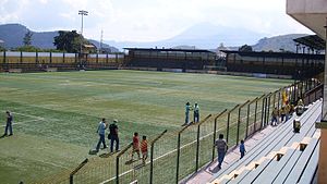
Estadio Municipal de San Miguel Petapa, or Estadio Julio Armando Cobar, is a multi-use stadium in San Miguel Petapa, Guatemala. With artificial turf surface, it is used mostly for football and was the home stadium of Deportivo Petapa.
February 2007 Salvadoran congressmen killings
Distance: Approx. 7589 meters
Latitude and longitude: 14.48333333,-90.53333333
On 19 February 2007, three members of the ARENA party of El Salvador — Eduardo D'Aubuisson, William Pichinte and José Ramón González, as well as their driver, Gerardo Ramírez — were found murdered near Guatemala City, Guatemala. Four police detectives were arrested and charged with the murder; within three days of their arrest, the four were murdered in a maximum-security prison cell. Several prosecutors investigating the deaths have also been murdered.
Villalobos River
River in Guatemala
Distance: Approx. 7894 meters
Latitude and longitude: 14.5779,-90.6384
The Villalobos River is a river of Guatemala, in the Guatemala Department. It is a tributary that drains into the Lake Amatitlán and its basin. Making it one of the main sources of pollution towards the Lake.
Naciones Unidas National Park
National park in Villa Nueva, Guatemala
Distance: Approx. 4017 meters
Latitude and longitude: 14.49833333,-90.61027778
Naciones Unidas National Park is a forested park area of 4.91 km2, located 21 km south of Guatemala City, just north of Lake Amatitlán in the municipality of Villa Nueva. It is one of the last remaining nature reserves in the Guatemala City Metropolitan Area.
Xavier Lyceum, Guatemala
Private primary and secondary school in Villa Nueva, Guatemala
Distance: Approx. 7103 meters
Latitude and longitude: 14.58583333,-90.56222222
Xavier Lyceum (Spanish: Liceo Javier) is a private Catholic preschool, primary and secondary school located in the City of Guatemala. The school was founded by the Society of Jesus in 1952 as a boys only school, and became co-educational in 2000. The school includes preschool through baccalaureate in science and in literature.
Fraternidad Cristiana de Guatemala
Church in Mixco, Guatemala
Distance: Approx. 7314 meters
Latitude and longitude: 14.5921,-90.5791
Fraternidad Cristiana de Guatemala (or Mega Frater) is an evangelical pentecostal megachurch, in Mixco (Ciudad San Cristóbal), Guatemala. The senior pastor of this community is Dr. Jorge H. Lopez.
Weather in this IP's area
broken clouds
19 Celsius
19 Celsius
19 Celsius
21 Celsius
1020 hPa
63 %
1020 hPa
847 hPa
10000 meters
13.38 m/s
10 degree
75 %

