181.189.133.200 - IP Lookup: Free IP Address Lookup, Postal Code Lookup, IP Location Lookup, IP ASN, Public IP
Country:
Region:
City:
Location:
Time Zone:
Postal Code:
ISP:
ASN:
language:
User-Agent:
Proxy IP:
Blacklist:
IP information under different IP Channel
ip-api
Country
Region
City
ASN
Time Zone
ISP
Blacklist
Proxy
Latitude
Longitude
Postal
Route
db-ip
Country
Region
City
ASN
Time Zone
ISP
Blacklist
Proxy
Latitude
Longitude
Postal
Route
IPinfo
Country
Region
City
ASN
Time Zone
ISP
Blacklist
Proxy
Latitude
Longitude
Postal
Route
IP2Location
181.189.133.200Country
Region
chimaltenango
City
parramos
Time Zone
America/Guatemala
ISP
Language
User-Agent
Latitude
Longitude
Postal
ipdata
Country
Region
City
ASN
Time Zone
ISP
Blacklist
Proxy
Latitude
Longitude
Postal
Route
Popular places and events near this IP address

Chimaltenango
Municipality and city in Guatemala
Distance: Approx. 6352 meters
Latitude and longitude: 14.66222222,-90.82083333
Chimaltenango is a city in Guatemala with a population of 96,985 (2018 census). It serves as both the capital of the department of Chimaltenango and the municipal seat for the surrounding municipality of the same name. Chimaltenango stands some 56 kilometres (35 mi) west of Guatemala City, on the Pan-American Highway.

Estadio Pensativo
Distance: Approx. 8320 meters
Latitude and longitude: 14.5675,-90.73805556
Estadio Pensativo is a football stadium in Antigua Guatemala, Guatemala. The venue is home to Liga Nacional club Antigua (Panzas Verdes), and has a maximum capacity of 10,000 people. The stadium is also the home of women's first division club Santiago de los Caballeros, and in 2011 it hosted three matches of the 2011 CONCACAF U-17 Championship qualification between Panama, Honduras, and Guatemala.

Jocotenango
Municipality in Sacatepéquez, Guatemala
Distance: Approx. 7025 meters
Latitude and longitude: 14.58194444,-90.74361111
Jocotenango (alternate: Xocotenango; translation from Kaqchikel: "place of many plums") is a town and small municipality in the northeast section of Guatemalan department of Sacatepéquez, and is situated north of Antigua Guatemala. It has seven zones, two villages, and one hamlet. According to the 2018 census, the municipality has a total population of 21,657 of which 1,680 are native population and the balance are non-indigenous; and approximately 19,280 live in an urban area, while the balance are rural dwellers.
Pastores
Distance: Approx. 5786 meters
Latitude and longitude: 14.6,-90.75
Pastores is a town, with a population of 12,621 (2018 census), and a municipality, with a population of 17,814 (2018 census), in the Guatemalan department of Sacatepéquez.
Santa Catarina Barahona
Distance: Approx. 6778 meters
Latitude and longitude: 14.55,-90.78333333
Santa Catarina Barahona (Spanish pronunciation: [ˈsanta kataˈɾina βaɾaˈona]) is a municipality in the Guatemalan department of Sacatepéquez.

El Tejar, Chimaltenango
Municipality and town in Chimaltenango, Guatemala
Distance: Approx. 4710 meters
Latitude and longitude: 14.65,-90.8
El Tejar is a municipality and town in the Chimaltenango department of Guatemala. As of 2018, the municipality has a population of 15,639.
Parramos
Municipality and town in Chimaltenango, Guatemala
Distance: Approx. 5 meters
Latitude and longitude: 14.60777778,-90.80305556
Parramos is a town, with a population of 11,970 (2018 census), and a municipality in the Chimaltenango department of Guatemala.
San Andrés Itzapa
Municipality and town in Chimaltenango, Guatemala
Distance: Approx. 5148 meters
Latitude and longitude: 14.61666667,-90.85
San Andrés Itzapa (Spanish pronunciation: [anˈdɾes itˈsapa]) is a town, with a population of 24,992 (2018 census), and a municipality of Chimaltenango, Guatemala. San Andrés Itzapa is in the eastern region of Chimaltenango, while the district capital lies to the north, Acatenango lies to the south and to the east is Parramos. The municipality cover an area of 63.7 km2, with a total population of 32,083.

Templo de Nuestra Señora de la Asunción, Jocotenango
Church in Jocotenango, Guatemala
Distance: Approx. 7623 meters
Latitude and longitude: 14.5748,-90.7411
The Templo de Nuestra Señora de la Asunción (English: Temple of Our Lady of the Assumption) is a church in Jocotenango, Guatemala. The church is situated on the Plazuela de Jocotenango, the main town square, and is the centre of annual local celebrations of Our Lady of the Assumption (that is to say, of the Virgin Mary).
Centro Cultural la Azotea
Museum complex in Jocotenango, Guatemala
Distance: Approx. 7252 meters
Latitude and longitude: 14.57444444,-90.74527778
The Centro Cultural la Azotea ("La Azotea" Cultural Center) is a cultural center and museum complex, located in the township and municipality of Jocotenango in Guatemala's Sacatepéquez Department. It lies some 2 kilometres (1.2 mi) north of the department's capital Antigua Guatemala in the city's modern outskirts, and is approximately 43 kilometres (27 mi) from the national capital, Guatemala City. The center comprises three separate museums, on the grounds of a coffee-growing estate or finca.

Los Aposentos
National park in Chimaltenango, Guatemala
Distance: Approx. 3368 meters
Latitude and longitude: 14.63555556,-90.81555556
Los Aposentos is a small forested park area with a number of springs and two small lakes. It is located a few kilometers south of the city of Chimaltenango in Guatemala. It was formerly known as "Finca la Alameda" and renamed to Los Aposentos in 1929.

La Recolección Architectural Complex
Building in Antigua Guatemala, Guatemala
Distance: Approx. 8500 meters
Latitude and longitude: 14.56055556,-90.74111111
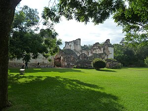
La Recolección Architectural Complex is a former church and monastery of the Order of the Recollects (Ordo Fratrum Minorum Recollectorum) and its adjacent park in Antigua, Guatemala. It is in the western part of the old city.
Weather in this IP's area
few clouds
18 Celsius
18 Celsius
16 Celsius
18 Celsius
1020 hPa
59 %
1020 hPa
824 hPa
10000 meters
4.01 m/s
6.07 m/s
15 degree
18 %
