181.174.71.70 - IP Lookup: Free IP Address Lookup, Postal Code Lookup, IP Location Lookup, IP ASN, Public IP
Country:
Region:
City:
Location:
Time Zone:
Postal Code:
ISP:
ASN:
language:
User-Agent:
Proxy IP:
Blacklist:
IP information under different IP Channel
ip-api
Country
Region
City
ASN
Time Zone
ISP
Blacklist
Proxy
Latitude
Longitude
Postal
Route
db-ip
Country
Region
City
ASN
Time Zone
ISP
Blacklist
Proxy
Latitude
Longitude
Postal
Route
IPinfo
Country
Region
City
ASN
Time Zone
ISP
Blacklist
Proxy
Latitude
Longitude
Postal
Route
IP2Location
181.174.71.70Country
Region
san marcos
City
san marcos
Time Zone
America/Guatemala
ISP
Language
User-Agent
Latitude
Longitude
Postal
ipdata
Country
Region
City
ASN
Time Zone
ISP
Blacklist
Proxy
Latitude
Longitude
Postal
Route
Popular places and events near this IP address

San Marcos Department
Department of Guatemala
Distance: Approx. 785 meters
Latitude and longitude: 14.96111111,-91.79555556
San Marcos is a department in southwestern Guatemala, on the Pacific Ocean and along the western Guatemala-Mexico border. The department's capital is the city of San Marcos.

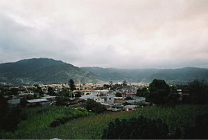
San Marcos, Guatemala
Municipality in San Marcos, Guatemala
Distance: Approx. 475 meters
Latitude and longitude: 14.96527778,-91.79583333
San Marcos is a city and municipality in Guatemala. It is the capital of the department of San Marcos. The municipality has a population of 47,063 (2018 census).
Estadio Marquesa de la Ensenada
Distance: Approx. 893 meters
Latitude and longitude: 14.967045,-91.7917
Estadio Marquesa de la Ensenada is a football stadium in San Marcos, Guatemala. It is home to Liga Nacional club Marquense and has an 11,000-seat capacity.

Esquipulas Palo Gordo
Municipality in San Marcos, Guatemala
Distance: Approx. 4124 meters
Latitude and longitude: 14.93333333,-91.81666667
Esquipulas Palo Gordo (Spanish pronunciation: [eskiˈpulas ˈpalo ˈɣoɾðo]) is a town and municipality in the San Marcos department of Guatemala. The town was founded on 24 December 1826 year. In the 1920s it was merged with San Marcos, but in 1948 it recovered its autonomy again.
San Cristóbal Cucho
Municipality in San Marcos, Guatemala
Distance: Approx. 7638 meters
Latitude and longitude: 14.9,-91.78333333
San Cristóbal Cucho is a town and municipality in the San Marcos department of Guatemala.It was found on 11 October 1825. It was annexed to San Pedro Sacatepéquez, in 1935, but it was named a municipality again on 12 July 1945.

San Lorenzo, San Marcos
Place in San Marcos, Guatemala
Distance: Approx. 9025 meters
Latitude and longitude: 15.02111111,-91.73777778
San Lorenzo (Spanish pronunciation: [san loˈɾenso]) is a municipality in the San Marcos department of Guatemala. It was founded in 1812 year by Spanish families. This is the birthplace of Justo Rufino Barrios-who served as President of Guatemala from 1873 until his death in 1885 and whose native house has been declared as a National Heritage.
San Pedro Sacatepéquez, San Marcos
Municipality of Guatemala in San Marcos
Distance: Approx. 3585 meters
Latitude and longitude: 14.96666667,-91.76666667
San Pedro Sacatepéquez (Spanish pronunciation: [sam ˈpeðɾo sakateˈpekes]) is a city, with a population of 49,589 (2018 census), and a municipality in the San Marcos department of Guatemala. The municipality covers an area of 114 km2 at an altitude of 2330 metres and has a population of 79,158 (2018 census). The city of San Pedro was named after Saint Peter Apostle, and a rooster is the official mascot.
San Marcos Airport (Guatemala)
Airport
Distance: Approx. 1448 meters
Latitude and longitude: 14.95555556,-91.80694444
San Marcos Airport (ICAO: MGSM) is a high elevation airport serving the city of San Marcos, the capital of San Marcos Department in Guatemala. The airport is on the southwest side of the city. San Marcos is in a high mountain basin.
Weather in this IP's area
few clouds
15 Celsius
14 Celsius
15 Celsius
15 Celsius
1020 hPa
58 %
1020 hPa
804 hPa
10000 meters
2.7 m/s
6.3 m/s
47 degree
20 %