181.174.68.79 - IP Lookup: Free IP Address Lookup, Postal Code Lookup, IP Location Lookup, IP ASN, Public IP
Country:
Region:
City:
Location:
Time Zone:
Postal Code:
ISP:
ASN:
language:
User-Agent:
Proxy IP:
Blacklist:
IP information under different IP Channel
ip-api
Country
Region
City
ASN
Time Zone
ISP
Blacklist
Proxy
Latitude
Longitude
Postal
Route
db-ip
Country
Region
City
ASN
Time Zone
ISP
Blacklist
Proxy
Latitude
Longitude
Postal
Route
IPinfo
Country
Region
City
ASN
Time Zone
ISP
Blacklist
Proxy
Latitude
Longitude
Postal
Route
IP2Location
181.174.68.79Country
Region
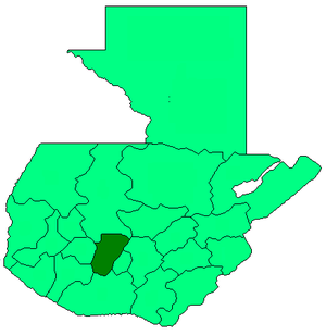
chimaltenango
City
tecpan guatemala
Time Zone
America/Guatemala
ISP
Language
User-Agent
Latitude
Longitude
Postal
ipdata
Country
Region
City
ASN
Time Zone
ISP
Blacklist
Proxy
Latitude
Longitude
Postal
Route
Popular places and events near this IP address

Patzún
Municipality in Chimaltenango, Guatemala
Distance: Approx. 9612 meters
Latitude and longitude: 14.68333333,-91.01666667
Patzún (Spanish pronunciation: [patˈsun]) is a town, with a population of 26,632 (2018 census) and a municipality in the Chimaltenango department of Guatemala.
Santa Apolonia, Chimaltenango
Municipality and town in Chimaltenango, Guatemala
Distance: Approx. 3483 meters
Latitude and longitude: 14.78333333,-90.96666667
Santa Apolonia is a municipality in the northern part of Chimaltenango department of Guatemala. Santa Apolonia is bordered by the towns of Tecpán to the west and south, San José Poaquil to the east and San Juan Comalapa to the southeast.[1] The geographical extension of the town is 96 square kilometers (37 mi²). Santa Apolonia is well known for its handicrafts, particularly its earthenware pottery, although this tradition has been in decline for the past few decades.

Tecpán, Guatemala
Municipality and town in Chimaltenango, Guatemala
Distance: Approx. 625 meters
Latitude and longitude: 14.76666667,-91
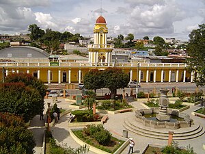
Tecpán is a town, with a population of 34,519 (2018 census), and a municipality in the department of Chimaltenango, in Guatemala, on the Inter-American Highway CA-1. The climate is generally cold. It is characterized as a tourist destination, with some fame derived from its landscapes, varied vegetation and from being on an access route to Iximché archaeological site.

Iximche
Pre-Columbian Mesoamerican site in the highlands of Guatemala
Distance: Approx. 3469 meters
Latitude and longitude: 14.7358,-90.9962
Iximcheʼ (/iʃimˈtʃeʔ/) (or Iximché using Spanish orthography) is a Pre-Columbian Mesoamerican archaeological site in the western highlands of Guatemala. Iximche was the capital of the Late Postclassic Kaqchikel Maya kingdom from 1470 until its abandonment in 1524. The architecture of the site included a number of pyramid-temples, palaces and two Mesoamerican ballcourts.
Weather in this IP's area
broken clouds
13 Celsius
12 Celsius
13 Celsius
13 Celsius
1021 hPa
72 %
1021 hPa
793 hPa
10000 meters
3.84 m/s
7.44 m/s
19 degree
61 %
