Country:
Region:
City:
Latitude and Longitude:
Time Zone:
Postal Code:
IP information under different IP Channel
ip-api
Country
Region
City
ASN
Time Zone
ISP
Blacklist
Proxy
Latitude
Longitude
Postal
Route
Luminati
Country
Region
b
City
villaballester
ASN
Time Zone
America/Argentina/Buenos_Aires
ISP
Techtel LMDS Comunicaciones Interactivas S.A.
Latitude
Longitude
Postal
IPinfo
Country
Region
City
ASN
Time Zone
ISP
Blacklist
Proxy
Latitude
Longitude
Postal
Route
db-ip
Country
Region
City
ASN
Time Zone
ISP
Blacklist
Proxy
Latitude
Longitude
Postal
Route
ipdata
Country
Region
City
ASN
Time Zone
ISP
Blacklist
Proxy
Latitude
Longitude
Postal
Route
Popular places and events near this IP address

Munro, Buenos Aires
District in Buenos Aires, Argentina
Distance: Approx. 4282 meters
Latitude and longitude: -34.53333333,-58.51666667
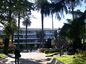
Munro is a city of the Vicente López Partido in northern Greater Buenos Aires, Argentina, best known for its jeans and apparel stores and outlets. It is located some 20 km from the downtown of the city. It is bordered by the neighborhoods of Villa Adelina, Carapachay and Martínez on the north; Villa Ballester on the west; Florida Este in the south; and Olivos to the east.

Villa Ballester
City in Buenos Aires Province, Argentina
Distance: Approx. 3783 meters
Latitude and longitude: -34.51666667,-58.53333333
Villa Ballester is a city located in the northern Greater Buenos Aires urban area and it is part of the General San Martín Partido in Buenos Aires Province, Argentina. It is served by the Línea Mitre commuter railway with its station also named Villa Ballester. Founded on 26 October 1889.
San Martín, Buenos Aires
Place in Buenos Aires, Argentina
Distance: Approx. 3938 meters
Latitude and longitude: -34.56666667,-58.53333333
Ciudad del Libertador General Don José de San Martín, more commonly known as San Martín, is the administrative seat of General San Martín Partido in the urban agglomeration of Greater Buenos Aires.
Villa Maipú
Place in Buenos Aires, Argentina
Distance: Approx. 3938 meters
Latitude and longitude: -34.56666667,-58.53333333
Villa Maipú is a localidad (district) of the General San Martín Partido in Buenos Aires Province, Argentina. It forms part of the urban agglomeration of Greater Buenos Aires. The localidad is home to Chacarita Juniors, a football club that won the 1969 Metropolitano.

Villa Adelina
District in Buenos Aires, Argentina
Distance: Approx. 3783 meters
Latitude and longitude: -34.51666667,-58.53333333
Villa Adelina is a city in Buenos Aires Province, Argentina. It is divided between the counties (partidos) of San Isidro and Vicente López and forms part of the urban conurbation of Greater Buenos Aires. The town is named after Adelina Munro Drysdale, whose grandfather was a British railway official in Argentina.

Torre Ader
Tower in Buenos Aires, Argentina
Distance: Approx. 1775 meters
Latitude and longitude: -34.53388889,-58.545
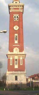
The Torre Ader (Ader Tower in English) is an 18th-century Florentine-style tower located in Carapachay in Vicente López Partido, Buenos Aires, Argentina. It is an historical monument built in similar style to the Torre Monumental (Monumental Tower) in Buenos Aires. It reaches a height of 42.30 m (138 ft 9+1⁄2 in) and has a 217-step staircase to the lookout point.

Carapachay
District in Buenos Aires, Argentina
Distance: Approx. 3783 meters
Latitude and longitude: -34.51666667,-58.53333333
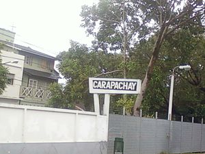
Carapachay is a town located in Vicente López Partido in Argentina. It forms part of the Greater Buenos Aires agglomeration.
El Libertador, Argentina
District in Buenos Aires, Argentina
Distance: Approx. 2916 meters
Latitude and longitude: -34.56666667,-58.56666667
El Libertador is a town in Tres de Febrero Partido of Buenos Aires Province, Argentina. It is located in the Greater Buenos Aires urban agglomeration.
Villa Bosch
District in Buenos Aires, Argentina
Distance: Approx. 2916 meters
Latitude and longitude: -34.56666667,-58.56666667
Villa Bosch is a town in Tres de Febrero County of Buenos Aires Province, Argentina. It is located in the Greater Buenos Aires urban agglomeration.
Billinghurst
Place in Buenos Aires, Argentina
Distance: Approx. 3938 meters
Latitude and longitude: -34.56666667,-58.53333333
Billinghurst is a town in General San Martín Partido of Buenos Aires Province, Argentina. It is located in the Greater Buenos Aires urban agglomeration.
Ciudad Jardín El Libertador
Town in Buenos Aires, Argentina
Distance: Approx. 3938 meters
Latitude and longitude: -34.56666667,-58.53333333
Ciudad Jardín El Libertador is a town in General San Martín Partido of Buenos Aires Province, Argentina. It is located in the Greater Buenos Aires area.

Hölters Schule
Private school in Villa Ballester, San Martín, Buenos Aires Province, Argentina
Distance: Approx. 309 meters
Latitude and longitude: -34.5431,-58.5642
The Hölters Institute (or Hölters Schule) is a school which integrates high school, elementary school and kindergarten. It is located in the city of Villa Ballester, in Buenos Aires Province, Argentina. It was established in 1931 by Hermann Hölters, a German educator, and, therefore, German is taught since kindergarten.
Weather in this IP's area
clear sky
31 Celsius
30 Celsius
29 Celsius
32 Celsius
1006 hPa
40 %
1006 hPa
1003 hPa
10000 meters
5.81 m/s
360 degree
05:40:59
19:37:07

