Country:
Region:
City:
Latitude and Longitude:
Time Zone:
Postal Code:
IP information under different IP Channel
ip-api
Country
Region
City
ASN
Time Zone
ISP
Blacklist
Proxy
Latitude
Longitude
Postal
Route
Luminati
Country
ASN
Time Zone
Asia/Hong_Kong
ISP
YAHOO-1
Latitude
Longitude
Postal
IPinfo
Country
Region
City
ASN
Time Zone
ISP
Blacklist
Proxy
Latitude
Longitude
Postal
Route
db-ip
Country
Region
City
ASN
Time Zone
ISP
Blacklist
Proxy
Latitude
Longitude
Postal
Route
ipdata
Country
Region
City
ASN
Time Zone
ISP
Blacklist
Proxy
Latitude
Longitude
Postal
Route
Popular places and events near this IP address
Dongguk University
Private university in Seoul, South Korea
Distance: Approx. 549 meters
Latitude and longitude: 37.558222,127.000139
Dongguk University (Korean: 동국대학교) is a private university in Jung District, Seoul, South Korea. It is one of the few Buddhist-affiliated universities in the world, and is a member of the International Association of Buddhist Universities. Established in 1906 as Myeongjin School (명진학교; 明進學校) by Buddhist pioneers of the Association of Buddhism Research (불교연구회; 佛敎硏究會), the university gained full university status with its current name in 1953.

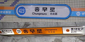
Chungmuro station
Distance: Approx. 56 meters
Latitude and longitude: 37.56130556,126.9945
Chungmuro Station is a station on Line 3 and Line 4 of the Seoul Subway system. Platforms for both Line 3 and Line 4 are located in Chungmuro-4-ga, Jung District, Seoul. This station is named after the road under which it passes, in honor of the Chosun general Yi Sunsin, who was also known by the title of Chungmugong.

Euljiro 3(sam)-ga station
Train station in South Korea
Distance: Approx. 621 meters
Latitude and longitude: 37.56629444,126.99278056
Euljiro 3(sam)-ga (Korean: 을지로3가역) is a station on Line 2 and Line 3 of the Seoul Metropolitan Subway.

Seoul Metropolitan Fire and Disaster Management Headquarters
Distance: Approx. 581 meters
Latitude and longitude: 37.558884,126.988985
Seoul Metropolitan Fire and Disaster Management Headquarters is a department of the Seoul Metro government in charge of fire and rescue services in Seoul, South Korea.

International Worship in English
Distance: Approx. 580 meters
Latitude and longitude: 37.563243,126.989062
International Worship in English (IWE - pronounced "I" "WE") is a Christian ministry of Youngnak Presbyterian Church in Myeongdong Seoul, South Korea that in English offers traditional worship at 10am and contemporary worship at 3:30pm on Sundays. English worship in two different styles, small group Bible studies, counseling, fellowship, and retreats are provided for the international community in the greater Seoul area. The ministry is like a church (mega-church or KM) within a church (international church or EM).

Namsangol Hanok Village
Recreated village in Seoul, South Korea
Distance: Approx. 226 meters
Latitude and longitude: 37.55916667,126.99388889
Namsangol Hanok Village (Korean: 남산골한옥마을) is a recreated village of historical Korean buildings in Pil-dong, Jung District, Seoul, South Korea. The village contains several Korean traditional houses called hanok. The Namsangol Hanok Village offers one the opportunity to experience a wide cross-section of Joseon-era citizenry and activities, from royalty to commoners.
Cho-dong
Neighborhood in Seoul, South Korea
Distance: Approx. 426 meters
Latitude and longitude: 37.564,126.992
Cho-dong (Korean: 초동) is a legal dong (neighborhood) of Jung District, Seoul, South Korea. It is governed by its administrative dong, Euljiro 3, 4, 5-dong.

Seoul
Capital of South Korea
Distance: Approx. 455 meters
Latitude and longitude: 37.56,126.99
Seoul, officially Seoul Special Metropolitan City, is the capital and largest city of South Korea. The broader Seoul Capital Area, encompassing Gyeonggi Province and Incheon, emerged as the world's sixth largest metropolitan economy in 2022, trailing behind Paris, San Francisco, Los Angeles, Tokyo, and New York, and hosts more than half of South Korea's population. Although Seoul's population peaked at slightly over 10 million, it has gradually decreased since 2014, standing at approximately 9.97 million residents as of 2020.
Asia Song Festival
Pop music festival
Distance: Approx. 455 meters
Latitude and longitude: 37.56,126.99
Asia Song Festival, a.k.a. A-Song-Fe or ASF, is an annual Asian pop music festival held in South Korea, since 2004. It is hosted by Korea Foundation for International Culture Exchange (KOFICE) and features artists from Asian countries.
Maeil Broadcasting Network
South Korean cable TV network
Distance: Approx. 201 meters
Latitude and longitude: 37.560475,126.9928191
Maeil Broadcasting Network, Inc. (MBN) (주식회사 매일방송) is a South Korean cable TV network operated by the Maeil Business Newspaper.

Daehan Cinema
Historic movie theater in Seoul, South Korea
Distance: Approx. 37 meters
Latitude and longitude: 37.5611,126.9954
Daehan Cinema (Korean: 대한극장; Hanja: 大韓劇場) is a historic movie theater at Chungmu-ro, Jung District, Seoul, South Korea. It was founded in 1958, and considered one of the premiere theaters in the country until the 1980s. The building has an entrance within the Chungmuro station on lines 3 and 4 of the Seoul Metropolitan Subway.

Taishōkan
1912–1935 movie theater in Korea
Distance: Approx. 557 meters
Latitude and longitude: 37.566,126.9948
Taishōkan (Japanese: 大正館, Korean: 대정관; RR: Daejeonggwan; MR: Taejŏnggwan) was a movie theater in Keijō (Seoul), Korea, Empire of Japan. It operated between 1912 and 1935. It was located at Sakuraicho 1-chōme (櫻井町1丁目; now 26 Inhyeon-dong 1-ga).
Weather in this IP's area
clear sky
-1 Celsius
-1 Celsius
-1 Celsius
2 Celsius
1033 hPa
74 %
1033 hPa
1028 hPa
10000 meters
1.03 m/s
330 degree
07:16:04
17:19:02