Country:
 Australia
Region:
City:
Latitude and Longitude:
Time Zone:
Postal Code:
IP information under different IP Channel
ip-api
Country
Region
City
ASN
Time Zone
ISP
Blacklist
Proxy
Latitude
Longitude
Postal
Route
IPinfo
Country
Region
City
ASN
Time Zone
ISP
Blacklist
Proxy
Latitude
Longitude
Postal
Route
MaxMind
Country
Region
City
ASN
Time Zone
ISP
Blacklist
Proxy
Latitude
Longitude
Postal
Route
Luminati
Country
AURegion
vic
City
geelong
ASN
Time Zone
Australia/Melbourne
ISP
Neighbourhood Cable
Latitude
Longitude
Postal
db-ip
Country
Region
City
ASN
Time Zone
ISP
Blacklist
Proxy
Latitude
Longitude
Postal
Route
ipdata
Country
Region
City
ASN
Time Zone
ISP
Blacklist
Proxy
Latitude
Longitude
Postal
Route
Popular places and events near this IP address
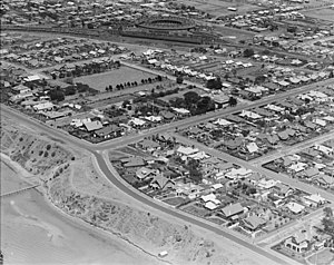
Drumcondra, Victoria
Suburb of Geelong, Victoria, Australia
Distance: Approx. 1301 meters
Latitude and longitude: -38.132,144.354
Drumcondra () is a wealthy residential bayside suburb of Geelong, Victoria, Australia, overlooking Corio Bay. It is the smallest suburb in Geelong and one of the smallest in Victoria. It was named after Drumcondra, which is an inner suburb of Dublin, Ireland.

Lightning (clipper)
Distance: Approx. 568 meters
Latitude and longitude: -38.14,144.36861111
Lightning was a clipper ship, one of the last really large clippers to be built in the United States. She was built by Donald McKay for James Baines of the Black Ball Line, Liverpool, for the Australia trade. It has been said that Lightning was the most extreme example of a type of ship classified as an extreme clipper.
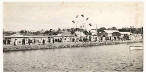
Hi-Lite Park
Amusement park in Geelong, Australia (1956–1985)
Distance: Approx. 1242 meters
Latitude and longitude: -38.146,144.367
Hi-Lite Park was an amusement park in Geelong, Australia, located near Eastern Beach, on the corner of Bellarine Street and Ritchie Boulevard, where the Eastern Beach tram terminus was once situated. The park opened in 1956 and closed c. 1985.

Westfield Geelong
Shopping mall in Victoria, Australia
Distance: Approx. 1387 meters
Latitude and longitude: -38.1465,144.3626
Westfield Geelong is a shopping centre located in the Geelong CBD in Victoria, Australia which was opened in 1988. It was formerly known as Westfield Bay City before the 2008 redevelopment, and as Bay City Plaza before being acquired by the Westfield Group in 2003. The centre is located on the northern side of Malop Street opposite the Market Square shopping complex (the two of which together make up Geelong's Central Shopping Complex), and is bounded by Moorabool Street, Yarra Street (although since redevelopment the centre now extends East of Yarra Street via a flyover), Malop Street and Brougham Street.

Ford Discovery Centre
Automobile museum in Victoria, Australia
Distance: Approx. 1322 meters
Latitude and longitude: -38.1442,144.359
The Ford Discovery Centre was an interactive automobile museum located in Geelong, Victoria, Australia. It was operated by Ford Heritage Ltd, a Not for Profit Trust set up to showcase and preserve the heritage of the Ford Motor Company in Australia.

Geelong Power Station
Distance: Approx. 1316 meters
Latitude and longitude: -38.14611111,144.36361111
The city of Geelong, Victoria, Australia was once home to two coal-fired power stations - Geelong A and Geelong B. The first moves to provide an electricity supply to Geelong were made in 1898, with three separate companies vying for the right to operate in the city. Two of these companies merged to form the Electric Lighting and Traction Company of Australia, which built the Geelong A power station. The company was later taken over by the Melbourne Electric Supply Company, which remained the supplier of electricity to Geelong until 1 September 1930, when the company was purchased by the State Electricity Commission of Victoria.

Geelong Waterfront
Waterfront
Distance: Approx. 1109 meters
Latitude and longitude: -38.143803,144.362718
The Geelong Waterfront is a tourist and recreation area on the north facing shores of Corio Bay in Geelong, Australia. The area was once part of the Port of Geelong, falling into disuse before being redeveloped during the 1990s.

Geelong Customs House
Heritage-listed building in Geelong, Victoria, Australia
Distance: Approx. 1265 meters
Latitude and longitude: -38.1452,144.3623
The Geelong Customs House is a bluestone and freestone classical style public building in Geelong, Victoria, built in 1855. It replaced a small timber prefabricated building of 1838, which was later relocated to the Geelong Botanic Gardens. The Customs House was erected near the Geelong foreshore to serve the needs of the colonial administration during the peak of the gold rushes.

Geelong Library and Heritage Centre
Distance: Approx. 1326 meters
Latitude and longitude: -38.145408,144.361253
The Geelong Library and Heritage Centre is a regional library, archive and resource facility in the city of Geelong, Victoria, Australia. Geelong Free Library was begun in 1858. The Geelong Historical Records Centre was established in 1979 as a depository for significant historical records and archives from the district.
National Wool Museum (Geelong)
Historical museum in Geelong, Australia
Distance: Approx. 1324 meters
Latitude and longitude: -38.145374,144.361221
The National Wool Museum tells the Australian story of wool, fibre and textiles, alongside a range of contemporary exhibitions, public programs and special events. The National Wool Museum was established in Geelong, Victoria in 1988 as part of the Australian Bicentennial Celebrations. Housed in the former Dennys, Lascelles Ltd Woolstore at 26 Moorabool Street, Geelong, the Museum began its life as the National Wool Centre and was opened by Her Majesty Queen Elizabeth II on 14 April 1988.
The Geelong Club
Private social club in Geelong, Victoria, Australia
Distance: Approx. 1293 meters
Latitude and longitude: -38.14596,144.36389
The Geelong Club is a private social club originally established in 1859 originally as the Western Club, since most of its members were from outside Geelong in the Western District. After a period of inactivity the club reformed in 1874, and then again in 1881, when a group of gentlemen committed to an ongoing organisation. The present organisation dates is foundation from this year.

Geelong Carousel
Victorian era merry-go-round in Australia
Distance: Approx. 1076 meters
Latitude and longitude: -38.14361111,144.36305556
The Geelong Carousel is a fully-restored Victorian era carousel (or merry-go-round), that operates in a custom-built pavilion on the waterfront in Geelong, Victoria, Australia. It is owned and operated by the City of Greater Geelong. The carousel and its original steam engine were purchased and restored between 1996 and 2000, as part of the redevelopment of the Geelong Waterfront.
Weather in this IP's area
overcast clouds
12 Celsius
11 Celsius
12 Celsius
13 Celsius
1008 hPa
76 %
1008 hPa
1008 hPa
10000 meters
8.75 m/s
300 degree
93 %
06:15:14
18:16:52