180.222.174.191 - IP Lookup: Free IP Address Lookup, Postal Code Lookup, IP Location Lookup, IP ASN, Public IP
Country:
Region:
City:
Location:
Time Zone:
Postal Code:
ISP:
ASN:
language:
User-Agent:
Proxy IP:
Blacklist:
IP information under different IP Channel
ip-api
Country
Region
City
ASN
Time Zone
ISP
Blacklist
Proxy
Latitude
Longitude
Postal
Route
db-ip
Country
Region
City
ASN
Time Zone
ISP
Blacklist
Proxy
Latitude
Longitude
Postal
Route
IPinfo
Country
Region
City
ASN
Time Zone
ISP
Blacklist
Proxy
Latitude
Longitude
Postal
Route
IP2Location
180.222.174.191Country
Region
new south wales
City
smithfield
Time Zone
Australia/Sydney
ISP
Language
User-Agent
Latitude
Longitude
Postal
ipdata
Country
Region
City
ASN
Time Zone
ISP
Blacklist
Proxy
Latitude
Longitude
Postal
Route
Popular places and events near this IP address

Woodpark, New South Wales
Suburb of Sydney, New South Wales, Australia
Distance: Approx. 2469 meters
Latitude and longitude: -33.84194444,150.9625
Woodpark is a suburb of Sydney, in the state of New South Wales, Australia. Woodpark is located 29 kilometres west of the Sydney central business district in the local government area of the Cumberland Council.
Wetherill Park, New South Wales
Suburb of Greater Western Sydney, New South Wales, Australia
Distance: Approx. 2405 meters
Latitude and longitude: -33.84972222,150.91111111
Wetherill Park is a suburb in Greater Western Sydney, in the state of New South Wales, Australia. Wetherill Park is located 34 kilometres west of the Sydney central business district, in the local government area of the City of Fairfield. The 2016 census recorded that Wetherill Park as having a resident population of 6,127.

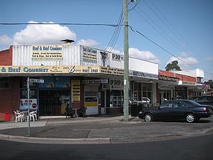
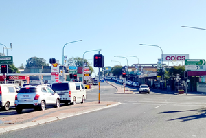
Smithfield, New South Wales
Suburb of Sydney, New South Wales, Australia
Distance: Approx. 651 meters
Latitude and longitude: -33.85277778,150.93194444
Smithfield is a suburb of Sydney, in the state of New South Wales, Australia. Smithfield is located 31 kilometres (19 mi) west of the Sydney central business district, in the local government areas of the City of Fairfield and Cumberland Council. Located in the Greater Western Sydney region, the suburb is one of the largest in Fairfield City by area.
Fairfield Heights, New South Wales
Suburb of Sydney, New South Wales, Australia
Distance: Approx. 2245 meters
Latitude and longitude: -33.86848,150.94239
Fairfield Heights is a suburb of Sydney, in the state of New South Wales, Australia. Fairfield Heights is located 25 kilometres west of the Sydney central business district in the local government area of the City of Fairfield. Fairfield Heights is part of the Greater Western Sydney region.
Guildford West, New South Wales
Suburb of Sydney, New South Wales, Australia
Distance: Approx. 2411 meters
Latitude and longitude: -33.850656,150.96308
Guildford West is a suburb of Sydney, in the state of New South Wales, Australia that is located 26 kilometres west of the Sydney central business district, in the local government area of the Cumberland City Council and is part of the Greater Western Sydney region. Guildford West shares the postcode of 2161 with the separate suburbs of Guildford and Old Guildford.
Westfields Sports High School
School in Australia
Distance: Approx. 2540 meters
Latitude and longitude: -33.866728,150.920104
Westfields Sports High School (abbreviated as WSHS) is a government-funded co-educational comprehensive and specialist secondary day school, with speciality in sports, located in Fairfield West, a western suburb of Sydney, New South Wales, Australia. Established in 1963, the school caters for approximately 1,660 students in 2018, from Year 7 to Year 12, of whom three percent identified as Indigenous Australians and 66 percent were from a language background other than English. The school is operated by the NSW Department of Education; the principal is Andrew Rogers.
Leightonfield
Place in New South Wales, Australia
Distance: Approx. 1340 meters
Latitude and longitude: -33.84863,150.92261
Leightonfield is an industrial locality in south-western Sydney, in the state of New South Wales, Australia.

Lower Prospect Canal Reserve
Australian nature reserve
Distance: Approx. 2050 meters
Latitude and longitude: -33.8319,150.9459
The Lower Prospect Canal Reserve is a heritage-listed former farm and public water supply canal and now bushy corridor and nature reserve stretching 7.7 kilometres (4.8 mi) through the heart of suburban Sydney, New South Wales, Australia. The lineal corridor stretches from Prospect Reservoir to Sydney Water Pipehead at Albert Street, Guildford with the majority of the reserve located in Greystanes, which is a suburb within the Cumberland Council area. The Canal Reserve is one of the last remaining remnants of natural Cumberland Plain Woodland in the Sydney basin and contains a number of rare and endangered plant specimens.
Holroyd High School
School in Greystanes, New South Wales, Australia
Distance: Approx. 2128 meters
Latitude and longitude: -33.83322222,150.9504389
Holroyd High School, (abbreviation HHS) is a school located in Greystanes, New South Wales, Australia. It is a co-educational high school operated by the New South Wales Department of Education with students from Years 7 to 12. The school was established in 1968.

Brenan Park
Urban park in Sydney, Australia
Distance: Approx. 1226 meters
Latitude and longitude: -33.8581,150.93
Brenan Park is a 20-hectare (49-acre) urban park situated in the western suburbs of Sydney, New South Wales, Australia. Primarily categorised as a sports field, the reserve contains an open grassland, bushland and recreational areas within the vicinity of native plants, such as eucalyptus trees. It is named after John Ryan Brenan, who founded the suburb of Smithfield in 1836.

Cumberland Plain Woodland
Indigenous woodland community in Sydney, Australia
Distance: Approx. 2405 meters
Latitude and longitude: -33.84972222,150.91111111
The Cumberland Plain Woodland, also known as Cumberland Plain Bushland and Western Sydney woodland, is a grassy woodland community found predominantly in Western Sydney, New South Wales, Australia, that comprises an open tree canopy, a groundcover with grasses and herbs, usually with layers of shrubs and/or small trees. Situated in the Cumberland Plain, the Cumberland Plain Woodland (CPW) is a savanna that features dry sclerophyll woodlands, grasslands and/or forests, reminiscent of Mediterranean forests. According to Office of Environment and Heritage, the community falls predominantly within the Coastal Valley Grassy Woodlands region, which are part of the Grassy Woodlands formation found in the eastern corridor of New South Wales.

Smithfield West
Place in New South Wales, Australia
Distance: Approx. 1340 meters
Latitude and longitude: -33.84863,150.92261
Smithfield West is a locality situated in western Sydney, New South Wales, Australia. Part of Smithfield, it is an unofficial designation for the region, or neighbourhood area, westwards from Dublin Street to Wetherill Street on the boundary of Wetherill Park.
Weather in this IP's area
clear sky
38 Celsius
43 Celsius
36 Celsius
39 Celsius
1008 hPa
41 %
1008 hPa
1002 hPa
10000 meters
0.89 m/s
2.68 m/s
9 degree
2 %

