Country:
 Australia
Region:
City:
Latitude and Longitude:
Time Zone:
Postal Code:
IP information under different IP Channel
ip-api
Country
Region
City
ASN
Time Zone
ISP
Blacklist
Proxy
Latitude
Longitude
Postal
Route
IPinfo
Country
Region
City
ASN
Time Zone
ISP
Blacklist
Proxy
Latitude
Longitude
Postal
Route
MaxMind
Country
Region
City
ASN
Time Zone
ISP
Blacklist
Proxy
Latitude
Longitude
Postal
Route
Luminati
Country
AURegion
vic
City
geelong
ASN
Time Zone
Australia/Melbourne
ISP
Neighbourhood Cable
Latitude
Longitude
Postal
db-ip
Country
Region
City
ASN
Time Zone
ISP
Blacklist
Proxy
Latitude
Longitude
Postal
Route
ipdata
Country
Region
City
ASN
Time Zone
ISP
Blacklist
Proxy
Latitude
Longitude
Postal
Route
Popular places and events near this IP address
K Rock 95.5
Radio station in Geelong, Australia
Distance: Approx. 321 meters
Latitude and longitude: -38.146994,144.361017
K Rock 95.5 (call sign: 3CAT; stylised as K rock 95.5 and previously as K-Rock) is a commercial FM radio station based in Geelong, Australia. K Rock operates a mainstream Top 40 playlist and also airs Australian Football League matches involving the Geelong Football Club. K Rock shares transmitter facilities with sister station 93.9 Bay FM (along with 94.7 The Pulse and 96.3 Rhema FM), broadcasting from a transmitter on top of Murradoc Hill on the Bellarine Peninsula.

Geelong railway station
Railway station in Geelong, Victoria, Australia
Distance: Approx. 321 meters
Latitude and longitude: -38.1444,144.3549
Geelong railway station is a regional railway station on the Warrnambool line, which is part of the Regional railway network. It serves the city Geelong, in Victoria, Australia. Geelong station is a ground-level unstaffed station, featuring three platforms, an island platform with two faces and one side platform.

Gordon Institute of TAFE
Cel pbs kisd
Distance: Approx. 188 meters
Latitude and longitude: -38.14649,144.35526
The Gordon Institute of TAFE is the Technical and Further Education institute predominantly servicing the wider Geelong area. The Gordon opened in 1887 and celebrated 130 years of providing education in 2017. The Gordon provides education to more than 13,500 students annually and, with more than 500 staff members, it is one of the largest employers in Geelong.
Bay 93.9
Radio station in Geelong, Victoria
Distance: Approx. 352 meters
Latitude and longitude: -38.1469,144.3614
Bay 93.9 (Stylised as Bay 93.9, call sign: 3BAY) is a commercial FM radio station based in Geelong, Victoria, Australia. Commencing broadcasting in 1989, the station broadcasts an adult contemporary format.

View of Geelong
1856 painting by Eugene von Guerard
Distance: Approx. 93 meters
Latitude and longitude: -38.14733889,144.35738889
Throughout this article, the $ symbol refers to the Australian dollar. View of Geelong is an 1856 oil painting on canvas by Eugene von Guerard. The painting measures 154.5 x 89 cm and is owned by the Geelong Art Gallery in Victoria, Australia.

Ford Discovery Centre
Automobile museum in Victoria, Australia
Distance: Approx. 291 meters
Latitude and longitude: -38.1442,144.359
The Ford Discovery Centre was an interactive automobile museum located in Geelong, Victoria, Australia. It was operated by Ford Heritage Ltd, a Not for Profit Trust set up to showcase and preserve the heritage of the Ford Motor Company in Australia.

Geelong Town Hall
Civic building in Victoria, Australia
Distance: Approx. 78 meters
Latitude and longitude: -38.1472,144.3575
Geelong City Hall is a civic building located on Gheringhap Street in central Geelong, Victoria. It was originally built for the City of Geelong, which became the City of Greater Geelong in 1993.

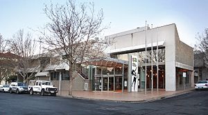
Geelong Art Gallery
Art gallery in Geelong, Australia
Distance: Approx. 93 meters
Latitude and longitude: -38.14733889,144.35738889
The Geelong Art Gallery, currently known as Geelong Gallery, is a major regional gallery in the city of Geelong in Victoria, Australia. The gallery has over 6,000 works of art in its collection. The Gallery forms Geelong's Cultural Precinct with the adjacent Geelong Library and Heritage Centre (Geelong Regional Library and Geelong Heritage Centre), Geelong Arts Centre, and the Geelong Courthouse (housing Back to Back Theatre and Platform Arts).

Old Geelong Post Office
Post office in Victoria, Australia
Distance: Approx. 191 meters
Latitude and longitude: -38.1482,144.3571
The current Geelong Post Office opened in 1994 and is located on the corner of Gheringhap and Little Myers Streets. The original post office was located on the corner of Ryrie and Gheringhap Streets. The Geelong Telegraph Station was located next door.

Johnstone Park
Distance: Approx. 66 meters
Latitude and longitude: -38.147,144.357
Johnstone Park is a landscaped garden in Geelong, Victoria, Australia. It is bounded by Railway Terrace, Gheringhap Street, Little Malop Street, Fenwick Street, and Mercer Street. The park is surrounded by civic buildings including the Geelong City Hall, Geelong Art Gallery, Geelong Library, Geelong Law Courts, and the Geelong Railway Station.
Geelong Arts Centre
Performing arts venue in Geelong, Victoria, Australia
Distance: Approx. 282 meters
Latitude and longitude: -38.1474,144.3544
Geelong Arts Centre, formerly the Geelong Performing Arts Centre (GPAC), is a performing arts, functions, and events venue located in Geelong, Victoria, Australia. The complex is located between Little Malop and Ryrie Streets in central Geelong, and comprises a number of venues. It also hosts Creative Engine, a sector of the organisation that runs programs such as Community Fuel.
National Wool Museum (Geelong)
Historical museum in Geelong, Australia
Distance: Approx. 356 meters
Latitude and longitude: -38.145374,144.361221
The National Wool Museum tells the Australian story of wool, fibre and textiles, alongside a range of contemporary exhibitions, public programs and special events. The National Wool Museum was established in Geelong, Victoria in 1988 as part of the Australian Bicentennial Celebrations. Housed in the former Dennys, Lascelles Ltd Woolstore at 26 Moorabool Street, Geelong, the Museum began its life as the National Wool Centre and was opened by Her Majesty Queen Elizabeth II on 14 April 1988.
Weather in this IP's area
overcast clouds
12 Celsius
11 Celsius
12 Celsius
13 Celsius
1008 hPa
76 %
1008 hPa
1006 hPa
10000 meters
8.75 m/s
300 degree
90 %
06:15:16
18:16:55