180.128.32.75 - IP Lookup: Free IP Address Lookup, Postal Code Lookup, IP Location Lookup, IP ASN, Public IP
Country:
Region:
City:
Location:
Time Zone:
Postal Code:
ISP:
ASN:
language:
User-Agent:
Proxy IP:
Blacklist:
IP information under different IP Channel
ip-api
Country
Region
City
ASN
Time Zone
ISP
Blacklist
Proxy
Latitude
Longitude
Postal
Route
db-ip
Country
Region
City
ASN
Time Zone
ISP
Blacklist
Proxy
Latitude
Longitude
Postal
Route
IPinfo
Country
Region
City
ASN
Time Zone
ISP
Blacklist
Proxy
Latitude
Longitude
Postal
Route
IP2Location
180.128.32.75Country
Region
samut prakan
City
phra pradaeng
Time Zone
Asia/Bangkok
ISP
Language
User-Agent
Latitude
Longitude
Postal
ipdata
Country
Region
City
ASN
Time Zone
ISP
Blacklist
Proxy
Latitude
Longitude
Postal
Route
Popular places and events near this IP address

Phra Pradaeng district
Place in Samut Prakan, Thailand
Distance: Approx. 42 meters
Latitude and longitude: 13.65833333,100.53388889
Phra Pradaeng (Thai: พระประแดง, pronounced [pʰráʔ prā.dɛ̄ːŋ]) is a district (amphoe) of Samut Prakan province in Thailand.

Bhumibol Bridge
Bridge in Bangkok, Thailand
Distance: Approx. 1008 meters
Latitude and longitude: 13.66527778,100.53944444
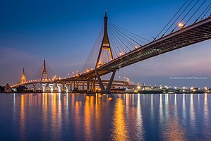
The Bhumibol Bridge (Thai: สะพานภูมิพล, RTGS: Saphan Phumiphon), also known as the Industrial Ring Road Bridge (Thai: สะพานวงแหวนอุตสาหกรรม, RTGS: Saphan Wongwaen Utsahakam) is part of the 13 km long Industrial Ring Road connecting southern Bangkok with Samut Prakan province. The bridge crosses the Chao Phraya River twice, with two striking cable-stayed spans of lengths of 702 m and 582 m supported by two diamond-shaped pylons 173 m and 164 m high. Where the two spans meet, another road rises to join them at a free-flowing interchange suspended 50 metres above the ground.

Rama IX Bridge
Bridge in Bangkok, Thailand
Distance: Approx. 3075 meters
Latitude and longitude: 13.682058,100.519001
Rama IX Bridge (Thai: สะพานพระราม ๙, RTGS: Saphan Phra Ram Kao, pronounced [sā.pʰāːn pʰráʔ rāːm kâːw]) is a bridge in Bangkok, Thailand over the Chao Phraya River. It connects the Yan Nawa District to Rat Burana District as a part of the Tha Ruea – Dao Khanong Section of Chaloem Maha Nakhon Expressway. The bridge was named in the honor of King Bhumibol Adulyadej's 60th birthday.

Kanchanaphisek Bridge
Bridge in Samut Prakan, Thailand
Distance: Approx. 2648 meters
Latitude and longitude: 13.634831,100.537477
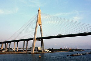
The Kanchanaphisek Bridge (Thai: สะพานกาญจนาภิเษก) is a cable stayed bridge crossing the Chao Phraya river in Samut Prakan Province, Thailand. It is part of the Outer Ring Road encircling Bangkok. The bridge was opened to traffic on 15 November 2007 and has a main span of 500 meters.

Museum of Counterfeit Goods
Distance: Approx. 3110 meters
Latitude and longitude: 13.682809,100.547293
The Tilleke & Gibbins Museum of Counterfeit Goods is a museum focused on intellectual property infringement in Yan Nawa District, Bangkok, Thailand. It is operated by Tilleke & Gibbins, a law firm with offices in Thailand and Vietnam. In the firm's Bangkok office on the 26th floor of Supalai Grand Tower, the museum is home to a variety of counterfeit and infringed goods that the firm has accumulated in its work.
The Pano
Residential in Bangkok, Thailand
Distance: Approx. 1744 meters
Latitude and longitude: 13.67161667,100.54199722
The Pano is a 57-storey riverside condominium located in Bangkok. It is the thirteenth tallest building and fourth tallest residential building in Thailand. The Pano has a height of 219 metres and 57 floors.

MS Siritara Ocean Queen
Distance: Approx. 2857 meters
Latitude and longitude: 13.681111,100.521389
MS Siritara Ocean Queen was a cruise ship owned since 2006 by Siritara Enterprise in Thailand. She was built in 1964 by VEB Mathias-Thesen Werft, Wismar, East Germany as Bashkiriya for the Soviet Union's Black Sea Shipping Company. It was named after an Autonomous Soviet Socialist Republic in the former Soviet Union Bashkir Autonomous Soviet Socialist Republic.

Bang Phongphang
Sub-district in Bangkok, Thailand
Distance: Approx. 2360 meters
Latitude and longitude: 13.67905833,100.52908889
Bang Phongphang (Thai: บางโพงพาง, pronounced [bāːŋ pʰōːŋ.pʰāːŋ]) is one of the two khwaengs (sub-districts) of Yan Nawa District, Bangkok, apart from Chong Nonsi. In December 2018 it had a population of 29,754 people, with total area of 6.678 km2 (2.5784 mi2). The sub-district is also divided into seven communities.

Rama III Road
Street in Bangkok, Thailand
Distance: Approx. 3723 meters
Latitude and longitude: 13.687784,100.517251
Rama III Road (Thai: ถนนพระรามที่ 3, RTGS: Thanon Phra Ram Thi Sam; usually shortened to ถนนพระราม 3) is a main road in inner Bangkok. The 12 km (7.5 mi) long road runs along the bend of Chao Phraya River on the Phra Nakhon side (Bangkok core).
Sathu Pradit Road
Street in Thailand
Distance: Approx. 2238 meters
Latitude and longitude: 13.67763889,100.52783333
Sathu Pradit Road (Thai: ถนนสาธุประดิษฐ์), generally referred simply as Sathu Pradit (สาธุประดิษฐ์) is a road in Bangkok.

Wat Pariwat
Distance: Approx. 1734 meters
Latitude and longitude: 13.673877,100.533387
Wat Pariwat Ratchasongkram (Thai: วัดปริวาสราชสงคราม), also known as Wat Pariwat, is a Buddhist temple in Yan Nawa district, Bangkok, Thailand.

Khlong Lat Pho
Distance: Approx. 1147 meters
Latitude and longitude: 13.666909,100.539328
Khlong Lat Pho (Thai: คลองลัดโพธิ์, pronounced [kʰlɔ̄ːŋ lát pʰōː]) is a waterway in form of khlong (canal) in the area of Bang Kachao, connecting Bangkok and the neighbouring province of Samut Prakan. It was dug during the King Tai Sa's reign of Ban Phlu Luang dynasty in the late Ayutthaya period. The canal was used as a travel route for underclass, as well as a thoroughfare for kings when they went fishing in Samut Prakan.
Weather in this IP's area
scattered clouds
31 Celsius
30 Celsius
31 Celsius
31 Celsius
1008 hPa
26 %
1008 hPa
1007 hPa
10000 meters
0.98 m/s
2.66 m/s
98 degree
39 %