179.56.58.9 - IP Lookup: Free IP Address Lookup, Postal Code Lookup, IP Location Lookup, IP ASN, Public IP
Country:
Region:
City:
Location:
Time Zone:
Postal Code:
ISP:
ASN:
language:
User-Agent:
Proxy IP:
Blacklist:
IP information under different IP Channel
ip-api
Country
Region
City
ASN
Time Zone
ISP
Blacklist
Proxy
Latitude
Longitude
Postal
Route
db-ip
Country
Region
City
ASN
Time Zone
ISP
Blacklist
Proxy
Latitude
Longitude
Postal
Route
IPinfo
Country
Region
City
ASN
Time Zone
ISP
Blacklist
Proxy
Latitude
Longitude
Postal
Route
IP2Location
179.56.58.9Country
Region
los lagos
City
castro
Time Zone
America/Santiago
ISP
Language
User-Agent
Latitude
Longitude
Postal
ipdata
Country
Region
City
ASN
Time Zone
ISP
Blacklist
Proxy
Latitude
Longitude
Postal
Route
Popular places and events near this IP address

Castro, Chile
City and Commune in Los Lagos, Chile
Distance: Approx. 2282 meters
Latitude and longitude: -42.46666667,-73.8
Castro is a city and commune on Chiloé Island in Chile. Castro is the capital of the Chiloé Province in the Los Lagos Region. The city is located on Estero de Castro on the eastern coast of central Chiloé Island.
Gamboa Airport
Airport in Castro, Chiloé Island, Chile
Distance: Approx. 1813 meters
Latitude and longitude: -42.48833333,-73.775
Gamboa Airport (Spanish: Aeródromo Gamboa) (IATA: WCA, ICAO: SCST) is an airport serving Castro, a city on Chiloé Island in the Los Lagos Region of Chile. The airport runs along the shoreline just south of Gamboa, and south approach and departures are over the water. Runway 34 has an additional 175 metres (574 ft) of unpaved overrun on the north end.

Church of San Francisco, Castro
UNESCO World Heritage Site in Los Lagos Region, Chile
Distance: Approx. 1286 meters
Latitude and longitude: -42.48138889,-73.76388889
The Church of San Francisco (Spanish, Iglesia de San Francisco), located on one side of the Plaza de Armas of Castro, Chile, is the main Catholic church of Chiloé’s capital. This 1912 building has a surface area of 1,404 m2, a width of 52 m and a height of 27 m. The dome above the church's presbytery is 32 m high and the height of its towers is 42 m.
Church of Nercón
UNESCO World Heritage Site in Los Lagos Region, Chile
Distance: Approx. 2350 meters
Latitude and longitude: -42.4925,-73.78055556
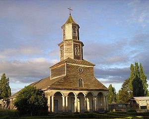
The Church of Nercón —Spanish: Iglesia de Señora de Gracia de Nercón— is a UNESCO World Heritage Site. It is a Church on the Chiloé Island in Chiloé, Chile. It is in the town of Nercón, about 4 km from the town of Castro.

Fort Tauco
Monument in Estero de Castro, Chonchi, Chile
Distance: Approx. 9088 meters
Latitude and longitude: -42.55222222,-73.75194444
Fort Tauco (From Spanish: Fuerte Tauco, also known as Fortín Tauco) is a coastal battery built in 1779 in the commune of Chonchi, Province of Chiloe in southern Chile.
Weather in this IP's area
broken clouds
18 Celsius
17 Celsius
18 Celsius
18 Celsius
1020 hPa
55 %
1020 hPa
1014 hPa
10000 meters
2.06 m/s
340 degree
75 %
