179.56.149.5 - IP Lookup: Free IP Address Lookup, Postal Code Lookup, IP Location Lookup, IP ASN, Public IP
Country:
Region:
City:
Location:
Time Zone:
Postal Code:
ISP:
ASN:
language:
User-Agent:
Proxy IP:
Blacklist:
IP information under different IP Channel
ip-api
Country
Region
City
ASN
Time Zone
ISP
Blacklist
Proxy
Latitude
Longitude
Postal
Route
db-ip
Country
Region
City
ASN
Time Zone
ISP
Blacklist
Proxy
Latitude
Longitude
Postal
Route
IPinfo
Country
Region
City
ASN
Time Zone
ISP
Blacklist
Proxy
Latitude
Longitude
Postal
Route
IP2Location
179.56.149.5Country
Region
la araucania
City
pucon
Time Zone
America/Santiago
ISP
Language
User-Agent
Latitude
Longitude
Postal
ipdata
Country
Region
City
ASN
Time Zone
ISP
Blacklist
Proxy
Latitude
Longitude
Postal
Route
Popular places and events near this IP address

Pucón
City in Araucanía, Chile
Distance: Approx. 1842 meters
Latitude and longitude: -39.27666667,-71.97444444
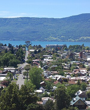
Pucón (Mapudungun: "entrance to the cordillera") is a Chilean city and commune administered by the municipality of Pucón. It is located in the Province of Cautín, Araucanía Region, 100 km to the southeast of Temuco and 780 km to the south of Santiago. It is on the eastern shore of Lake Villarrica, and Villarrica volcano is located roughly 17 km to the south.

Trancura River
River in Chile
Distance: Approx. 5040 meters
Latitude and longitude: -39.2375,-71.9636
Trancura River (also known as Pucón River or Minetúe River) is a river located in the La Araucanía Region of Chile. Its headwaters drain the southeasternmost portion of Villarrica National Park, including the northwestern slope of Lanín volcano. The river flows initially to the north and from its junction with its main tributary, the Maichín River, the Trancura turns in a westerly direction until emptying into the Villarrica Lake, after having received the waters of Caburgua Lake through Carrileufú River.

Pucón Airport
Airport in Chile
Distance: Approx. 3060 meters
Latitude and longitude: -39.29138889,-71.92083333
Pucón Airport (Spanish: Aeropuerto Pucón, IATA: ZPC, ICAO: SCPC) is an airport 5 kilometres (3.1 mi) east of Pucón, a city on the eastern shore of Villarrica Lake in the Araucanía Region of Chile. The airport can handle aircraft up to the Boeing 737 in size and operates seasonal flights from Santiago de Chile. Travel options vary between high and low tourist season.
Curimanque Airport
Airport
Distance: Approx. 7960 meters
Latitude and longitude: -39.32694444,-72.02638889
Curimanque Airport (Spanish: Aeropuerto Curimanque), (ICAO: SCKQ) is an airport 7 kilometres (4.3 mi) southwest of Pucón, a lakeside city in the La Araucanía Region of Chile. The runway is 3 kilometres (1.9 mi) south of Villarrica Lake.
Weather in this IP's area
overcast clouds
16 Celsius
16 Celsius
16 Celsius
16 Celsius
1018 hPa
90 %
1018 hPa
942 hPa
10000 meters
2.07 m/s
4.21 m/s
294 degree
100 %