179.127.127.63 - IP Lookup: Free IP Address Lookup, Postal Code Lookup, IP Location Lookup, IP ASN, Public IP
Country:
Region:
City:
Location:
Time Zone:
Postal Code:
IP information under different IP Channel
ip-api
Country
Region
City
ASN
Time Zone
ISP
Blacklist
Proxy
Latitude
Longitude
Postal
Route
Luminati
Country
ASN
Time Zone
America/Sao_Paulo
ISP
SERVICOS DE ELETRICIDADE SA
Latitude
Longitude
Postal
IPinfo
Country
Region
City
ASN
Time Zone
ISP
Blacklist
Proxy
Latitude
Longitude
Postal
Route
IP2Location
179.127.127.63Country
Region
rio de janeiro
City
itaguai
Time Zone
America/Sao_Paulo
ISP
Language
User-Agent
Latitude
Longitude
Postal
db-ip
Country
Region
City
ASN
Time Zone
ISP
Blacklist
Proxy
Latitude
Longitude
Postal
Route
ipdata
Country
Region
City
ASN
Time Zone
ISP
Blacklist
Proxy
Latitude
Longitude
Postal
Route
Popular places and events near this IP address

Casa da Moeda do Brasil
Mint of Brazil
Distance: Approx. 5093 meters
Latitude and longitude: -22.88916667,-43.74555556
The Casa da Moeda do Brasil is the Brazilian mint, owned by the Brazilian government and administratively subordinated to the Ministry of Finances. It was established in 1694. Its current headquarters and industrial facilities occupy a modern plant with 110,000 square metres (1.2 million square feet) in Rio de Janeiro's western suburb of Santa Cruz.

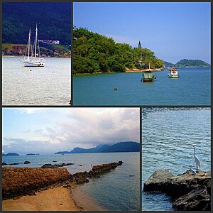
Itaguaí
Municipality in Southeast, Brazil
Distance: Approx. 52 meters
Latitude and longitude: -22.85194444,-43.775
Itaguaí (Portuguese pronunciation: [itɐgwaˈi]) is a municipality located in the Brazilian state of Rio de Janeiro and contains several important iron ore loading ports of the world including Ilha Guaiba. Its population was 134,819 in 2020 and its area is 273 km2. The city was founded in 1688 and lies midway between Rio de Janeiro and Angra dos Reis.

Roman Catholic Diocese of Itaguaí
Catholic ecclesiastical territory
Distance: Approx. 1904 meters
Latitude and longitude: -22.8692,-43.7786
The Roman Catholic Diocese of Itaguaí (Latin: Dioecesis Itaguaiensis) is located in the ecclesiastical province of São Sebastião do Rio de Janeiro in Brazil.
Da Guarda River
River in Brazil
Distance: Approx. 7596 meters
Latitude and longitude: -22.91666667,-43.8
The Da Guarda River is a river of Rio de Janeiro state in southeastern Brazil.
Mazomba River
River in Brazil
Distance: Approx. 4299 meters
Latitude and longitude: -22.88333333,-43.75
The Mazomba River is a river of Rio de Janeiro state in southeastern Brazil.
Piranema River
River in Brazil
Distance: Approx. 5847 meters
Latitude and longitude: -22.81666667,-43.73333333
The Piranema River is a river of Rio de Janeiro state in southeastern Brazil.

Madeira Island Submarine Base
Submarine base of the Brazilian Navy
Distance: Approx. 52 meters
Latitude and longitude: -22.85194444,-43.775
Madeira Island Submarine Base, commonly shortned BSIM is a submarine base of the Brazilian Navy, located in Itaguaí, Brazil.
Weather in this IP's area
clear sky
23 Celsius
23 Celsius
23 Celsius
26 Celsius
1012 hPa
83 %
1012 hPa
1008 hPa
10000 meters
3.6 m/s
350 degree