179.125.112.174 - IP Lookup: Free IP Address Lookup, Postal Code Lookup, IP Location Lookup, IP ASN, Public IP
Country:
Region:
City:
Location:
Time Zone:
Postal Code:
ISP:
ASN:
language:
User-Agent:
Proxy IP:
Blacklist:
IP information under different IP Channel
ip-api
Country
Region
City
ASN
Time Zone
ISP
Blacklist
Proxy
Latitude
Longitude
Postal
Route
db-ip
Country
Region
City
ASN
Time Zone
ISP
Blacklist
Proxy
Latitude
Longitude
Postal
Route
IPinfo
Country
Region
City
ASN
Time Zone
ISP
Blacklist
Proxy
Latitude
Longitude
Postal
Route
IP2Location
179.125.112.174Country
Region
santa catarina
City
criciuma
Time Zone
America/Sao_Paulo
ISP
Language
User-Agent
Latitude
Longitude
Postal
ipdata
Country
Region
City
ASN
Time Zone
ISP
Blacklist
Proxy
Latitude
Longitude
Postal
Route
Popular places and events near this IP address

Criciúma
Municipality in South, Brazil
Distance: Approx. 56 meters
Latitude and longitude: -28.6775,-49.36972222
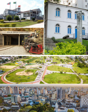
Criciúma is a city in the Brazilian state of Santa Catarina. At 28°40′39″S 49°22′11″W, it is located 180 km south of Florianópolis, the state capital and around 900 km south of São Paulo. The city is the center of Brazil's flooring and home materials industry, and is the second-largest such center in the world.

Estádio Heriberto Hülse
Football stadium in Criciúma, Santa Catarina, Brazil
Distance: Approx. 829 meters
Latitude and longitude: -28.68416667,-49.3675
Estádio Heriberto Hülse, is a football stadium located in Criciúma, Santa Catarina, Brazil. The stadium holds 19,225 people. It was built in 1955.
Içara
Place in Santa Catarina, Brazil
Distance: Approx. 7926 meters
Latitude and longitude: -28.71333333,-49.3
Içara is a city in the Brazilian state of Santa Catarina. It is located 170 km south of Florianópolis, the state capital and around 890 km south of São Paulo. It is the Brazilian capital of the honey and tobacco industries, but is also very strong in plastic, ceramic tiles and chemicals.

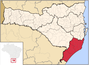
Sul Catarinense
Mesoregion in Santa Catarina, Brazil
Distance: Approx. 89 meters
Latitude and longitude: -28.67777778,-49.37
Sul Catarinense is a mesoregion in the Brazilian state of Santa Catarina.
Roman Catholic Diocese of Criciúma
Catholic ecclesiastical territory
Distance: Approx. 73 meters
Latitude and longitude: -28.6776,-49.3695
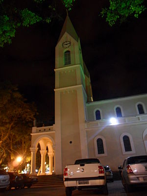
The Roman Catholic Diocese of Criciúma (Latin: Dioecesis Criciumensis) is a diocese located in the city of Criciúma in the ecclesiastical province of Florianópolis in Brazil.
Cocal do Sul
Municipality in South, Brazil
Distance: Approx. 9510 meters
Latitude and longitude: -28.6008,-49.3258
Cocal do Sul is a municipality in the state of Santa Catarina in the South region of Brazil.

Diomício Freitas Airport
Airport in Forquilhinha, Brazil
Distance: Approx. 7636 meters
Latitude and longitude: -28.72583333,-49.42472222
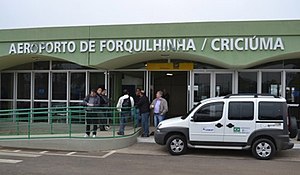
Diomício Freitas/Forquilhinha Airport (IATA: CCM, ICAO: SSIM) formerly SBCM, is the airport serving Criciúma, Brazil, located in the adjoining municipality of Forquilhinha. It is named after Diomício Manoel de Freitas (1911-1981), a local entrepreneur and politician. It is operated by Infracea.

Universidade do Extremo Sul Catarinense
Distance: Approx. 4640 meters
Latitude and longitude: -28.7013,-49.4084
The Universidade do Extremo Sul Catarinense (Unesc) is a community university, located in the municipality of Criciúma, in the southern part of Santa Catarina, Brazil. It works through education, research and extension in different areas of knowledge. It was the first institution of higher education to be deployed in the southern state of Santa Catarina.
Weather in this IP's area
clear sky
24 Celsius
25 Celsius
24 Celsius
24 Celsius
1014 hPa
76 %
1014 hPa
1005 hPa
10000 meters
1.6 m/s
3.27 m/s
126 degree
