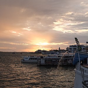
Country:
Region:
City:
Latitude and Longitude:
Time Zone:
Postal Code:
IP information under different IP Channel
ip-api
Country
Region
City
ASN
Time Zone
ISP
Blacklist
Proxy
Latitude
Longitude
Postal
Route
Luminati
Country
Region
pa
City
santarem
ASN
Time Zone
America/Santarem
ISP
ZUM TELECOM LTDA- ME
Latitude
Longitude
Postal
IPinfo
Country
Region
City
ASN
Time Zone
ISP
Blacklist
Proxy
Latitude
Longitude
Postal
Route
db-ip
Country
Region
City
ASN
Time Zone
ISP
Blacklist
Proxy
Latitude
Longitude
Postal
Route
ipdata
Country
Region
City
ASN
Time Zone
ISP
Blacklist
Proxy
Latitude
Longitude
Postal
Route
Popular places and events near this IP address

Tapajós
River in Brazil
Distance: Approx. 4668 meters
Latitude and longitude: -2.40833333,-54.73666667
The Tapajós (Portuguese: Rio Tapajós [ˈʁi.u tɐpɐˈʒɔs]) is a river in Brazil. It runs through the Amazon Rainforest and is a major tributary of the Amazon River. When combined with the Juruena River, the Tapajós is approximately 2,080 km (1,290 mi) long.

Santarém, Pará
Place in Northern Region, Brazil
Distance: Approx. 1670 meters
Latitude and longitude: -2.43,-54.72
Santarém (Brazilian Portuguese pronunciation: [sɐ̃taˈɾẽj]) is a town and municipality in the western part of the state of Pará in Brazil. Located at the confluence of the Tapajós and Amazon Rivers, it has become a popular tourist destination. It is the second-most important city in the state, and the financial and economic center of the western part of the state.

Santarém-Maestro Wilson Fonseca Airport
Airport
Distance: Approx. 8208 meters
Latitude and longitude: -2.42472222,-54.78583333
Santarém–Maestro Wilson Fonseca International Airport (IATA: STM, ICAO: SBSN) is the airport serving Santarém, Brazil. It is named after the composer Wilson Dias da Fonseca (1912–2002), who was born in Santarém.
Port of Santarém
Port in the city of Paranaguá, Brazil
Distance: Approx. 3728 meters
Latitude and longitude: -2.41722222,-54.73472222
The Port of Santarém is a river port in Brazil. It's located in the city of Santarém, in the Brazilian state of Pará. It is located at Ponta do Salé, on the right bank of the Tapajós River, about 3 km from the confluence with the Amazon River and a river distance of 876 km from Belém.
Weather in this IP's area
few clouds
34 Celsius
38 Celsius
34 Celsius
34 Celsius
1005 hPa
49 %
1005 hPa
997 hPa
7000 meters
6.17 m/s
100 degree
20 %
06:17:30
18:31:32
