179.108.242.56 - IP Lookup: Free IP Address Lookup, Postal Code Lookup, IP Location Lookup, IP ASN, Public IP
Country:
Region:
City:
Location:
Time Zone:
Postal Code:
ISP:
ASN:
language:
User-Agent:
Proxy IP:
Blacklist:
IP information under different IP Channel
ip-api
Country
Region
City
ASN
Time Zone
ISP
Blacklist
Proxy
Latitude
Longitude
Postal
Route
db-ip
Country
Region
City
ASN
Time Zone
ISP
Blacklist
Proxy
Latitude
Longitude
Postal
Route
IPinfo
Country
Region
City
ASN
Time Zone
ISP
Blacklist
Proxy
Latitude
Longitude
Postal
Route
IP2Location
179.108.242.56Country
Region
rio grande do sul
City
jaguarao
Time Zone
America/Sao_Paulo
ISP
Language
User-Agent
Latitude
Longitude
Postal
ipdata
Country
Region
City
ASN
Time Zone
ISP
Blacklist
Proxy
Latitude
Longitude
Postal
Route
Popular places and events near this IP address

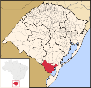
Jaguarão
Municipality in Rio Grande do Sul, Brazil
Distance: Approx. 30 meters
Latitude and longitude: -32.56583333,-53.37583333
Jaguarão (Portuguese pronunciation: [ʒaɡwɐˈɾɐ̃w]) is a municipality in the southern Brazilian state of Rio Grande do Sul located on the shores of the Jaguarão River, bordering Uruguay. It lies a short distance inland from the Mirim Lagoon.

Microregion of Jaguarão
Microregion in Rio Grande do Sul, Brazil
Distance: Approx. 30 meters
Latitude and longitude: -32.56583333,-53.37583333
The Jaguarão microregion (Brazilian Portuguese: Microrregião de Jaguarão) is a microregion in the southern part of the state of Rio Grande do Sul, Brazil. Its total area is 6,331.228 km².

Río Branco, Uruguay
City in Cerro Largo, Uruguay
Distance: Approx. 3536 meters
Latitude and longitude: -32.59722222,-53.38333333
Río Branco is a city in the Cerro Largo department of northeastern Uruguay, it borders the Brazilian city of Jaguarão, with which it communicates through the Baron of Mauá International Bridge.
Baron of Mauá International Bridge
International Bridge between Uruguay and Brazil
Distance: Approx. 577 meters
Latitude and longitude: -32.571,-53.3778
The Baron of Mauá International Bridge (Portuguese: Ponte Internacional Barão de Mauá, Spanish: Puente Internacional Barón de Mauá) is a bridge that crosses the Jaguarão River, linking the cities of Jaguarão, Rio Grande do Sul, Brazil and Río Branco, Uruguay. Built between 1927 and 1930, it was named in honor of Irineu Evangelista de Souza, Baron and Viscount of Mauá, an important businessman and banker who developed activities in both countries during the 19th century.
Río Branco Airport
Airport serving Río Branco, Uruguay
Distance: Approx. 7590 meters
Latitude and longitude: -32.58305556,-53.45416667
Río Branco Airport (ICAO: SURB) is an airport serving the town of Río Branco in Cerro Largo Department, Uruguay. The runway is 6 kilometres (3.7 mi) west of town.
Weather in this IP's area
overcast clouds
19 Celsius
20 Celsius
19 Celsius
19 Celsius
1006 hPa
93 %
1006 hPa
1005 hPa
10000 meters
7.33 m/s
14.2 m/s
159 degree
98 %
