179.1.88.68 - IP Lookup: Free IP Address Lookup, Postal Code Lookup, IP Location Lookup, IP ASN, Public IP
Country:
Region:
City:
Location:
Time Zone:
Postal Code:
IP information under different IP Channel
ip-api
Country
Region
City
ASN
Time Zone
ISP
Blacklist
Proxy
Latitude
Longitude
Postal
Route
Luminati
Country
Region
cun
ASN
Time Zone
America/Bogota
ISP
SAMM TECNOLOGIA E TELECOMUNICACOES S.A
Latitude
Longitude
Postal
IPinfo
Country
Region
City
ASN
Time Zone
ISP
Blacklist
Proxy
Latitude
Longitude
Postal
Route
IP2Location
179.1.88.68Country
Region
santander
City
san gil
Time Zone
America/Bogota
ISP
Language
User-Agent
Latitude
Longitude
Postal
db-ip
Country
Region
City
ASN
Time Zone
ISP
Blacklist
Proxy
Latitude
Longitude
Postal
Route
ipdata
Country
Region
City
ASN
Time Zone
ISP
Blacklist
Proxy
Latitude
Longitude
Postal
Route
Popular places and events near this IP address

Páramo, Santander
Municipality and town in Santander Department, Colombia
Distance: Approx. 6201 meters
Latitude and longitude: 6.5,-73.13333333
Páramo is a town and municipality in the Santander Department in northeastern Colombia.

Pinchote
Municipality and town in Santander Department, Colombia
Distance: Approx. 6088 meters
Latitude and longitude: 6.53333333,-73.18333333
Pinchote is a town and municipality in the Santander Department in northeastern Colombia.

San Gil
Municipality and town in Santander Department, Colombia
Distance: Approx. 439 meters
Latitude and longitude: 6.55916667,-73.135
San Gil is a town and municipality in the Department of Santander in northeastern Colombia, located roughly 300 km (192 mi) from Bogotá and 95 km from the department's capital, Bucaramanga. As of 2020, San Gil had a population of 51,874 within the urban area, making it the third largest urban area in the department, after Bucaramanga and Barrancabermeja. Founded in 1689, San Gil is over 300 years old.

Socorro, Santander
Municipality and town in Santander Department, Colombia
Distance: Approx. 7806 meters
Latitude and longitude: 6.53333333,-73.2
Socorro is a town and municipality in the Santander Department in northeastern Colombia. It was founded in 1681 by José de Archila and José Díaz Sarmiento. The town was very influential in the history of Colombia.

Santander State
Former state of Colombia
Distance: Approx. 7807 meters
Latitude and longitude: 6.53333,-73.2
Santander State was one of the states of Colombia, which existed from 1857 until 1886. Today the area of the former state makes up most of modern-day areas of the Santander Department and Norte de Santander Department in northeastern Colombia.

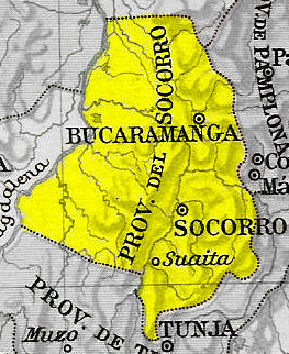
Socorro Province
Distance: Approx. 7806 meters
Latitude and longitude: 6.53333333,-73.2
Socorro Province was one of the provinces of Gran Colombia. It belonged to the Boyacá Department which was created in 1824.
Los Pozos Airport
Airport
Distance: Approx. 3874 meters
Latitude and longitude: 6.59027778,-73.12916667
Los Pozos Airport (ICAO: SKSG) is an airport serving the city of San Gil in the Santander Department of Colombia. The airport sits on a plateau in the eastern Colombian Andes, 1,800 feet (550 m) above San Gil, which lies in a steep cut through the plateau on the banks of the Fonce River.
Weather in this IP's area
overcast clouds
19 Celsius
19 Celsius
19 Celsius
19 Celsius
1016 hPa
95 %
1016 hPa
890 hPa
10000 meters
0.63 m/s
0.95 m/s
183 degree
94 %