179.1.78.82 - IP Lookup: Free IP Address Lookup, Postal Code Lookup, IP Location Lookup, IP ASN, Public IP
Country:
Region:
City:
Location:
Time Zone:
Postal Code:
IP information under different IP Channel
ip-api
Country
Region
City
ASN
Time Zone
ISP
Blacklist
Proxy
Latitude
Longitude
Postal
Route
Luminati
Country
Region
cun
ASN
Time Zone
America/Bogota
ISP
SAMM TECNOLOGIA E TELECOMUNICACOES S.A
Latitude
Longitude
Postal
IPinfo
Country
Region
City
ASN
Time Zone
ISP
Blacklist
Proxy
Latitude
Longitude
Postal
Route
IP2Location
179.1.78.82Country
Region
boyaca
City
paipa
Time Zone
America/Bogota
ISP
Language
User-Agent
Latitude
Longitude
Postal
db-ip
Country
Region
City
ASN
Time Zone
ISP
Blacklist
Proxy
Latitude
Longitude
Postal
Route
ipdata
Country
Region
City
ASN
Time Zone
ISP
Blacklist
Proxy
Latitude
Longitude
Postal
Route
Popular places and events near this IP address
Vargas Swamp Lancers
Distance: Approx. 6651 meters
Latitude and longitude: 5.7375,-73.075
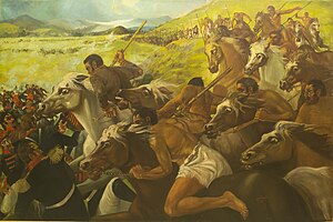
Vargas Swamp Lancers, or Monument to the Lancers (Spanish: Monumento a los Lanceros), is a large sculptural complex realized by Colombian artist Rodrigo Arenas Betancourt and by engineer Guillermo Gonzalez Zuleta in the department of Boyacá (Colombia) as a memorial for the Battle of Vargas Swamp. It is the largest monument in Colombia. This monument depicts the attack of the 14 lancers commanded by Colonel Juan José Rondón.

Battle of Vargas Swamp
1819 Colombian War of Independence battle
Distance: Approx. 6651 meters
Latitude and longitude: 5.7375,-73.075
The Battle of Vargas Swamp (Spanish: Batalla del Pantano de Vargas) fought on July 25, 1819, was an engagement of Bolívar's campaign to liberate New Granada. The battle involved a joint Venezuelan and Neogranadine army commanded by General Simón Bolívar against the III Division of the Spanish Royalist Army commanded by Colonel José María Barreiro. The Battle of Vargas Swamp is considered one of the most important battles of the Colombian War of Independence as it cleared the path for the Patriot army to advance towards Santafé de Bogotá, while also demoralizing the Royalist troops.
Juan José Rondón Airport
Airport
Distance: Approx. 2161 meters
Latitude and longitude: 5.76444444,-73.10555556
Juan José Rondón Airport (IATA: RON, ICAO: SKPA) is a high-elevation airport serving the town of Paipa in the Boyacá Department of Colombia. The airport is 4.6 kilometres (2.9 mi) east of the TermoPaipa power plant and 2 kilometres (1.2 mi) south of the town, just east of Lake Sochagota. The runway length does not include a 100 metres (330 ft) displaced threshold on Runway 04.
Weather in this IP's area
overcast clouds
17 Celsius
17 Celsius
17 Celsius
17 Celsius
1012 hPa
78 %
1012 hPa
759 hPa
10000 meters
1.68 m/s
1.88 m/s
325 degree
92 %
