179.1.76.24 - IP Lookup: Free IP Address Lookup, Postal Code Lookup, IP Location Lookup, IP ASN, Public IP
Country:
Region:
City:
Location:
Time Zone:
Postal Code:
IP information under different IP Channel
ip-api
Country
Region
City
ASN
Time Zone
ISP
Blacklist
Proxy
Latitude
Longitude
Postal
Route
Luminati
Country
Region
cun
ASN
Time Zone
America/Bogota
ISP
SAMM TECNOLOGIA E TELECOMUNICACOES S.A
Latitude
Longitude
Postal
IPinfo
Country
Region
City
ASN
Time Zone
ISP
Blacklist
Proxy
Latitude
Longitude
Postal
Route
IP2Location
179.1.76.24Country
Region
santander
City
barrancabermeja
Time Zone
America/Bogota
ISP
Language
User-Agent
Latitude
Longitude
Postal
db-ip
Country
Region
City
ASN
Time Zone
ISP
Blacklist
Proxy
Latitude
Longitude
Postal
Route
ipdata
Country
Region
City
ASN
Time Zone
ISP
Blacklist
Proxy
Latitude
Longitude
Postal
Route
Popular places and events near this IP address

Barrancabermeja
Municipality and city in Santander, Colombia
Distance: Approx. 520 meters
Latitude and longitude: 7.06666667,-73.85
Barrancabermeja (Spanish: [baraŋkaβeɾˈmexa]) is a municipality and city in Colombia, located on the shore of the Magdalena River, in the western part of the department of Santander. It is home to the largest oil refinery in the country, under direct management of ECOPETROL. Barrancabermeja is known as the Oil Capital of Colombia. It is located 114 km west of Bucaramanga, on the banks of the Magdalena River in the Middle Magdalena region, which is the largest municipality and second in the entire department.

Yondó
Municipality and town in Antioquia Department, Colombia
Distance: Approx. 10001 meters
Latitude and longitude: 7,-73.91666667
Yondó is a town and municipality in Antioquia Department, Colombia. It is part of the Magdalena Medio Antioquia sub-region. The first settlers arrived around 10,000 BC; archaeological site.

Magdalena River Valley
Region in Colombia
Distance: Approx. 643 meters
Latitude and longitude: 7.05969444,-73.85308333
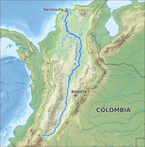
The Magdalena River Valley (Spanish: Valle del Río Magdalena) is a valley in Colombia located within the Colombian Andes. The valley is specifically situated between the Central and Eastern Ranges and crossed by the river of the same name, the Magdalena River.

Roman Catholic Diocese of Barrancabermeja
Diocese of the Catholic Church in Colombia
Distance: Approx. 1995 meters
Latitude and longitude: 7.0605,-73.8719
The Roman Catholic Diocese of Barrancabermeja (Latin: Barrancabermeiensis) is a Latin suffragan diocese in the ecclesiastical province of Bucaramanga. Its cathedral episcopal see is the Catedral del Sagrado Corazón, dedicated to the Sacred Heart, in the city of Barrancabermeja in Santander State, Colombia.

Middle Magdalena Valley
Distance: Approx. 520 meters
Latitude and longitude: 7.06666667,-73.85
The Middle Magdalena Valley, Middle Magdalena Basin or Middle Magdalena Valley Basin (Spanish: Valle Medio del Magdalena, commonly abbreviated to VMM) is an intermontane basin, located in north-central Colombia between the Central and Eastern Ranges of the Andes. The basin, covering an area of 34,000 square kilometres (13,000 sq mi), is situated in the departments of Santander, Boyacá, Cundinamarca and Tolima. The basin is structurally bounded by the Palestina Fault to the west and the Bucaramanga Fault to the east.
Estadio Daniel Villa Zapata
Multi-use stadium in Barrancabermeja, Colombia
Distance: Approx. 1421 meters
Latitude and longitude: 7.0730528,-73.8647139
Estadio Daniel Villa Zapata is a multi-use stadium in Barrancabermeja, Colombia. It is currently used mostly for football matches. The stadium was originally built in 1960 with a capacity of 6,000 people.
Weather in this IP's area
heavy intensity rain
26 Celsius
26 Celsius
26 Celsius
26 Celsius
1011 hPa
94 %
1011 hPa
1001 hPa
10000 meters
1.54 m/s
220 degree
100 %