179.0.77.39 - IP Lookup: Free IP Address Lookup, Postal Code Lookup, IP Location Lookup, IP ASN, Public IP
Country:
Region:
City:
Location:
Time Zone:
Postal Code:
ISP:
ASN:
language:
User-Agent:
Proxy IP:
Blacklist:
IP information under different IP Channel
ip-api
Country
Region
City
ASN
Time Zone
ISP
Blacklist
Proxy
Latitude
Longitude
Postal
Route
db-ip
Country
Region
City
ASN
Time Zone
ISP
Blacklist
Proxy
Latitude
Longitude
Postal
Route
IPinfo
Country
Region
City
ASN
Time Zone
ISP
Blacklist
Proxy
Latitude
Longitude
Postal
Route
IP2Location
179.0.77.39Country
Region
sao paulo
City
aracatuba
Time Zone
America/Sao_Paulo
ISP
Language
User-Agent
Latitude
Longitude
Postal
ipdata
Country
Region
City
ASN
Time Zone
ISP
Blacklist
Proxy
Latitude
Longitude
Postal
Route
Popular places and events near this IP address

Araçatuba
Place in Southeast, Brazil
Distance: Approx. 21 meters
Latitude and longitude: -21.20888889,-50.43277778
Araçatuba is a city located in the northwest of São Paulo state, Brazil. The city has 198,129 inhabitants (IBGE/2020) and spans 1,167 square kilometres (451 sq mi). The city name comes from the Tupi language and means "abundance of araçá (a fruit, Psidium cattleianum)".
Roman Catholic Diocese of Araçatuba
Catholic ecclesiastical territory
Distance: Approx. 634 meters
Latitude and longitude: -21.2069,-50.4386
The Roman Catholic Diocese of Araçatuba (Latin: Dioecesis Arassatubensis) is a diocese located in the city of Araçatuba in the ecclesiastical province of Botucatu in Brazil.

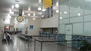
Araçatuba Airport
Airport
Distance: Approx. 7215 meters
Latitude and longitude: -21.14416667,-50.42638889
Araçatuba–Dario Guarita State Airport (IATA: ARU, ICAO: SBAU) is the airport serving Araçatuba, Brazil.

Microregion of Araçatuba
Microregion in Southeast, Brazil
Distance: Approx. 21 meters
Latitude and longitude: -21.20888889,-50.43277778
The Microregion of Araçatuba (Portuguese: Microrregião de Araçatuba) is located on the northwest of São Paulo state, Brazil, and is made up of 7 municipalities. It belongs to the Mesoregion of Araçatuba.

Microregion of Andradina
Microregion in Southeast, Brazil
Distance: Approx. 21 meters
Latitude and longitude: -21.20888889,-50.43277778
The Microregion of Andradina (Portuguese: Microrregião de Andradina) is located on the northwest of São Paulo state, Brazil, and is made up of 11 municipalities. It belongs to the Mesoregion of Araçatuba.
Weather in this IP's area
scattered clouds
28 Celsius
29 Celsius
28 Celsius
28 Celsius
1015 hPa
63 %
1015 hPa
970 hPa
10000 meters
5.67 m/s
8.06 m/s
344 degree
31 %