Country:
Region:
City:
Latitude and Longitude:
Time Zone:
Postal Code:
IP information under different IP Channel
ip-api
Country
Region
City
ASN
Time Zone
ISP
Blacklist
Proxy
Latitude
Longitude
Postal
Route
Luminati
Country
Region
ms
City
aparecidadotaboado
ASN
Time Zone
America/Campo_Grande
ISP
DMS COMUNICACAO LTDA
Latitude
Longitude
Postal
IPinfo
Country
Region
City
ASN
Time Zone
ISP
Blacklist
Proxy
Latitude
Longitude
Postal
Route
db-ip
Country
Region
City
ASN
Time Zone
ISP
Blacklist
Proxy
Latitude
Longitude
Postal
Route
ipdata
Country
Region
City
ASN
Time Zone
ISP
Blacklist
Proxy
Latitude
Longitude
Postal
Route
Popular places and events near this IP address

Sucuriú River
River in Brazil
Distance: Approx. 9852 meters
Latitude and longitude: -20.71194444,-51.66
The Sucuriú River (Portuguese, Rio Sucuriú) is a river located in the Mato Grosso do Sul state in southwestern Brazil. It is a tributary of the Paraná River, which it joins just upriver of Eng Souza Dias (Jupiá) Dam.

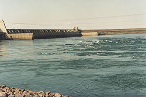
Engineer Souza Dias Dam
Dam in Mato Grosso do Sul, Brazil
Distance: Approx. 8970 meters
Latitude and longitude: -20.77777778,-51.62916667
The Engineer Souza Dias Dam, formerly known as the Jupiá Dam, is an embankment dam on the Paraná River near Três Lagoas in Mato Grosso do Sul, Brazil. It was constructed for hydroelectric power production, flood control and navigation. Studies on the dam and power plant began in 1951 which recommended the dam along with the Ilha Solteira Dam.

Três Lagoas Airport
Airport
Distance: Approx. 5122 meters
Latitude and longitude: -20.75138889,-51.68027778
Plínio Alarcom Airport (IATA: TJL, ICAO: SBTG) is the airport serving Três Lagoas, Brazil.
Weather in this IP's area
overcast clouds
35 Celsius
37 Celsius
35 Celsius
35 Celsius
1010 hPa
40 %
1010 hPa
975 hPa
10000 meters
2.43 m/s
2.67 m/s
324 degree
99 %
04:37:30
17:48:01