Country:
 Great Britain
Region:
City:
Latitude and Longitude:
Time Zone:
Postal Code:
IP information under different IP Channel
ip-api
Country
Region
City
ASN
Time Zone
ISP
Blacklist
Proxy
Latitude
Longitude
Postal
Route
IPinfo
Country
Region
City
ASN
Time Zone
ISP
Blacklist
Proxy
Latitude
Longitude
Postal
Route
MaxMind
Country
Region
City
ASN
Time Zone
ISP
Blacklist
Proxy
Latitude
Longitude
Postal
Route
Luminati
Country
GBASN
Time Zone
Europe/London
ISP
British Telecommunications PLC
Latitude
Longitude
Postal
db-ip
Country
Region
City
ASN
Time Zone
ISP
Blacklist
Proxy
Latitude
Longitude
Postal
Route
ipdata
Country
Region
City
ASN
Time Zone
ISP
Blacklist
Proxy
Latitude
Longitude
Postal
Route
Popular places and events near this IP address

Aberdeen Airport
International airport in Aberdeen, Scotland
Distance: Approx. 954 meters
Latitude and longitude: 57.2025,-2.19805556
Aberdeen International Airport (Scottish Gaelic: Port-adhair Eadar-nàiseanta Obar Dheathain) (IATA: ABZ, ICAO: EGPD) is an international airport, located in the Dyce suburb of Aberdeen, Scotland, approximately 5 nautical miles (9.3 km; 5.8 mi) northwest of Aberdeen city centre. As of 2023, 1.9 million people used the airport. The airport is owned and operated by AGS Airports which also owns and operates Glasgow and Southampton airports.

Dyce
Human settlement in Scotland
Distance: Approx. 1319 meters
Latitude and longitude: 57.2031,-2.192
Dyce (Scottish Gaelic: Deis) is a suburb of Aberdeen, Scotland, situated on the River Don about 6 mi (10 km) northwest of the city centre. It is best known as the location of Aberdeen Airport.

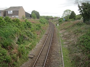
Dyce railway station
Railway station in Aberdeen, Scotland
Distance: Approx. 1403 meters
Latitude and longitude: 57.2056,-2.1926
Dyce railway station is a railway station serving the suburb of Dyce, Aberdeen, Scotland. The station is managed by ScotRail and is on the Aberdeen to Inverness Line, with some trains operating on the Edinburgh to Aberdeen Line and Glasgow to Aberdeen Line also extended to call at Dyce and Inverurie. It is sited 6.25 miles (10.06 kilometres) from Aberdeen, being the first stop north of the station.

Barra Castle
L-plan tower house in Aberdeenshire
Distance: Approx. 940 meters
Latitude and longitude: 57.1919,-2.2048
Barra Castle is an unusual L-plan tower house dating from the early 16th century, about two miles (three kilometres) south of Oldmeldrum, above the Lochter Burn, in the parish of Bourtie, Aberdeenshire, Scotland. It occupies the site of the Battle of Inverurie (1308), in which Robert Bruce defeated John Comyn, Earl of Buchan.

Stoneywood, Aberdeen
Village in Scotland
Distance: Approx. 1803 meters
Latitude and longitude: 57.1909,-2.1869822
Stoneywood is a small area of Aberdeen, Scotland, located between Dyce and Bucksburn near Aberdeen Airport. Stoneywood is served by two primary schools and one secondary school, which sits in Bucksburn. The main road running through the suburb is the A947, a north-south two-lane highway linking Aberdeen with Banff on the coast.
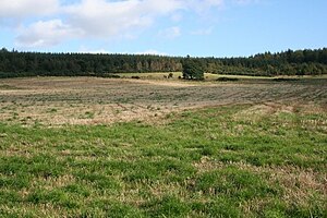
Kirkhill Forest
Distance: Approx. 1830 meters
Latitude and longitude: 57.194262,-2.241597
Kirkhill Forest is a forest in Scotland, situated to the north-west of Aberdeen, on the north side of the A96 between the villages of Dyce and Blackburn. Kirkhill is a working forest with a network of paths for walking, a permanent orienteering trail, and a mountain bike fun park.
Aberdeen International Business Park
Distance: Approx. 553 meters
Latitude and longitude: 57.195382,-2.206771
Aberdeen International Business Park (AIBP) is a major commercial building project located on the south eastern edge of Aberdeen International Airport, at Dyce, with direct road links to the Scottish motorway network, and close to Dyce railway station. The park's 40 acres will eventually provide up to 92,000 sq m of development, including offices, shops, leisure facilities and at least one 4-star hotel. AIBP's first phase set records in 2014 as Scotland's biggest single office-letting deal, after Norwegian oilfield services giant Aker Solutions leased 31,100 sq m of space, including its own purpose-built leisure facilities.

Dyce Work Camp
Scottish camp for conscientious objectors in World War I.
Distance: Approx. 1707 meters
Latitude and longitude: 57.213,-2.225
Dyce Work Camp was set up in August 1916 at quarries north-west of Aberdeen, Scotland, to accommodate conscientious objectors who had been in prison for refusing military service in World War I. These men, mostly from England, had been released on the condition that they performed "work of national importance" – breaking up granite rock to produce stone for road building. The conditions in the tented camp near the village of Dyce were poor, exacerbated by the very wet weather, and one man died of pneumonia without receiving medical treatment. Following an inquiry and a debate in parliament, the camp was closed in October 1916, with the ministerial statement that it had always been intended to be only temporary.
Stoneywood Parkvale F.C.
Association football club in Scotland
Distance: Approx. 1875 meters
Latitude and longitude: 57.190015,-2.186584
Stoneywood Parkvale Football Club are a Scottish football club from the Stoneywood area of Aberdeen. Members of the Scottish Junior Football Association, North Region, they were formed in 2016 following the amalgamation of two existing clubs, F.C. Stoneywood and Parkvale.
Stoneywood railway station
Disused railway station in Stoneywood, Aberdeenshire
Distance: Approx. 2082 meters
Latitude and longitude: 57.1906,-2.182
Stoneywood railway station served the village of Stoneywood, Aberdeen, Scotland from 1887 to 1937 on the Great North of Scotland Railway.

P&J Live
Multi-purpose indoor arena in Bucksburn, Aberdeen, Scotland
Distance: Approx. 1949 meters
Latitude and longitude: 57.18527778,-2.19305556
P&J Live (also known as The Event Complex Aberdeen) is a multi-purpose indoor arena in Aberdeen, Scotland. Opened in August 2019, it offers a capacity for all types of shows and events from 5,000 to 15,000. Replacing the former Aberdeen Exhibition and Conference Centre (AECC), the 10,000-seat arena is used for concerts and other events.
Craibstone Park and Ride
Distance: Approx. 739 meters
Latitude and longitude: 57.192575,-2.21336667
Craibstone Park and Ride is a park and ride facility near Dyce, Scotland. It is one of three such facilities near the city of Aberdeen, the other two being situated at Kingswells and Bridge of Don.
Weather in this IP's area
fog
13 Celsius
13 Celsius
13 Celsius
14 Celsius
1008 hPa
98 %
1008 hPa
999 hPa
300 meters
1.03 m/s
330 degree
100 %
06:25:49
19:47:24