Country:
Region:
City:
Latitude and Longitude:
Time Zone:
Postal Code:
IP information under different IP Channel
ip-api
Country
Region
City
ASN
Time Zone
ISP
Blacklist
Proxy
Latitude
Longitude
Postal
Route
Luminati
Country
Region
14
City
warsaw
ASN
Time Zone
Europe/Warsaw
ISP
Liberty Global B.V.
Latitude
Longitude
Postal
IPinfo
Country
Region
City
ASN
Time Zone
ISP
Blacklist
Proxy
Latitude
Longitude
Postal
Route
db-ip
Country
Region
City
ASN
Time Zone
ISP
Blacklist
Proxy
Latitude
Longitude
Postal
Route
ipdata
Country
Region
City
ASN
Time Zone
ISP
Blacklist
Proxy
Latitude
Longitude
Postal
Route
Popular places and events near this IP address

Warsaw Chopin Airport
Airport in Warsaw, Poland
Distance: Approx. 1352 meters
Latitude and longitude: 52.16583333,20.96722222
Warsaw Chopin Airport (Polish: Lotnisko Chopina w Warszawie, Polish pronunciation: [lɔtˈɲiskɔ ʂɔˈpɛna]) (IATA: WAW, ICAO: EPWA) is an international airport in the Włochy district of Warsaw, Poland. It is the busiest airport in Poland and the 31st busiest airport in Europe with 18.5 million passengers in 2023, handling approximately 40% of the country's total air passenger traffic. The airport is a central hub for LOT Polish Airlines as well as a base for Enter Air and Wizz Air.

Lufthansa Flight 2904
1993 passenger plane crash in Warsaw, Poland
Distance: Approx. 1165 meters
Latitude and longitude: 52.16083333,20.98527778
Lufthansa Flight 2904 was an Airbus A320-200 flying from Frankfurt, Germany to Warsaw, Poland that overran the runway at Okęcie International Airport on 14 September 1993.

Służewiec
Neighbourhood of Warsaw, Poland
Distance: Approx. 1121 meters
Latitude and longitude: 52.17972222,20.99388889
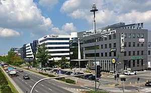
Służewiec is a neighbourhood, and an area of the City Information System, in the city of Warsaw, Poland, located within the district of Mokotów. Most of the neighbourhood consists of office buildings, which form one of the biggest complexes of office buildings in Poland, and one of the most important office centres in the city. It contains many headquarters of branches of many domestic and multinational corporations.
Warsaw Chopin Airport railway station
Railway station in Warsaw, Poland
Distance: Approx. 687 meters
Latitude and longitude: 52.16963056,20.97521111
Warsaw Chopin Airport railway station (Polish: Warszawa Lotnisko Chopina) is the railway station of the Warsaw Chopin Airport in Warsaw, Poland. The station was built as part of a new Terminal 2 in 2008 but remained out of service until the rail link was completed in 2012. The cost of the 2 km (1.2 mi) link to Warszawa Służewiec was 230 million złoty.

LOT Polish Airlines Flight 16
2011 aviation accident
Distance: Approx. 1366 meters
Latitude and longitude: 52.16555556,20.96722222
LOT Polish Airlines Flight 16 was a Boeing 767 (registered SP-LPC) passenger jet on a scheduled service from Newark, United States, to Warsaw, Poland, that on 1 November 2011 made a successful gear-up emergency landing at Warsaw Chopin Airport, after its landing gear failed to extend. All 231 aboard survived without serious injuries. A leak in one of the aircraft's hydraulic systems occurred shortly after takeoff, resulting in the loss of all of the hydraulic fluid supplying the primary landing gear system.

Warszawa Służewiec railway station
Railway station in Warsaw, Poland
Distance: Approx. 1009 meters
Latitude and longitude: 52.18027778,20.98694444
Warszawa Służewiec is a railway stop in the city of Warsaw, Poland, on Marynarska Street, operated by the Polish State Railways. It is located at the railway line no. 8, which connects Warszawa Zachodnia (Warsaw West) and Kraków Główny (Kraków Main) railway stations.

Warszawa Okęcie railway station
Railway station in Warsaw, Poland
Distance: Approx. 516 meters
Latitude and longitude: 52.16694444,20.9875
Warszawa Okęcie railway station is a railway station in the Ursynów district of Warsaw, Poland. It is served by Koleje Mazowieckie, which runs services from Warszawa Wschodnia to Góra Kalwaria and Skarżysko-Kamienna. There is also an unelectrified single track spur line branch (PKP rail line 937) linking the station to the Kabaty Depot of Warsaw Metro and the Siekierki Power Station.

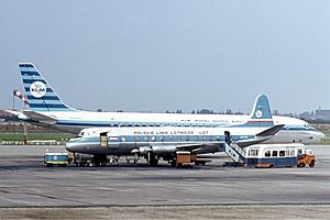
1962 LOT Vickers Viscount Warsaw crash
Distance: Approx. 1352 meters
Latitude and longitude: 52.16583333,20.96722222
The 1962 LOT Vickers Viscount Warsaw crash occurred on 19 December 1962 when a Vickers Viscount 804, operated by LOT Polish Airlines on a flight from Brussels to Warsaw, crashed on landing. All passengers and crew died. The plane was returning from Brussels, and had a mid-way landing in Berlin from where it took off at 5:55 pm.
Zbarż
Distance: Approx. 1344 meters
Latitude and longitude: 52.1667,20.9667
Zbarż is a locality within the borough of Włochy and a former village. It was established some time in 13th or 14th century. Granted with Magdeburg Law by Prince Bolesław IV of Warsaw, it was home to the Zbarski family until 1528, when Mazovia was annexed by Poland and the village was taken over by Babicki family.
Zbarż Pond
Distance: Approx. 974 meters
Latitude and longitude: 52.18,20.98333333
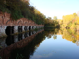
Staw Zbarski is a small pond in Warsaw in the district of Włochy.

Mordor, Warsaw
Informal name for an area of Warsaw, Poland
Distance: Approx. 1444 meters
Latitude and longitude: 52.18055556,20.99972222
Mordor, also known as Mordor on Domaniewska Street, is an informal name for the area, mostly composed of office buildings, in the city of Warsaw, Poland, located within the neighbourhoods of Służewiec (Służewiec Przemysłowy) and western Ksawerów in the district of Mokotów. It is located in the area around Cybernetyki, Domaniewska, Marynarska, and Wołoska Streets. The area is mostly composed of office buildings, including the headquarters of branches of many multinational corporations.

Nowy Służewiec
Neighbourhood in Warsaw, Masovian Voivodeship, Poland
Distance: Approx. 86 meters
Latitude and longitude: 52.17083333,20.98388889
Nowy Służewiec, also known as Służewiec Nowy, is a neighbourhood of the city of Warsaw, Poland, located within the district of Włochy, within the City Information System area (neighbourhood) of Okęcie.
Weather in this IP's area
clear sky
3 Celsius
2 Celsius
3 Celsius
4 Celsius
1032 hPa
81 %
1032 hPa
1019 hPa
10000 meters
1.57 m/s
1.61 m/s
220 degree
10 %
06:37:14
16:01:59


