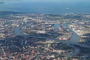
Country:
 Poland
Region:
City:
Latitude and Longitude:
Time Zone:
Postal Code:
IP information under different IP Channel
ip-api
Country
Region
City
ASN
Time Zone
ISP
Blacklist
Proxy
Latitude
Longitude
Postal
Route
IPinfo
Country
Region
City
ASN
Time Zone
ISP
Blacklist
Proxy
Latitude
Longitude
Postal
Route
MaxMind
Country
Region
City
ASN
Time Zone
ISP
Blacklist
Proxy
Latitude
Longitude
Postal
Route
Luminati
Country
PLRegion
22
City
gdansk
ASN
Time Zone
Europe/Warsaw
ISP
Liberty Global B.V.
Latitude
Longitude
Postal
db-ip
Country
Region
City
ASN
Time Zone
ISP
Blacklist
Proxy
Latitude
Longitude
Postal
Route
ipdata
Country
Region
City
ASN
Time Zone
ISP
Blacklist
Proxy
Latitude
Longitude
Postal
Route
Popular places and events near this IP address

Gdańsk Voivodeship (1975–1998)
Former voivodeship of Poland from 1975 to 1998.
Distance: Approx. 802 meters
Latitude and longitude: 54.357965,18.655306
The Gdańsk Voivodeship was a voivodeship (province) of the Polish People's Republic from 1975 to 1989, and the Third Republic of Poland from 1989 to 1998. Its capital was Gdańsk, and it was centered on the region of Pomerelia. It was established on 1 June 1975, from the parts of the voivodeships of Gdańsk, and Bydgoszcz, and existed until 31 December 1998, when it was incorporated into then-established Pomeranian Voivodeship.
Ostrów Island
Island in the Vistula River in Poland
Distance: Approx. 748 meters
Latitude and longitude: 54.371,18.654
Ostrów Island (Polish pronunciation: [ɔstruf]) is a river island, located in the delta of the Vistula river, within the city limits of Gdańsk in northern Poland. Administratively, it is located within the district of Młyniska. The northern border of the island is formed by the waters of Port Channel (Gdańsk), while the southern border is a branch of the Vistula called Martwa Wisła.

Motława
River in Poland
Distance: Approx. 1024 meters
Latitude and longitude: 54.36,18.66416667
The Motława (German: Mottlau; Kashubian: Mòtława) is a river in Eastern Pomerania in Poland. Its source is in Szpęgawskie Lake, northeast from the town of Starogard Gdański. The Motlawa goes through Rokickie Lake to Martwa Wisła, a branch of the Vistula.

Suchanino
District of Gdańsk in Pomeranian Voivodeship, Poland
Distance: Approx. 232 meters
Latitude and longitude: 54.36666667,18.65
Suchanino (Kashubian: Cëgónczi, German: Zigankenberg) is a district of Gdańsk, Poland, located in the central part of the city. With 12,937 inhabitants in an area of 1.3 km2 it has a population density of 9,812 inhabitants/km2. Most buildings are high-rise and were constructed in the 1970s.

Młyniska
District of Gdańsk in Pomeranian Voivodeship, Poland
Distance: Approx. 877 meters
Latitude and longitude: 54.372184,18.646846
Młyniska (German: Schellmühl) is one of the quarters of the city of Gdańsk, Poland.

Monument to the Fallen Shipyard Workers of 1970
Distance: Approx. 464 meters
Latitude and longitude: 54.3605,18.6492
The Monument to the fallen Shipyard Workers 1970 (Polish: Pomnik Poległych Stoczniowców 1970) was unveiled on 16 December 1980 near the entrance to what was then the Lenin Shipyard in Gdańsk, Poland. It commemorates the 42 or more people killed during the Coastal cities events in December 1970. It was created in the aftermath of the Gdańsk Agreement and is the first monument to the victims of communist oppression to be erected in a communist country.

Siege of Danzig (1734)
Siege during War of the Polish Succession
Distance: Approx. 1137 meters
Latitude and longitude: 54.36666667,18.63333333
The Siege of Danzig of 1734 was the Russian encirclement (22 February – 30 June) and capture of the Polish city-port of Gdańsk, during the War of Polish Succession. It was the first time that troops of France and Russia had met as foes in the field.

Cemetery of Lost Cemeteries
Monument in Gdańsk, Poland
Distance: Approx. 936 meters
Latitude and longitude: 54.3575,18.64277778
The Cemetery of Lost Cemeteries (Polish: Cmentarz Nieistniejących Cmentarzy) is a monument that commemorates the necropolis which no longer exists in the city of Gdańsk, Poland. It is dedicated to the citizens of Gdańsk who were once buried in one of the city’s 27 graveyards either destroyed during World War II or bulldozed on purpose after the end of the war. The monument was designed to resemble a temple.

Father Eugeniusz Dutkiewicz SAC Hospice
Distance: Approx. 984 meters
Latitude and longitude: 54.36305556,18.63555556
Father Eugeniusz Dutkiewicz SAC Hospice (formerly: Pallottinum Hospice) in Gdańsk, a charitable organization, founded by the Pallottine priest E. Dutkiewicz in 1983, provides palliative care for the terminally ill patients.

European Solidarity Centre
Distance: Approx. 398 meters
Latitude and longitude: 54.36111111,18.64916667
The European Solidarity Centre (Polish: Europejskie Centrum Solidarności) is a museum and library in Gdańsk, Poland, devoted to the history of Solidarity, the Polish trade union and civil resistance movement, and other opposition movements of Communist Eastern Europe. It opened on 31 August 2014.

Gate No. 2 of the Gdańsk Shipyard
Gate in Gdańsk, Poland
Distance: Approx. 478 meters
Latitude and longitude: 54.360333,18.649722
The Gate No. 2 of the Gdańsk Shipyard (Brama nr 2 Stoczni Gdańskiej) is one of the gates leading into Gdańsk Shipyard. Because of the gate's proximity to the Shipyard's management buildings as well as its good access to Gdańsk Main City and Gdańsk Główny railway station, the Gate is commonly considered to be the main entrance to the Shipyard.

State Archives, Gdańsk
Distance: Approx. 771 meters
Latitude and longitude: 54.357806,18.648222
State Archives in Gdańsk (Polish: Archiwum Państwowe w Gdańsku, AP) is one of Poland's regional state archives. The archive in the city of Gdańsk (German: Danzig) was founded under Prussian jurisdiction in 1901. The headquarters is located at Wałowa 5 Street in Gdańsk.
Weather in this IP's area
clear sky
18 Celsius
18 Celsius
18 Celsius
18 Celsius
1017 hPa
72 %
1017 hPa
1017 hPa
10000 meters
3.6 m/s
130 degree
06:06:14
19:20:08