Country:
 Poland
Region:
City:
Latitude and Longitude:
Time Zone:
Postal Code:
IP information under different IP Channel
ip-api
Country
Region
City
ASN
Time Zone
ISP
Blacklist
Proxy
Latitude
Longitude
Postal
Route
Luminati
Country
PLRegion
14
City
warsaw
ASN
Time Zone
Europe/Warsaw
ISP
Liberty Global B.V.
Latitude
Longitude
Postal
IPinfo
Country
Region
City
ASN
Time Zone
ISP
Blacklist
Proxy
Latitude
Longitude
Postal
Route
db-ip
Country
Region
City
ASN
Time Zone
ISP
Blacklist
Proxy
Latitude
Longitude
Postal
Route
ipdata
Country
Region
City
ASN
Time Zone
ISP
Blacklist
Proxy
Latitude
Longitude
Postal
Route
Popular places and events near this IP address

Foreign Intelligence Agency
Polish intelligence agency
Distance: Approx. 817 meters
Latitude and longitude: 52.19916389,20.99382222
The Foreign Intelligence Agency (Polish: Agencja Wywiadu (Polish pronunciation: [aˈɡɛnt͡sja vɨˈvʲadu]; or AW) is a Polish intelligence agency tasked with the gathering of public and secret information abroad for the Republic of Poland. It was created in 2002 from the reform and split of Urząd Ochrony Państwa, which was split into Agencja Wywiadu (AW) and Agencja Bezpieczeństwa Wewnętrznego (ABW). Current Head of the Foreign Intelligence Agency is Colonel Bartosz Jarmuszkiewicz.
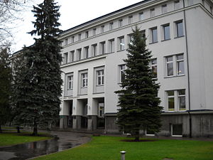
Medical University of Warsaw
Medical school in Poland
Distance: Approx. 1239 meters
Latitude and longitude: 52.2059,20.9856
The Medical University of Warsaw (Polish name: Warszawski Uniwersytet Medyczny) is one of the oldest and the largest medical schools in Poland. The first academic department of medicine was established as far back as two centuries ago in 1809. It is considered to be one of the most prestigious and reputable schools nationally for the medical sciences, partly due to its affiliation with a number of large hospitals in Poland.
Wyględów
Neighbourhood in Warsaw, Poland
Distance: Approx. 639 meters
Latitude and longitude: 52.19666667,20.99305556
Wyględów is a neighbourhood, and the City Information System area, located in Warsaw, Poland, within the district of Mokotów. The oldest known records of localities in the area of modern neighbourhood come from 16th century, referring to the settlement of Wyględowo-Kościesze. It was originally formed from two settlements, Wyględowo and Kościesze, with the latter being originally part of the nearby Rakowiec.

National Digital Archives
National archives of Poland
Distance: Approx. 1599 meters
Latitude and longitude: 52.20861111,20.97777778
National Digital Archives (Polish: Narodowe Archiwum Cyfrowe, NAC) are the national archives of Poland, collecting and digitising audiovisual materials. National Digital Archives are one of three central State Archives (Archiwa Państwowe), other two being Central Archives of Historical Records and Archives of Modern Records. National Digital Archives were established on 28 March 2008 by transforming the Archives of Audiovisual Records (Archiwum Dokumentacji Mechanicznej 'Mechanical Documentation Archives') created in 1955.
Faculty of Management of Warsaw University of Technology
Distance: Approx. 1550 meters
Latitude and longitude: 52.203056,21.0025
The Faculty of Management at the Warsaw University of Technology (pl.: Wydział Zarządzania Politechniki Warszawskiej , WZ) is a business school in Warsaw. Its facilities are located on the southern side of the Warsaw University of Technology campus on ul. Narbutta 85.

Free Polish University
Former Warsaw university
Distance: Approx. 1733 meters
Latitude and longitude: 52.2103,20.9818
Free Polish University (Polish: Wolna Wszechnica Polska), founded in 1918 in Warsaw, was a private university with different departments: mathematics and natural sciences, humanities, political sciences and social pedagogy. From 1929, its degrees were equivalent to those of university. In the years 1919–1939 the institution employed 70–80 professors.

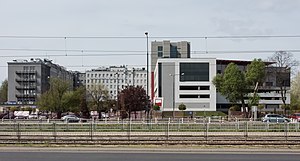
Warszawa Rakowiec railway station
Railway station in Warsaw, Poland
Distance: Approx. 1233 meters
Latitude and longitude: 52.19666667,20.96638889
Warszawa Rakowiec railway station is a railway station in the Ochota district of Warsaw, Poland. It is served by Koleje Mazowieckie, who run services from Warszawa Wschodnia to Góra Kalwaria or Skarżysko-Kamienna.
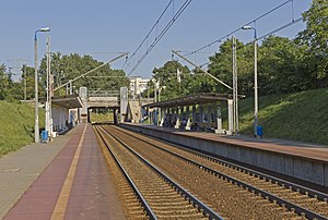
Warszawa Żwirki i Wigury railway station
Railway station in Warsaw, Poland
Distance: Approx. 287 meters
Latitude and longitude: 52.19305556,20.98111111
Warszawa Żwirki i Wigury railway station is a railway station in the Ochota district of Warsaw, Poland. It is served by Koleje Mazowieckie, who run services from Warszawa Wschodnia to Góra Kalwaria or Skarżysko-Kamienna.

Warszawa Służewiec railway station
Railway station in Warsaw, Poland
Distance: Approx. 1627 meters
Latitude and longitude: 52.18027778,20.98694444
Warszawa Służewiec is a railway stop in the city of Warsaw, Poland, on Marynarska Street, operated by the Polish State Railways. It is located at the railway line no. 8, which connects Warszawa Zachodnia (Warsaw West) and Kraków Główny (Kraków Main) railway stations.

Rakowiec, Warsaw
Place in Masovian Voivodeship, Poland
Distance: Approx. 963 meters
Latitude and longitude: 52.202605,20.978115
Rakowiec is a neighbourhood in Warsaw, the capital of Poland. Part of the borough of Ochota, it is located in the west-central part of the city.

Massacre in the Jesuit monastery on Rakowiecka Street, Warsaw
Nazi German war crime
Distance: Approx. 1632 meters
Latitude and longitude: 52.2057,21.0002
The Massacre in the Jesuit monastery on Rakowiecka Street in Warsaw was a Nazi German war crime perpetrated by members of the Waffen-SS on the second day of the Warsaw Uprising, during the Second World War. On 2 August 1944 about 40 Poles were murdered and their bodies burnt in the basement of the Jesuit monastery at 61 Rakowiecka Street in Warsaw. Among the victims were 16 priests and religious brothers of the Society of Jesus.

Zbarż Pond
Distance: Approx. 1649 meters
Latitude and longitude: 52.18,20.98333333
Staw Zbarski is a small pond in Warsaw in the district of Włochy.
Weather in this IP's area
clear sky
3 Celsius
2 Celsius
3 Celsius
4 Celsius
1032 hPa
81 %
1032 hPa
1019 hPa
10000 meters
1.55 m/s
1.61 m/s
221 degree
10 %
06:37:18
16:01:55