178.60.78.120 - IP Lookup: Free IP Address Lookup, Postal Code Lookup, IP Location Lookup, IP ASN, Public IP
Country:
Region:
City:
Location:
Time Zone:
Postal Code:
IP information under different IP Channel
ip-api
Country
Region
City
ASN
Time Zone
ISP
Blacklist
Proxy
Latitude
Longitude
Postal
Route
Luminati
Country
Region
an
City
zubia
ASN
Time Zone
Europe/Madrid
ISP
Euskaltel S.A.
Latitude
Longitude
Postal
IPinfo
Country
Region
City
ASN
Time Zone
ISP
Blacklist
Proxy
Latitude
Longitude
Postal
Route
IP2Location
178.60.78.120Country
Region
andalucia
City
marbella
Time Zone
Europe/Madrid
ISP
Language
User-Agent
Latitude
Longitude
Postal
db-ip
Country
Region
City
ASN
Time Zone
ISP
Blacklist
Proxy
Latitude
Longitude
Postal
Route
ipdata
Country
Region
City
ASN
Time Zone
ISP
Blacklist
Proxy
Latitude
Longitude
Postal
Route
Popular places and events near this IP address

Marbella
Place in Andalusia, Spain
Distance: Approx. 264 meters
Latitude and longitude: 36.51666667,-4.88333333
Marbella (UK: mar-BAY-yə, US: mar-BEL-ə, Spanish pronunciation: [maɾˈβeʎa]) is a city and municipality in southern Spain, belonging to the province of Málaga in the autonomous community of Andalusia. It is part of the Costa del Sol and is the headquarters of the Association of Municipalities of the region; it is also the head of the judicial district that bears its name. Marbella is situated on the Mediterranean Sea, between Málaga and the Strait of Gibraltar, in the foothills of the Sierra Blanca.

La Encarnación, Marbella
Church in Marbella, Spain
Distance: Approx. 662 meters
Latitude and longitude: 36.5098,-4.8838
The Iglesia de la Encarnación (Church of the Incarnation) is a church in Marbella, southern Spain. It was built in the 16th and 17th century.

Casa consistorial de Marbella
Building in Spain
Distance: Approx. 573 meters
Latitude and longitude: 36.5104,-4.885
The Casa Consistorial De Marbella is a historic building in the city of Marbella, southern Spain, currently housing the city's town hall. Constructed in 1568 in the Renaissance style, it lies in the Plaza de los Naranjos in the city's historic district. The building's exterior includes a sundial and coat of arms, as well as memorial plaques written in Old Spanish to commemorate the conquest of the city in 1485 by Ferdinand and Isabella, the establishment of the city's water supply in 1632, and additions to the building in 1779.

Casa del Corregidor (Marbella)
Building in Marbella, Andalusia, Spain
Distance: Approx. 598 meters
Latitude and longitude: 36.510156,-4.88522
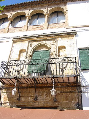
The Casa del Corregidor is a building located in the town of Marbella, southern Spain. It was built in 1552, with a stone facade emblazoned with a balcony backed by three arches, combining Gothic and Renaissance elements. The Moorish-style ceiling contains fresco murals.
Cortijo de Miraflores
Historical building in Marbella, Spain
Distance: Approx. 286 meters
Latitude and longitude: 36.51599,-4.88904
Cortijo de Miraflores is a historical building in the Pilar Miraflores neighborhood of Marbella, Spain. It originated in the cortijo built in 1706 by Tomás Francisco Domínguez y Godoy on the ruins of a former farming estate. the building houses a number of decorative elements, probably from earlier buildings, such as medallions.

Hospital Bazán
Former hospital turned museum in Marbella, Spain
Distance: Approx. 658 meters
Latitude and longitude: 36.5101,-4.8829
The Hospital Bazán is a historical building in Marbella, Andalucia, Spain. Today it houses the Museum of Contemporary Spanish Engravings or "Museo del Grabado Español Contemporáneo".

Marbella Lighthouse
Lighthouse in southern Spain
Distance: Approx. 985 meters
Latitude and longitude: 36.50727778,-4.88997222
Marbella Lighthouse (Spanish: Faro de Marbella) is a lighthouse in Marbella, southern Spain. It was built in 1864 and is 29 metres (95 ft) high. It is automatic and electric, its light controlled by photoelectric cells.

Muralla urbana de Marbella
Fort in southern Spain
Distance: Approx. 495 meters
Latitude and longitude: 36.5113,-4.8841
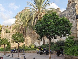
The Muralla urbana is a fortress in Marbella, southern Spain. It was built in the 10th century, and contained the old Arab medina, which today corresponds to the old part of the city. The fort was accessible through three entrances: the Puerta de Ronda, the Puerta de Málaga and the Puerta del Mar, and was composed of at least 20 towers.

Costa del Sol Occidental
Comarca in Andalusia, Spain
Distance: Approx. 729 meters
Latitude and longitude: 36.515,-4.87777778
Costa del Sol Occidental (English: "Western Coast of the Sun") is a comarca (county) in Andalusia, southern Spain. It occupies a narrow coastal strip delimited by the cordillera Penibética (Sierra de Mijas, Sierra Alpujata, Sierra Blanca, Sierra Bermeja, Sierra Crestallina) to the north and the Mediterranean Sea to the south. The coast shows a diversity of landscapes: beaches, cliffs, estuaries, bays and dunes.
Estadio Municipal de Marbella
Distance: Approx. 759 meters
Latitude and longitude: 36.51166667,-4.87888889
Estadio Municipal Antonio Lorenzo Cuevas is a stadium in Marbella, Spain. It is primarily used for football. Spanish football team Marbella FC holding home matches at this stadium.
1989 World Cup (men's golf)
Golf tournament
Distance: Approx. 264 meters
Latitude and longitude: 36.51666667,-4.88333333
The 1989 World Cup took place 16–19 November at Las Brisas Golf Club in Marbella, Spain. It was the 35th World Cup event. The tournament was shortened, due to rain, from 72 to 36 holes.
1973 World Cup
Golf tournament
Distance: Approx. 264 meters
Latitude and longitude: 36.51666667,-4.88333333
The 1973 World Cup took place 22–25 November at the Club de Golf Nueva Andalucía in Marbella, Spain. The name of the club was later changed to Real Club de Golf Las Brisas. It was the 21st World Cup event.
Weather in this IP's area
scattered clouds
10 Celsius
8 Celsius
10 Celsius
12 Celsius
1028 hPa
74 %
1028 hPa
1021 hPa
10000 meters
2.87 m/s
3.99 m/s
40 degree
43 %