Country:
Region:
City:
Latitude and Longitude:
Time Zone:
Postal Code:
IP information under different IP Channel
ip-api
Country
Region
City
ASN
Time Zone
ISP
Blacklist
Proxy
Latitude
Longitude
Postal
Route
Luminati
Country
Region
an
City
lasgabias
ASN
Time Zone
Europe/Madrid
ISP
Euskaltel S.A.
Latitude
Longitude
Postal
IPinfo
Country
Region
City
ASN
Time Zone
ISP
Blacklist
Proxy
Latitude
Longitude
Postal
Route
db-ip
Country
Region
City
ASN
Time Zone
ISP
Blacklist
Proxy
Latitude
Longitude
Postal
Route
ipdata
Country
Region
City
ASN
Time Zone
ISP
Blacklist
Proxy
Latitude
Longitude
Postal
Route
Popular places and events near this IP address
Sant Joan d'Alacant
Municipality in Spain
Distance: Approx. 40 meters
Latitude and longitude: 38.40138889,-0.43666667
Sant Joan d'Alacant (Valencian: [ˈsaɲ dʒuˈan dalaˈkant]; Spanish: San Juan de Alicante [saŋ xwan de aliˈkante]), or simply Sant Joan (or San Juan), is a municipality belonging to Alicante metropolitan area, in the southeast of Valencian Community, Spain. It is the geographic center of the Old Garden of Alicante. Its limits are with the settled areas of Alicante (7 km), Mutxamel (1 km) and El Campello (3 km).
El Campello
Municipality in Valencian Community, Spain
Distance: Approx. 4214 meters
Latitude and longitude: 38.4275,-0.40111111
El Campello (Valencian: [el kamˈpeʎo]; Spanish: Campello [kamˈpeʎo]) is a town on the Costa Blanca of Spain, within the Valencian Community. It is a 20-minute tram ride from Alicante city. There is a busy marina and fish market.

Alicante Tram
Railway system in Alicante, Spain
Distance: Approx. 4095 meters
Latitude and longitude: 38.36527778,-0.44444444
The Alicante Tram, trademarked as Alicante Metropolitan TRAM (Valencian: TRAM Metropolità d'Alacant, Spanish: TRAM Metropolitano de Alicante), operates in the Spanish city of Alicante (Valencian Community) and its surrounding area. Like other narrow gauge railways in the Valencian Community, it is run by Ferrocarrils de la Generalitat Valenciana (FGV). It was inaugurated on 15 August 2003 replacing narrow-gauge diesel trains between Alicante and El Campello.

Archaeological Museum of Alicante
Archaeology museum in Alicante, Spain
Distance: Approx. 6367 meters
Latitude and longitude: 38.35375,-0.47638889
The Archaeological Museum of Alicante (Spanish: Museo Arqueológico Provincial de Alicante, Valencian: Museu Arqueològic Provincial d'Alacant, abbreviated as MARQ) is an archaeological museum in Alicante, Spain. The museum won the European Museum of the Year Award in 2004, a few years after significant expansion and reallocation to renovated buildings of the antique hospital of San Juan de Dios. The museum houses eight galleries that use multimedia to allow visitors to interact with the lives of past residents of the region.

Lucentum
Human settlement in Alicante, L'Alacantí, Alicante Province, Spain
Distance: Approx. 4129 meters
Latitude and longitude: 38.36444444,-0.43833333
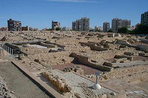
Lucentum (‹See Tfd›Greek: Λούκεντον, Loúkenton), called Lucentia by Pomponius Mela, is the Roman predecessor of the city of Alicante, Spain. Particularly, it refers to the archaeological site in which the remains of this ancient settlement lie, at a place known as El Tossal de Manises, in the neighborhood of Albufereta.

Dona Lluna
Distance: Approx. 6907 meters
Latitude and longitude: 38.394177,-0.51485
Dona Lluna: A Tribute to Womankind is a sculpture by Saülo Mercader, standing in the middle of a rotunda, in the heart of the City of Sant Vicent del Raspeig, the home of Alicante University, in Southeastern Spain. It was unveiled on March 11, 2007 by local dignitaries and a symphony orchestra from Madrid. The sculpture, representing the shape of a powerful and massive female body, weighs 2 tons and is 4 metres high.

Santa Bárbara Castle
Castle in Alicante, Spain
Distance: Approx. 6901 meters
Latitude and longitude: 38.34888889,-0.47805556
Santa Bárbara Castle (Valencian: Castell de Santa Bàrbara, Spanish: Castillo de Santa Bárbara) is a fortification in the center of Alicante, Spain. It stands on Mount Benacantil (166 m) bordering the sea, which gave it enormous strategic value since from it you can see the entire bay of Alicante and its land surroundings. The image of the mountain from the beach resembles a face, which is why it is called "the face of the Moor" and is an icon of the city of Alicante.

Mutxamel
Municipality in Valencia, Spain
Distance: Approx. 1575 meters
Latitude and longitude: 38.41361111,-0.44555556
Mutxamel (Valencian: [mutʃaˈmɛl]; Spanish: Muchamiel [mutʃaˈmjel]) is a municipality in the comarca of Alacantí, Alicante, Valencian Community, Spain.
Mount Benacantil
Mountain in Alicante, Spain
Distance: Approx. 6796 meters
Latitude and longitude: 38.35,-0.47805556
Mount Benacantil (Valencian pronunciation: [benakanˈtil]) is a mount (or rather a large hill) that dominates the urban part of Alicante, and is the characteristic image of the city. The mount name appears as Banu-l-Qatil in the work of Muslim geographer Al-Idrisi in the 12th century, but it is possible that this is an error of transcription (Arab names like "beni" are abundant on the peninsula; the name means "family tree") because it does not make sense in Arabic (it would be "the family of the murderer"). Compared with other names in the Valencian Community, the mount name is more likely to be derived from the word "benna", an Arabic transcription of "pinna", which is "rock" in Latin; combined with the adjective "laqanti", which comes from "Laqant," the Arabic name of the city.

El Barco, Alicante
Distance: Approx. 4689 meters
Latitude and longitude: 38.360711,-0.449646
El Barco (The Ship) is a residential apartment tower in Albufereta, Alicante, Spain. It is formally called Torre Vistamar de la Albufereta, meaning "Albufereta Sea View Tower". El Barco was one of a cluster of buildings erected in the former village of Albufereta for "Pied-Noirs", or residents from France and other European countries, in Francoist Spain.
Lycée Français d'Alicante
School
Distance: Approx. 2034 meters
Latitude and longitude: 38.40151,-0.41291
Lycée Français d'Alicante Pierre Deschamps (LFA; Spanish: Liceo Francés de Alicante) is a French international school in El Campello, Alicante Province, Spain. It serves maternelle/educación infantil (preschool) through lycée/bachillerato. As of 2016 the main campus, which is adjacent to Villa Marco, has about 1,300 students.
College of the Immaculate, Alicante
Jesuit, catholic school in Alicante, Spain
Distance: Approx. 5121 meters
Latitude and longitude: 38.36110278,-0.46430556
College of the Immaculate, Alicante, Spain, was founded by the Society of Jesus in 1954. It is coeducational and includes three-year-olds through primary, secondary (ESO), and baccalaureate.
Weather in this IP's area
few clouds
20 Celsius
20 Celsius
19 Celsius
20 Celsius
1021 hPa
65 %
1021 hPa
1016 hPa
10000 meters
8.75 m/s
60 degree
20 %
07:43:44
17:49:17


