Country:
Region:
City:
Latitude and Longitude:
Time Zone:
Postal Code:
IP information under different IP Channel
ip-api
Country
Region
City
ASN
Time Zone
ISP
Blacklist
Proxy
Latitude
Longitude
Postal
Route
Luminati
Country
Region
06
City
oryahovo
ASN
Time Zone
Europe/Sofia
ISP
Net-Surf.net Ltd.
Latitude
Longitude
Postal
IPinfo
Country
Region
City
ASN
Time Zone
ISP
Blacklist
Proxy
Latitude
Longitude
Postal
Route
db-ip
Country
Region
City
ASN
Time Zone
ISP
Blacklist
Proxy
Latitude
Longitude
Postal
Route
ipdata
Country
Region
City
ASN
Time Zone
ISP
Blacklist
Proxy
Latitude
Longitude
Postal
Route
Popular places and events near this IP address

Ogosta
River in Bulgaria
Distance: Approx. 6357 meters
Latitude and longitude: 43.7461,23.8849
The Ogosta (Bulgarian: Огоста [oˈɡɔstɐ], Latin: Augusta), is the largest river in Northwestern Bulgaria, a right tributary of the Danube. It originates at Chiprovska Mountain, 2,168 meters high section of the Western Balkan Mountains, at about an altitude of 1,760 meters, on the border with Serbia. The towns of Chiprovtsi, Montana, and Miziya are situated on the river's banks.
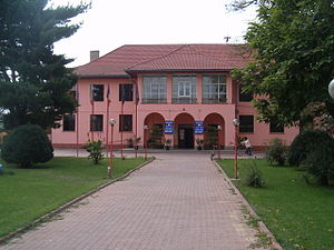
Oryahovo
Place in Vratsa, Bulgaria
Distance: Approx. 963 meters
Latitude and longitude: 43.73416667,23.96111111
Oryahovo (Bulgarian: Оряхово pronounced [oˈrʲaxovo]) is a port city in northwestern Bulgaria, part of Vratsa Province. It is located in a hilly area on the right bank of the Danube, just east of the mouth of the river Ogosta, a few more kilometres downstream from where the Jiu flows into the Danube on Romanian territory. The town is known for the ferry service that connects it to the Romanian town of Bechet across the river.

Bechet
Town in Dolj, Romania
Distance: Approx. 4668 meters
Latitude and longitude: 43.78333333,23.95
Bechet is a town in Dolj County, Oltenia, Romania, on the river Danube, opposite the Bulgarian city of Oryahovo.
Jieț (Danube)
River in Dolj County, Romania
Distance: Approx. 2823 meters
Latitude and longitude: 43.7483,23.9296
The Jieț is a left tributary of the river Danube in Romania. It discharges into the Danube near Bechet. Its length is 52 km (32 mi) and its basin size is 633 km2 (244 sq mi).
Călărași, Dolj
Commune in Dolj, Romania
Distance: Approx. 8785 meters
Latitude and longitude: 43.79333333,24.0475
Călărași (Romanian pronunciation: [kələˈraʃʲ] ) is a commune in Dolj County, Oltenia, Romania with a population of 6,576 people. It is composed of two villages, Călărași and Sărata.
Ostroveni
Commune in Dolj, Romania
Distance: Approx. 9092 meters
Latitude and longitude: 43.8,23.88333333
Ostroveni is a commune in Dolj County, Oltenia, Romania with a population of 5,684 people. It is composed of two villages, Lișteava and Ostroveni.

Skat (river)
River in Bulgaria
Distance: Approx. 8800 meters
Latitude and longitude: 43.7214,23.8584
The Skat (Bulgarian: Скът, pronounced [ˈskɤt]; also transliterated Skǎt or Skut; Latin: Scitus) is a river in the western Danubian Plain of northern Bulgaria and a right tributary of the Ogosta. The Skat takes its source from the Rechka area near the Veslets mountain in Vratsa Province, part of the western Fore-Balkan Mountains, north of the Manyashki Vrah peak. It goes round the Borovan hill from the west and runs through a shallow gorge near Ohoden.
Saraevo
Place in Vratsa, Bulgaria
Distance: Approx. 8330 meters
Latitude and longitude: 43.71666667,23.86666667
Saraevo (Bulgarian: Сараево) is a village in Northwestern Bulgaria, part of Miziya Municipality, Vratsa Province. It is located on Skat River, which discharges into Ogosta nearby, which in its turn discharges into the Danube not far away.

Aedava
Distance: Approx. 7810 meters
Latitude and longitude: 43.737,23.867
Aedava (also known as Aedeva, Aedabe, Aedeba, Aedadeba) was a Dacian settlement located south of the Danube in Moesia (present-day northern Bulgaria). In his De Aedificiis, the 6th century AD historian Procopius placed Aedava on the Danubian road between Augustae and Variana. He also mentioned that Emperor Justinian (r.
Weather in this IP's area
clear sky
5 Celsius
2 Celsius
5 Celsius
5 Celsius
1033 hPa
50 %
1033 hPa
1029 hPa
10000 meters
2.69 m/s
3.27 m/s
89 degree
1 %
07:05:35
17:09:53