178.253.129.0 - IP Lookup: Free IP Address Lookup, Postal Code Lookup, IP Location Lookup, IP ASN, Public IP
Country:
Region:
City:
Location:
Time Zone:
Postal Code:
IP information under different IP Channel
ip-api
Country
Region
City
ASN
Time Zone
ISP
Blacklist
Proxy
Latitude
Longitude
Postal
Route
Luminati
Country
Region
bl
City
slovenskygrob
ASN
Time Zone
Europe/Bratislava
ISP
Slovanet a.s.
Latitude
Longitude
Postal
IPinfo
Country
Region
City
ASN
Time Zone
ISP
Blacklist
Proxy
Latitude
Longitude
Postal
Route
IP2Location
178.253.129.0Country
Region
banskobystricky kraj
City
brezno
Time Zone
Europe/Bratislava
ISP
Language
User-Agent
Latitude
Longitude
Postal
db-ip
Country
Region
City
ASN
Time Zone
ISP
Blacklist
Proxy
Latitude
Longitude
Postal
Route
ipdata
Country
Region
City
ASN
Time Zone
ISP
Blacklist
Proxy
Latitude
Longitude
Postal
Route
Popular places and events near this IP address
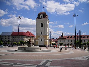
Brezno
City in Slovakia
Distance: Approx. 529 meters
Latitude and longitude: 48.80388889,19.64361111
Brezno (Slovak: [ˈbreznɔ] ; 1927–1948: Brezno nad Hronom; German: Bries or Briesen; Hungarian: Breznóbánya) is a town in central Slovakia with a population of around 21,000.
Braväcovo
Municipality in Banská Bystrica Region, Slovakia
Distance: Approx. 7410 meters
Latitude and longitude: 48.83,19.73
Braväcovo (until World War II Bravacovo; Hungarian: Baracka) is a village and municipality in Brezno District, in the Banská Bystrica Region of central Slovakia.

Bystrá, Brezno District
Municipality in Banská Bystrica Region, Slovakia
Distance: Approx. 4161 meters
Latitude and longitude: 48.83333333,19.6
Bystrá (Hungarian: Sebesér) is a village and municipality in Brezno District, in the Banská Bystrica Region of central Slovakia.

Čierny Balog
Municipality in Banská Bystrica Region, Slovakia
Distance: Approx. 6566 meters
Latitude and longitude: 48.75,19.67
Čierny Balog (until 1888 also Balog or Čierny Hronec; Hungarian: Feketebalog) is a municipality in Brezno District, in the Banská Bystrica Region of central Slovakia.
Hronec
Municipality in Banská Bystrica Region, Slovakia
Distance: Approx. 4973 meters
Latitude and longitude: 48.78,19.58
Hronec (Hungarian: Kisgaram, pronounced [ˈkiʒɡɒrɒm], until 1886: Rónicz) is a village and municipality in Brezno District, in the Banská Bystrica Region of central Slovakia.

Mýto pod Ďumbierom
Municipality in Banská Bystrica Region, Slovakia
Distance: Approx. 5065 meters
Latitude and longitude: 48.85,19.63
Mýto pod Ďumbierom (Hungarian: Vámos) is a village and municipality in Brezno District, in the Banská Bystrica Region of central Slovakia.

Podbrezová
Municipality in Banská Bystrica Region, Slovakia
Distance: Approx. 7991 meters
Latitude and longitude: 48.82,19.53
Podbrezová (Slovak pronunciation: [ˈpɔdbrezɔʋaː]; Hungarian: Zólyombrézó) is a large village and municipality in Brezno District, in the Banská Bystrica Region of central Slovakia, around 10 km west of the district seat town, Brezno.
Valaská
Municipality in Banská Bystrica Region, Slovakia
Distance: Approx. 4478 meters
Latitude and longitude: 48.82,19.58
Valaská (Hungarian: Garamolaszka) is a village and municipality in Brezno District, in the Banská Bystrica Region of central Slovakia.

Bystrianska Cave
Limestone cave in Slovakia
Distance: Approx. 4945 meters
Latitude and longitude: 48.84027778,19.59611111
Bystrianska Cave is a limestone cave located on the southern slopes of the Nizke Tatry Mountains, along the road towards Banska Bystrica, at the southern edge of the town of Bystrá, in the Brezno District, Banskobystrický region, in Slovakia.
Ladies Slovak Open
Professional golf tournament
Distance: Approx. 7764 meters
Latitude and longitude: 48.868,19.592
The Ladies Slovak Open is a women's professional golf tournament held on the Gray Bear Course at Golf Club Tále in Brezno, Slovakia. It was part of the Ladies European Tour between 2010 and 2014, and returned as part of the LET Access Series in 2024.
Mestský štadión Brezno
Football stadium in Brezno, Slovakia
Distance: Approx. 521 meters
Latitude and longitude: 48.80611111,19.62972222
The Municipal Stadium in Brezno, Slovakia, (Slovak: Mestský štadión Brezno) is the football (soccer) stadium. It is the temporary home stadium of the FO ŽP Šport Podbrezová football team playing in the Slovak Fortuna Liga. The stadium has a capacity of 3,000.
Horné lazy
Distance: Approx. 2925 meters
Latitude and longitude: 48.814444,19.599444
Horné lazy is a nature reserve in the Slovak municipality of Valaská in the Brezno District. The nature reserve covers an area of 34 ha in the Low Tatras mountain area. It has a protection level of 4 under the slovak nature protection system which corresponds to a protection level I according to IUCN standards.
Weather in this IP's area
overcast clouds
2 Celsius
0 Celsius
2 Celsius
2 Celsius
1011 hPa
95 %
1011 hPa
952 hPa
10000 meters
1.45 m/s
2.06 m/s
222 degree
100 %


