Country:
Region:
City:
Latitude and Longitude:
Time Zone:
Postal Code:
IP information under different IP Channel
ip-api
Country
Region
City
ASN
Time Zone
ISP
Blacklist
Proxy
Latitude
Longitude
Postal
Route
Luminati
Country
Region
bre
City
locronan
ASN
Time Zone
Europe/Paris
ISP
Odena SAS
Latitude
Longitude
Postal
IPinfo
Country
Region
City
ASN
Time Zone
ISP
Blacklist
Proxy
Latitude
Longitude
Postal
Route
db-ip
Country
Region
City
ASN
Time Zone
ISP
Blacklist
Proxy
Latitude
Longitude
Postal
Route
ipdata
Country
Region
City
ASN
Time Zone
ISP
Blacklist
Proxy
Latitude
Longitude
Postal
Route
Popular places and events near this IP address
Quéménéven
Commune in Brittany, France
Distance: Approx. 6970 meters
Latitude and longitude: 48.1147,-4.1206
Quéménéven (French pronunciation: [kemenevɛ̃]; Breton: Kemeneven) is a commune in the Finistère department of Brittany in northwestern France. Notable monuments include the Quéménéven Parish close in the village centre, and the Kergoat chapel in the hamlet Kergoat.

Locronan
Commune in Brittany, France
Distance: Approx. 781 meters
Latitude and longitude: 48.1,-4.2067
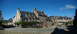
Locronan (French pronunciation: [lɔkʁɔnɑ̃]; Breton: Lokorn) is a commune in the Finistère department of Brittany in north-western France. Locronan is a member of the Les Plus Beaux Villages de France ("The most beautiful villages of France") association.

Guengat
Commune in Brittany, France
Distance: Approx. 5642 meters
Latitude and longitude: 48.0425,-4.2042
Guengat (Breton: Gwengad) is a commune in the Finistère department of Brittany in northwestern France.

Kerlaz
Commune in Brittany, France
Distance: Approx. 4751 meters
Latitude and longitude: 48.0928,-4.2725
Kerlaz (French pronunciation: [kɛʁlaz]; Breton: Kerlaz) is a commune in the Finistère department of Brittany in northwestern France. It extends over an area of 11.39 km2. In 2017 the commune had 799 inhabitants (density: 69.8 inhabitants/km2).

Le Juch
Commune in Brittany, France
Distance: Approx. 4395 meters
Latitude and longitude: 48.0669,-4.2528
Le Juch (French pronunciation: [lə ʒyk]; Breton: Ar Yeuc'h) is a commune in the Finistère department and administrative region of Brittany in north-western France.
Ploéven
Commune in Brittany, France
Distance: Approx. 7451 meters
Latitude and longitude: 48.1581,-4.2325
Ploéven (French pronunciation: [plɔevɛ̃]; Breton: Ploeven) is a commune in the Finistère department of Brittany in north-western France.

Plogonnec
Commune in Brittany, France
Distance: Approx. 1983 meters
Latitude and longitude: 48.0786,-4.1931
Plogonnec (French pronunciation: [plɔɡɔnɛk]; Breton: Plogoneg) is a commune and small town in the Finistère department of Brittany in north-western France. It is about 13 km (8 mi) north west of Quimper and 10 km (6 mi) east of Douarnenez. The town is twinned with Llandysul in Wales.

Plonévez-Porzay
Commune in Brittany, France
Distance: Approx. 3781 meters
Latitude and longitude: 48.1264,-4.2186
Plonévez-Porzay (French pronunciation: [plɔneve pɔʁzɛ]; Breton: Plonevez-Porzhe) is a commune in the Finistère department of Brittany in north-western France.
Canton of Douarnenez
Canton in Brittany, France
Distance: Approx. 6427 meters
Latitude and longitude: 48.06833333,-4.28666667
The Canton of Douarnenez is a French canton, located in the Finistère département (Brittany région).

Locronan Parish close
Church located in Finistère, in France
Distance: Approx. 581 meters
Latitude and longitude: 48.0983,-4.2079
The enclos paroissial or Parish close of Locronan comprises the parish church with adjoining chapel and a calvary. The article will also cover the nearby chapelle Notre-Dame-de-Bonne-Nouvelle. Locronan is a member of the Les Plus Beaux Villages de France ("The most beautiful villages of France") association.

Quéménéven Parish close
Distance: Approx. 7000 meters
Latitude and longitude: 48.1153,-4.1205
The Quéménéven Parish close comprising the parish church, a triumphal arch and calvary is located in the arrondissement of Châteaulin in Finistère in Brittany. The bell tower and the western façade of the church are a listed historical monument since 1969.
Kergoat chapel
Chapel in Quéménéven, Finistère, France
Distance: Approx. 3763 meters
Latitude and longitude: 48.1144,-4.1693
The Chapelle Notre-Dame de Kergoat is a 16th century chapel in the hamlet Kergoat, in the commune Quéménéven, Finistère, northwestern France. It has various stained glass windows and contains statues of Sainte Marguerite, Sainte Barbe, Saint Joseph, Saint Francis, Saint Mathurin, John the Baptist with the Virgin Mary. Some other statues have been moved to the musée de Quimper.
Weather in this IP's area
broken clouds
12 Celsius
12 Celsius
11 Celsius
12 Celsius
1017 hPa
88 %
1017 hPa
995 hPa
10000 meters
5.14 m/s
260 degree
75 %
08:28:33
17:35:54

