178.248.27.59 - IP Lookup: Free IP Address Lookup, Postal Code Lookup, IP Location Lookup, IP ASN, Public IP
Country:
Region:
City:
Location:
Time Zone:
Postal Code:
IP information under different IP Channel
ip-api
Country
Region
City
ASN
Time Zone
ISP
Blacklist
Proxy
Latitude
Longitude
Postal
Route
Luminati
Country
ASN
Time Zone
Europe/Stockholm
ISP
GlobalConnect AB
Latitude
Longitude
Postal
IPinfo
Country
Region
City
ASN
Time Zone
ISP
Blacklist
Proxy
Latitude
Longitude
Postal
Route
IP2Location
178.248.27.59Country
Region
stockholms lan
City
akersberga
Time Zone
Europe/Stockholm
ISP
Language
User-Agent
Latitude
Longitude
Postal
db-ip
Country
Region
City
ASN
Time Zone
ISP
Blacklist
Proxy
Latitude
Longitude
Postal
Route
ipdata
Country
Region
City
ASN
Time Zone
ISP
Blacklist
Proxy
Latitude
Longitude
Postal
Route
Popular places and events near this IP address
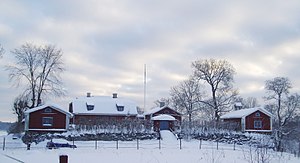
Österåker Municipality
Municipality in Stockholm County, Sweden
Distance: Approx. 438 meters
Latitude and longitude: 59.48333333,18.3
Österåker Municipality (Swedish: Österåkers kommun, IPA: [ˈœ̂sːtɛrˌoːkɛʂ kʊˈmʉːn]) is a municipality in Stockholm County in east central Sweden. Its seat is located in the town of Åkersberga, with a population of 26,727 (2005). From 1974 to 1982 Österåker was part of Vaxholm Municipality.
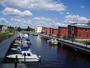
Åkersberga
Place in Uppland, Sweden
Distance: Approx. 438 meters
Latitude and longitude: 59.48333333,18.3
Åkersberga is a locality and the seat of Österåker Municipality, Stockholm County, Sweden with 28,033 inhabitants in 2010.

Österskär
Distance: Approx. 2086 meters
Latitude and longitude: 59.46156,18.311
Österskär is eastern part of Åkersberga, Österåker Municipality in Sweden. It hosts the terminal station of the Stockholm suburban railway Roslagsbanan. The area is located in a hilly peninsula between Tunaviken and Sätterfjärden northwest of Trälhavet.
Österåker Prison
Prison in Österåker Municipality, Sweden
Distance: Approx. 4806 meters
Latitude and longitude: 59.52222222,18.28888889
The Österåker Prison (Swedish: Anstalten Österåker, commonly known as Österåkersanstalten) is a prison located in Österåker Municipality, thirty kilometers north of Stockholm, Sweden. It is a Class 2-security prison with a capacity for 146 inmates. The facility also contains a remand prison with the capacity for 80 inmates.
Solberga, Österåker
Place in Uppland, Sweden
Distance: Approx. 3652 meters
Latitude and longitude: 59.5,18.35
Solberga () is a locality situated in Österåker Municipality, Stockholm County, Sweden with 409 inhabitants in 2010.
Norrö, Österåkers Municipality
Place in Uppland, Sweden
Distance: Approx. 2957 meters
Latitude and longitude: 59.5,18.26666667
Norrö is a locality situated in Österåker Municipality, Stockholm County, Sweden with 305 inhabitants in 2010. It is situated some 2.5 kilometres (1.6 mi) north of the town of Åkersberga.

Stava
Place in Uppland, Sweden
Distance: Approx. 4396 meters
Latitude and longitude: 59.5,18.23333333
Stava is a locality situated in Österåker Municipality, Stockholm County, Sweden with 305 inhabitants in 2010.
Svinninge, Sweden
Place in Uppland, Sweden
Distance: Approx. 3401 meters
Latitude and longitude: 59.45,18.28333333
Svinninge is a locality situated in Österåker Municipality, Stockholm County, Sweden with 1,636 inhabitants in 2010.
Täljö
Place in Uppland, Sweden
Distance: Approx. 4011 meters
Latitude and longitude: 59.46666667,18.23333333
Täljö is a locality situated in Österåker Municipality, Stockholm County, Sweden with 387 inhabitants in 2010.
Åker's Canal
River in Stockholm County, Sweden
Distance: Approx. 1070 meters
Latitude and longitude: 59.47083333,18.29111111
Åker's Canal (Swedish: Åkers kanal), previous known as Åkersström, is a waterway in Sweden. It was originally a natural river, but was renamed after having been regulated in the 19th century to be used as a canal.
Österåker Golf Club
Swedish golf club in Åkersberga
Distance: Approx. 2903 meters
Latitude and longitude: 59.4913,18.254
Österåker Golf Club (Österåkers Golfklubb) is a golf club situated in Åkersberga 20 km northeast of Stockholm, Sweden. It has hosted the Compaq Open on the Ladies European Tour.
Härsbacka mine
Mine in Österåker, Sweden
Distance: Approx. 5024 meters
Latitude and longitude: 59.48039722,18.38855
Härsbacka mine (Swedish: Härsbacka gruva) is a quartz and feldspar mine. It was once Sweden's foremost quartz mine. The mine was closed in 1946.
Weather in this IP's area
overcast clouds
3 Celsius
-1 Celsius
2 Celsius
3 Celsius
982 hPa
91 %
982 hPa
978 hPa
10000 meters
4.16 m/s
9.44 m/s
233 degree
100 %

