Country:
 Hong Kong (China)
Region:
City:
Latitude and Longitude:
Time Zone:
Postal Code:
IP information under different IP Channel
ip-api
Country
Region
City
ASN
Time Zone
ISP
Blacklist
Proxy
Latitude
Longitude
Postal
Route
IPinfo
Country
Region
City
ASN
Time Zone
ISP
Blacklist
Proxy
Latitude
Longitude
Postal
Route
MaxMind
Country
Region
City
ASN
Time Zone
ISP
Blacklist
Proxy
Latitude
Longitude
Postal
Route
Luminati
Country
HKASN
Time Zone
Asia/Hong_Kong
ISP
Yuhonet International Limited
Latitude
Longitude
Postal
db-ip
Country
Region
City
ASN
Time Zone
ISP
Blacklist
Proxy
Latitude
Longitude
Postal
Route
ipdata
Country
Region
City
ASN
Time Zone
ISP
Blacklist
Proxy
Latitude
Longitude
Postal
Route
Popular places and events near this IP address

Lei Cheng Uk Han Tomb Museum
Museum and ancient tomb in Hong Kong
Distance: Approx. 449 meters
Latitude and longitude: 22.33809444,114.16002222
The Lei Cheng Uk Han Tomb Museum is composed of a brick tomb (E. Han or slightly later) and an exhibition hall adjacent to it. It is located at 41 Tonkin Street, in Cheung Sha Wan, Sham Shui Po District, in the northwestern part of the Kowloon Peninsula of Hong Kong.

Cheung Sha Wan station
MTR station in Kowloon, Hong Kong
Distance: Approx. 628 meters
Latitude and longitude: 22.3354,114.1563
Cheung Sha Wan (Chinese: 長沙灣) is an underground station located underneath Cheung Sha Wan Road in Sham Shui Po District on the Tsuen Wan line of Hong Kong MTR, between Sham Shui Po and Lai Chi Kok. It was opened on 17 May 1982. The station's colour is yellow and brown.

Caritas Medical Centre
Hospital in Kowloon, Hong Kong
Distance: Approx. 435 meters
Latitude and longitude: 22.3411111,114.1527778
Caritas Medical Centre (Chinese: 明愛醫院; Cantonese Yale: Mìhng'oi Yīyún) is a Roman Catholic founded district general hospital in So Uk, Cheung Sha Wan, New Kowloon, Hong Kong. It is the largest hospital in Sham Shui Po District and co-managed by the Hospital Authority and Caritas Hong Kong.
Tonkin Street
Street in Hong Kong
Distance: Approx. 495 meters
Latitude and longitude: 22.33743,114.15987
Tonkin Street (Chinese: 東京街) is a street between Sham Shui Po and Cheung Sha Wan of New Kowloon in Hong Kong. It runs northeast to southwest and crosses many major roads in the Cheung Sha Wan area. After extensive reclamation in West Kowloon during the 1990s, an extension Tonkin Street West (東京街西) was built.
So Uk
Distance: Approx. 227 meters
Latitude and longitude: 22.3411,114.1548
So Uk (Chinese: 蘇屋; Cantonese Yale: Sōuūk) is an area in New Kowloon of Hong Kong, located to the north of Cheung Sha Wan. It was originally a village founded and resided by a clan bearing the surname So. The area now includes the area surrounding So Uk Estate, and a major hospital, Caritas Medical Centre, is also located within the area.
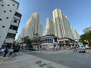
So Uk Estate
Distance: Approx. 136 meters
Latitude and longitude: 22.34222222,114.15694444
So Uk Estate (Chinese: 蘇屋邨; Cantonese Yale: Sōuūk Chyūn) is an early public housing estate in So Uk, a hillside area of Cheung Sha Wan, Kowloon, Hong Kong. The estate has undergone redevelopment, and new housing blocks are being built in place of the ones demolished.

Cheung Sha Wan Factory Estate
Distance: Approx. 598 meters
Latitude and longitude: 22.335637,114.157249
Cheung Sha Wan Factory Estate (Chinese: 長沙灣工廠大廈) was a factory estate in Cheung Sha Wan, Kowloon, Hong Kong, owned and managed by the Hong Kong Housing Authority. It comprised up to six low-storey blocks without lift service, built between 1957 and 1965. Cheung Sha Wan Factory Estate was the first factory estate in Hong Kong built in Hong Kong by the Public Works Department.

Un Chau Estate
Housing estate in Cheung Sha Wan, Hong Kong
Distance: Approx. 462 meters
Latitude and longitude: 22.336917,114.156219
Un Chau Estate (Chinese: 元州邨), or Un Chau Street Estate (Chinese: 元州街邨) before redevelopment, is a public housing estate on the reclaimed land of Cheung Sha Wan, Kowloon, Hong Kong, located between Un Chau Street and Cheung Sha Wan Road, next to MTR Cheung Sha Wan station. It consists of 10 residential buildings completed in 1998, 1999 and 2008, which were developed into 4 phases. Phase 5 was developed on the site of the former Cheung Sha Wan Factory Estate.

Lei Cheng Uk Estate
Housing estate in Kowloon, Hong Kong
Distance: Approx. 355 meters
Latitude and longitude: 22.3388,114.1595
Lei Cheng Uk Estate (Chinese: 李鄭屋邨; Jyutping: Lei5 Zeng6 Uk1 Cyun1; Cantonese Yale: Léihjehng'ūk Chyūn) is a public housing estate and Tenants Purchase Scheme estate in Lei Cheng Uk, downhill from Cheung Sha Wan, Kowloon, Hong Kong, located near the So Uk Estate. Since the redevelopment in 1980s, the estate consists of 10 residential buildings completed in 1984, 1989 and 1990 respectively. In 2002, some of the flats were sold to tenants through Tenants Purchase Scheme Phase 5.
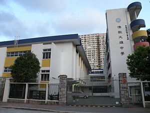
Buddhist Tai Hung College
Secondary school
Distance: Approx. 149 meters
Latitude and longitude: 22.340108,114.158085
Buddhist Tai Hung College (Chinese: 佛教大雄中學) is a school. It is located in the Cheung Sha Wan area of Sham Shui Po district of Kowloon, Hong Kong, near Caritas Medical Centre. Established in 1969, it was the second school established by the Hong Kong Buddhist Association.
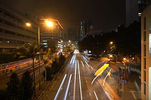
Cheung Sha Wan Road
Road in Kowloon, Hong Kong
Distance: Approx. 626 meters
Latitude and longitude: 22.33540883,114.156334
Cheung Sha Wan Road (Chinese: 長沙灣道; Jyutping: coeng4 saa1 waan4 dou6) is a main thoroughfare in Kowloon, Hong Kong going in a south-north direction from Mong Kok in the south to Lai Chi Kok in the north.

Tsung Tsin Middle School
School
Distance: Approx. 344 meters
Latitude and longitude: 22.3401,114.1602
Tsung Tsin Middle School is a secondary school affiliated to the Tsung Tsing Association of Hong Kong.
Weather in this IP's area
broken clouds
29 Celsius
34 Celsius
27 Celsius
29 Celsius
1002 hPa
84 %
1002 hPa
996 hPa
10000 meters
1.79 m/s
80 degree
55 %
06:11:33
18:22:11