178.216.2.87 - IP Lookup: Free IP Address Lookup, Postal Code Lookup, IP Location Lookup, IP ASN, Public IP
Country:
Region:
City:
Location:
Time Zone:
Postal Code:
ISP:
ASN:
language:
User-Agent:
Proxy IP:
Blacklist:
IP information under different IP Channel
ip-api
Country
Region
City
ASN
Time Zone
ISP
Blacklist
Proxy
Latitude
Longitude
Postal
Route
db-ip
Country
Region
City
ASN
Time Zone
ISP
Blacklist
Proxy
Latitude
Longitude
Postal
Route
IPinfo
Country
Region
City
ASN
Time Zone
ISP
Blacklist
Proxy
Latitude
Longitude
Postal
Route
IP2Location
178.216.2.87Country
Region
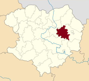
kharkivska oblast
City
shevchenkove
Time Zone
Europe/Kiev
ISP
Language
User-Agent
Latitude
Longitude
Postal
ipdata
Country
Region
City
ASN
Time Zone
ISP
Blacklist
Proxy
Latitude
Longitude
Postal
Route
Popular places and events near this IP address
Shevchenkove, Shevchenkove settlement hromada, Kupiansk Raion, Kharkiv Oblast
Rural locality in Kharkiv Oblast, Ukraine
Distance: Approx. 255 meters
Latitude and longitude: 49.69361111,37.17361111
Shevchenkove (Ukrainian: Шевченкове, pronounced [ʃeu̯ˈt͡ʃɛnkowe]) is a rural settlement in Kupiansk Raion, Kharkiv Oblast, Ukraine. It hosts the administration of Shevchenkove settlement hromada, one of the hromadas of Ukraine. Population: 6,627 (2022 estimate).

Shevchenkove Raion
Former subdivision of Kharkiv Oblast, Ukraine
Distance: Approx. 5719 meters
Latitude and longitude: 49.68181283,37.24986483
Shevchenkove Raion (Ukrainian: Шевченківський район) was a raion (district) in Kharkiv Oblast of Ukraine. Its administrative center was the urban-type settlement of Shevchenkove. The raion was abolished on 18 July 2020 as part of the administrative reform of Ukraine, which reduced the number of raions of Kharkiv Oblast to seven.

Hroza missile attack
2023 Russian airstrike in Ukraine
Distance: Approx. 3572 meters
Latitude and longitude: 49.67305556,37.20833333
On 5 October 2023, the Russian Armed Forces launched an Iskander ballistic missile at residents gathered in a memorial service at a shop and cafe in Hroza, Kupiansk Raion, Kharkiv Oblast, Ukraine, killing 59 and injuring at least 7 others. Among those killed in the airstrike was a six-year-old boy. The attack took place as part of the Russian invasion of Ukraine.
Hroza, Kharkiv Oblast
Village in Kharkiv Oblast, Ukraine
Distance: Approx. 3572 meters
Latitude and longitude: 49.673056,37.208333
Hroza (Ukrainian: Гроза, pronounced [ɦroˈzɑ]) is a village in the Kupiansk Raion of Kharkiv Oblast in northeastern Ukraine. It belongs to Shevchenkove settlement hromada, one of the hromadas of Ukraine, and is just outside the town of Shevchenkove. It is 34 kilometres (21 mi) west of Kupiansk and 79 kilometres (49 mi) southeast by east (SEbE) of the centre of Kharkiv city.
Weather in this IP's area
broken clouds
-1 Celsius
-5 Celsius
-1 Celsius
-1 Celsius
1020 hPa
86 %
1020 hPa
1001 hPa
10000 meters
3.93 m/s
8.01 m/s
318 degree
76 %
