178.212.156.132 - IP Lookup: Free IP Address Lookup, Postal Code Lookup, IP Location Lookup, IP ASN, Public IP
Country:
Region:
City:
Location:
Time Zone:
Postal Code:
ISP:
ASN:
language:
User-Agent:
Proxy IP:
Blacklist:
IP information under different IP Channel
ip-api
Country
Region
City
ASN
Time Zone
ISP
Blacklist
Proxy
Latitude
Longitude
Postal
Route
db-ip
Country
Region
City
ASN
Time Zone
ISP
Blacklist
Proxy
Latitude
Longitude
Postal
Route
IPinfo
Country
Region
City
ASN
Time Zone
ISP
Blacklist
Proxy
Latitude
Longitude
Postal
Route
IP2Location
178.212.156.132Country
Region
slaskie
City
lesna
Time Zone
Europe/Warsaw
ISP
Language
User-Agent
Latitude
Longitude
Postal
ipdata
Country
Region
City
ASN
Time Zone
ISP
Blacklist
Proxy
Latitude
Longitude
Postal
Route
Popular places and events near this IP address

Radziechowy
Village in Silesian Voivodeship, Poland
Distance: Approx. 2645 meters
Latitude and longitude: 49.64666667,19.12583333
Radziechowy [rad͡ʑɛˈxɔvɨ] is a village in the administrative district of Gmina Radziechowy-Wieprz, within Żywiec County, Silesian Voivodeship, in southern Poland. It lies approximately 8 kilometres (5 mi) south-west of Żywiec and 68 km (42 mi) south of the regional capital Katowice. It is one of the oldest villages in Żywiec Basin.

Golgotha of the Beskids
Distance: Approx. 2641 meters
Latitude and longitude: 49.6467,19.1258
The Golgotha of the Beskids (Polish: Golgota Beskidów) is a Way of the Cross on the Matyska hill in the Radziechowy village, near Żywiec, in the Silesian Beskids of south Poland.

Gmina Lipowa
Gmina in Silesian Voivodeship, Poland
Distance: Approx. 1952 meters
Latitude and longitude: 49.67888889,19.10388889
Gmina Lipowa is a rural gmina (administrative district) in Żywiec County, Silesian Voivodeship, in southern Poland. Its seat is the village of Lipowa, which lies approximately 8 kilometres (5 mi) west of Żywiec and 64 km (40 mi) south of the regional capital Katowice. The gmina covers an area of 58.08 square kilometres (22.4 sq mi), and as of 2019 its total population is 10,803.
Kalna, Poland
Village in Silesian Voivodeship, Poland
Distance: Approx. 4550 meters
Latitude and longitude: 49.70944444,19.10888889
Kalna ([ˈkalna] KAL-na) is a village in the administrative district of Gmina Buczkowice, within Bielsko County, Silesian Voivodeship, in southern Poland. It lies approximately 4 kilometres (2 mi) south-east of Buczkowice, 15 km (9 mi) south of Bielsko-Biała, and 61 km (38 mi) south of the regional capital Katowice.

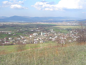
Leśna, Żywiec County
Village in Silesian Voivodeship, Poland
Distance: Approx. 376 meters
Latitude and longitude: 49.67,19.13277778
Leśna [ˈlɛɕna] is a village in the administrative district of Gmina Lipowa, within Żywiec County, Silesian Voivodeship, in southern Poland. It lies approximately 6 kilometres (4 mi) west of Żywiec and 66 km (41 mi) south of the regional capital Katowice.
Lipowa, Silesian Voivodeship
Village in Silesian Voivodeship, Poland
Distance: Approx. 1952 meters
Latitude and longitude: 49.67888889,19.10388889
Lipowa [liˈpɔva] is a village in Żywiec County, Silesian Voivodeship, in southern Poland. It is the seat of the gmina (administrative district) called Gmina Lipowa. It lies approximately 8 kilometres (5 mi) west of Żywiec and 64 km (40 mi) south of the regional capital Katowice.

Ostre, Silesian Voivodeship
Village in Silesian Voivodeship, Poland
Distance: Approx. 3397 meters
Latitude and longitude: 49.66277778,19.08194444
Ostre [ˈɔstrɛ] is a village in the administrative district of Gmina Lipowa, within Żywiec County, Silesian Voivodeship, in southern Poland. It lies approximately 10 kilometres (6 mi) west of Żywiec and 66 km (41 mi) south of the regional capital Katowice. The village was established in the early 17th century on the slopes of Ostre mountain in Silesian Beskids, originally named Podostre.

Sienna, Silesian Voivodeship
Village in Silesian Voivodeship, Poland
Distance: Approx. 586 meters
Latitude and longitude: 49.66666667,19.13333333
Sienna [ˈɕɛnna] is a village in the administrative district of Gmina Lipowa, within Żywiec County, Silesian Voivodeship, in southern Poland. It lies approximately 6 kilometres (4 mi) south-west of Żywiec and 66 km (41 mi) south of the regional capital Katowice. The village was established in 1608 by Mikołaj Komorowski, the owner of Żywiec Latifundium.

Twardorzeczka
Village in Silesian Voivodeship, Poland
Distance: Approx. 3916 meters
Latitude and longitude: 49.65,19.08333333
Twardorzeczka [tfardɔˈʐɛt͡ʂka] is a village in the administrative district of Gmina Lipowa, within Żywiec County, Silesian Voivodeship, in southern Poland. It lies approximately 10 kilometres (6 mi) south-west of Żywiec and 67 km (42 mi) south of the regional capital Katowice. It lies in Żywiec Basin alongside a Twardorzeczka stream flowing out from Silesian Beskids.
Pietrzykowice, Silesian Voivodeship
Village in Silesian Voivodeship, Poland
Distance: Approx. 2163 meters
Latitude and longitude: 49.68333333,19.15
Pietrzykowice [pjɛtʂɨkɔˈvit͡sɛ] is a village in the administrative district of Gmina Łodygowice, within Żywiec County, Silesian Voivodeship, in southern Poland. It lies approximately 5 kilometres (3 mi) south of Łodygowice, 5 km (3 mi) west of Żywiec, and 64 km (40 mi) south of the regional capital Katowice. It is one of the oldest villages in Żywiec Basin.

Wieprz, Silesian Voivodeship
Village in Silesian Voivodeship, Poland
Distance: Approx. 4936 meters
Latitude and longitude: 49.63805556,19.17444444
Wieprz (Polish: [ˈvjɛpʂ] , lit. '"Boar"') is a village in Żywiec County, Silesian Voivodeship, in southern Poland. It is the seat of the gmina (administrative district) called Gmina Radziechowy-Wieprz. It lies approximately 7 kilometres (4 mi) south of Żywiec and 70 km (43 mi) south of the regional capital Katowice.

Żywiec Basin
Distance: Approx. 3161 meters
Latitude and longitude: 49.68333333,19.16666667
Żywiec Basin (Polish: Kotlina Żywiecka) is a lowland, located in southern Poland, between the Little Beskids to the north, Silesian Beskids to the west, Żywiec Beskids to the south and east, and Maków Beskids to the east. It has the size of around 320 km2 (120 sq mi). It is centered on the confluences of the rivers Koszarawa and Żylica with Soła close to the town of Żywiec, whence the name of the basin is derived from.
Weather in this IP's area
broken clouds
7 Celsius
5 Celsius
6 Celsius
7 Celsius
1005 hPa
94 %
1005 hPa
929 hPa
10000 meters
2.93 m/s
3.31 m/s
162 degree
81 %


