Country:
 Saudi Arabia
Region:
City:
Latitude and Longitude:
Time Zone:
Postal Code:
IP information under different IP Channel
ip-api
Country
Region
City
ASN
Time Zone
ISP
Blacklist
Proxy
Latitude
Longitude
Postal
Route
IPinfo
Country
Region
City
ASN
Time Zone
ISP
Blacklist
Proxy
Latitude
Longitude
Postal
Route
MaxMind
Country
Region
City
ASN
Time Zone
ISP
Blacklist
Proxy
Latitude
Longitude
Postal
Route
Luminati
Country
SARegion
04
City
khobar
ASN
Time Zone
Asia/Riyadh
ISP
Nour Internet Company for Communications and Information Technology Ltd.
Latitude
Longitude
Postal
db-ip
Country
Region
City
ASN
Time Zone
ISP
Blacklist
Proxy
Latitude
Longitude
Postal
Route
ipdata
Country
Region
City
ASN
Time Zone
ISP
Blacklist
Proxy
Latitude
Longitude
Postal
Route
Popular places and events near this IP address

Khobar Towers bombing
1996 terrorist attack in Khobar, Saudi Arabia
Distance: Approx. 2603 meters
Latitude and longitude: 26.261243,50.206825
The Khobar Towers bombing was a terrorist attack on part of a housing complex in the city of Khobar, Saudi Arabia, near the national oil company (Saudi Aramco) headquarters of Dhahran and nearby King Abdulaziz Air Base on 25 June 1996. At that time, Khobar Towers was being used as living quarters for coalition forces who were assigned to Operation Southern Watch, a no-fly zone operation in southern Iraq, as part of the Iraqi no-fly zones. A truck bomb was detonated adjacent to Building #131, an eight-story structure housing members of the United States Air Force's 4404th Wing (Provisional), primarily from a deployed rescue squadron and deployed fighter squadron.

Saudi Aramco Residential Camp in Dhahran
Gated community in Eastern Province, Saudi Arabia
Distance: Approx. 8240 meters
Latitude and longitude: 26.3049,50.1286
Saudi Aramco Residential Camp in Dhahran is a residential community built by Saudi Aramco for its employees to live in. It is located within the city of Dhahran (Arabic: الظهران) in Saudi Arabia's Eastern Province. There are three areas recognized by the inhabitants in the Dhahran camp.

Khobar
City in Eastern Province, Saudi Arabia
Distance: Approx. 811 meters
Latitude and longitude: 26.28333333,50.2
Khobar (Arabic: ٱلْخُبَر, romanized: al-Khubar) is a city and governorate in the Eastern Province of the Kingdom of Saudi Arabia, situated on the coast of the Persian Gulf. With a population of 409,549 as of 2022 in the city core and 658,550 in the governorate, Khobar is part of the 'Triplet Cities' area, or Dammam metropolitan area along with Dammam and Dhahran, forming the residential core of the region. The city was founded alongside Dammam by the Dawasir who moved there in 1923 fearing British persecution with the permission of King Abdulaziz Al Saud.
2004 Khobar massacre
2004 terrorist attack in Saudi Arabia
Distance: Approx. 4373 meters
Latitude and longitude: 26.32134444,50.19249722
On 29 May 2004, a Saturday, four men armed with guns and bombs attacked two oil industry installations and a residential compound, in Al-Khobar, Saudi Arabia—the hub of the Saudi oil industry. Over approximately 25 hours, the gunmen, describing themselves as members of "The Jerusalem Squadron" or "Jerusalem Brigade", killed 22 and injured 25, mainly third country national personnel working in Khobar. Their targets were the Arab Petroleum Investments Corporation building and the Al-Khobar Petroleum Centre, and a foreign workers' housing complex, the Oasis Compound, in the Gulf city of Khobar.
King Fahd University of Petroleum and Minerals
Public research university in Dhahran, Saudi Arabia
Distance: Approx. 6983 meters
Latitude and longitude: 26.30972222,50.14388889
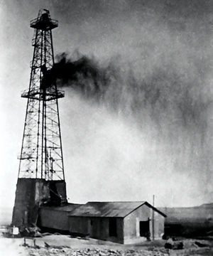
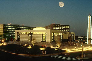
King Fahd University of Petroleum and Minerals (KFUPM) is a nonprofit research university in Dhahran, Eastern Province, Saudi Arabia. Established in 1963 by King Saud bin Abdulalziz as the College of Petroleum and Minerals, it is ranked among the most prestigious academic institutions in Saudi Arabia. Founded near the earliest local oil fields in response to the booming energy industry of Saudi Arabia, the University centers mainly around science, engineering, and management in order to advance the Kingdom’s petroleum and mineral industries.

King Abdulaziz Air Base
Royal Saudi Air Force base in Dhahran, Saudi Arabia
Distance: Approx. 6008 meters
Latitude and longitude: 26.26255556,50.15305556
King Abdulaziz Air Base (Arabic: قاعدة الملك عبدالعزيز الجوية) (IATA: DHA, ICAO: OEDR), also known as Dhahran Air Base and formerly Dhahran International Airport, Dhahran Airport and Dhahran Airfield, is a Royal Saudi Air Force base located in Dhahran in the Eastern Province, Saudi Arabia. Located west of Thuqbah and 7 km (4 mi) southeast of the Saudi Aramco Dhahran Camp, the airbase was the first Saudi Arabian airport to be constructed, in 1961, and is under the command of Air vice-marshal Prince Turki bin Bandar bin Abdulaziz Al Saud. The airbase was initially built and operated by the United States Air Force from 1945 until 1962 and was known as the Dhahran Airfield.
Dhahran
City in Eastern Province, Saudi Arabia
Distance: Approx. 6124 meters
Latitude and longitude: 26.26666667,50.15
Dhahran (Arabic: الظهران, romanized: Ad͟h D͟hahrān) is a city located in the Eastern Province, Saudi Arabia. With a total population of 143,936 as of 2022, it is a major administrative center for the Saudi oil industry. Together with the nearby cities of Dammam and Khobar, Dhahran forms part of the Dammam Metropolitan Area, which is commonly known as greater Dammam and has an estimated population of 2.2 million as of 2022.
Al Subeaei Tower Complex
Office in Khobar, Saudi Arabia
Distance: Approx. 2108 meters
Latitude and longitude: 26.30351,50.20918
Al Subeaei Tower Complex is a skyscraper located in Khobar, Saudi Arabia.
Saad Specialist Hospital
Hospital in Khobar, Saudi Arabia
Distance: Approx. 2095 meters
Latitude and longitude: 26.3021654,50.200467
Saad Specialist Hospital, often abbreviated as SSH, is a private hospital in Khobar, Saudi Arabia. It was initially owned and operated by the Saad Group, founded in 2001 by a businessman, Maan Abdul Wahed Al-Sanea. SSH is a JCI accredited hospital.

Saudi Readymix Concrete Company
Distance: Approx. 2039 meters
Latitude and longitude: 26.30261944,50.21164722
Saudi Readymix Concrete Company Ltd. is a producer and supplier of ready-mix concrete and related products in Saudi Arabia. The company is based in Khobar, Saudi Arabia, operates 20 commercial and 10 on-site factories, and is involved in many projects all over the kingdom.
Al Hugayet Tower
Residential / office in Khobar, Saudi Arabia
Distance: Approx. 2668 meters
Latitude and longitude: 26.3085,50.21
Al Hugayet Tower is the tallest building in Khobar, Saudi Arabia.
Al-Ettifaq Club Stadium
Multi-purpose stadium in Riyadh, Saudi Arabia
Distance: Approx. 7818 meters
Latitude and longitude: 26.35057111,50.18114278
Al-Ettifaq Club Stadium (Arabic: ملعب نادي الاتفاق), formerly known as Abdullah Al-Dabal Stadium, is a football stadium in Dammam, Saudi Arabia. It is the home stadium of Al-Ettifaq.
Weather in this IP's area
clear sky
34 Celsius
38 Celsius
34 Celsius
34 Celsius
1005 hPa
49 %
1005 hPa
1004 hPa
10000 meters
5.14 m/s
70 degree
05:25:22
17:42:47