178.19.235.199 - IP Lookup: Free IP Address Lookup, Postal Code Lookup, IP Location Lookup, IP ASN, Public IP
Country:
Region:
City:
Location:
Time Zone:
Postal Code:
ISP:
ASN:
language:
User-Agent:
Proxy IP:
Blacklist:
IP information under different IP Channel
ip-api
Country
Region
City
ASN
Time Zone
ISP
Blacklist
Proxy
Latitude
Longitude
Postal
Route
db-ip
Country
Region
City
ASN
Time Zone
ISP
Blacklist
Proxy
Latitude
Longitude
Postal
Route
IPinfo
Country
Region
City
ASN
Time Zone
ISP
Blacklist
Proxy
Latitude
Longitude
Postal
Route
IP2Location
178.19.235.199Country
Region
thuringen
City
bellevue
Time Zone
Europe/Berlin
ISP
Language
User-Agent
Latitude
Longitude
Postal
ipdata
Country
Region
City
ASN
Time Zone
ISP
Blacklist
Proxy
Latitude
Longitude
Postal
Route
Popular places and events near this IP address

Blankenstein
Ortsteil of Rosenthal am Rennsteig in Thuringia, Germany
Distance: Approx. 8898 meters
Latitude and longitude: 50.40194444,11.70027778
Blankenstein is a village and a former municipality in the district Saale-Orla-Kreis, in Thuringia, Germany. On 1 January 2019 it became part of the new municipality Rosenthal am Rennsteig. Prior to 2019, Blankenstein had been the seat of the Saale-Rennsteig Verwaltungsgemeinschaft (municipal association), which was disbanded in the reorganisation.
Bad Lobenstein
Town in Thuringia, Germany
Distance: Approx. 3081 meters
Latitude and longitude: 50.45,11.65
Bad Lobenstein is a spa town in the Saale-Orla-Kreis district, in Thuringia, Germany with a population of about 6,000 inhabitants. Until 2005, the town was named Lobenstein. The town, grouped round a rock, upon which stand the ruins of an old castle, is exceedingly picturesque.
Saalburg-Ebersdorf
Town in Thuringia, Germany
Distance: Approx. 3383 meters
Latitude and longitude: 50.49166667,11.7
Saalburg-Ebersdorf is a town in the Saale-Orla-Kreis district, in Thuringia, Germany close to the Bavarian border. It is situated on the river Saale, 10 km southwest of Schleiz, 30 km west of Plauen and 30 km north-west of Hof. The town is an administrative union of two large villages (Saalburg and Ebersdorf) lying either side of the Saale river near the Bleilochtalsperre as well as several smaller villages in between and around them.

Wurzbach
Town in Thuringia, Germany
Distance: Approx. 8723 meters
Latitude and longitude: 50.46388889,11.53666667
Wurzbach (German pronunciation: [ˈvʊʁt͡sˌbax] ) is a town in the Saale-Orla-Kreis district, in southern Thuringia, Germany. It is situated 33 kilometres (21 mi) southeast of Saalfeld, and 45 kilometres (28 mi) northwest of Hof.
Neundorf bei Lobenstein
Ortsteil of Rosenthal am Rennsteig in Thuringia, Germany
Distance: Approx. 6383 meters
Latitude and longitude: 50.43333333,11.6
Neundorf bei Lobenstein is a village and a former municipality in the district Saale-Orla-Kreis, in Thuringia, Germany. Since 1 January 2019, it is part of the municipality Rosenthal am Rennsteig.
Schlegel, Thuringia
Ortsteil of Rosenthal am Rennsteig in Thuringia, Germany
Distance: Approx. 8506 meters
Latitude and longitude: 50.40472222,11.62
Schlegel is a village and a former municipality in the district Saale-Orla-Kreis, in Thuringia, Germany. Since 1 January 2019, it is part of the municipality Rosenthal am Rennsteig. Olympian Harry Köcher was born here.
Birkenhügel
Ortsteil of Rosenthal am Rennsteig in Thuringia, Germany
Distance: Approx. 8146 meters
Latitude and longitude: 50.43333333,11.75
Birkenhügel is a village and a former municipality in the district Saale-Orla-Kreis, in Thuringia, Germany. Since 1 January 2019, it is part of the municipality Rosenthal am Rennsteig.
Harra
Ortsteil of Rosenthal am Rennsteig in Thuringia, Germany
Distance: Approx. 6859 meters
Latitude and longitude: 50.41777778,11.68361111
Harra is a village and a former municipality in the district Saale-Orla-Kreis, in Thuringia, Germany. Since 1 January 2019, it is part of the municipality Rosenthal am Rennsteig.
Remptendorf
Municipality in Thuringia, Germany
Distance: Approx. 6274 meters
Latitude and longitude: 50.53333333,11.65
Remptendorf is a municipality in the district Saale-Orla-Kreis, in Thuringia, Germany.
Saale-Rennsteig
Distance: Approx. 4961 meters
Latitude and longitude: 50.433,11.667
Saale-Rennsteig is a former Verwaltungsgemeinschaft ("collective municipality") in the district Saale-Orla-Kreis, in Thuringia, Germany. The seat of the Verwaltungsgemeinschaft was in Blankenstein. It was disbanded in January 2019.

Steinerne Rose
Rock formation in Germany
Distance: Approx. 7287 meters
Latitude and longitude: 50.52083333,11.73472222
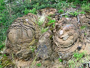
The Steinerne Rose is a rare natural monument. It is a diabase rock formation, that originated on the sea bed from outflowing lava in the middle Devonian, i.e. about 400 million years ago.

SonneMondSterne
Music festival in Germany
Distance: Approx. 5503 meters
Latitude and longitude: 50.5075,11.7194
The SonneMondSterne Festival (short SMS) is an open-air festival featuring electronic dance music held in Germany. The festival lasts three days and takes place on the second weekend of August in Thuringia at the Bleilochtalsperre near Saalburg-Ebersdorf. The first festival was in 1997 with 2,500 people.
Weather in this IP's area
clear sky
-0 Celsius
-3 Celsius
-4 Celsius
2 Celsius
1016 hPa
38 %
1016 hPa
949 hPa
10000 meters
2.22 m/s
2.49 m/s
186 degree
9 %


