178.19.234.243 - IP Lookup: Free IP Address Lookup, Postal Code Lookup, IP Location Lookup, IP ASN, Public IP
Country:
Region:
City:
Location:
Time Zone:
Postal Code:
ISP:
ASN:
language:
User-Agent:
Proxy IP:
Blacklist:
IP information under different IP Channel
ip-api
Country
Region
City
ASN
Time Zone
ISP
Blacklist
Proxy
Latitude
Longitude
Postal
Route
db-ip
Country
Region
City
ASN
Time Zone
ISP
Blacklist
Proxy
Latitude
Longitude
Postal
Route
IPinfo
Country
Region
City
ASN
Time Zone
ISP
Blacklist
Proxy
Latitude
Longitude
Postal
Route
IP2Location
178.19.234.243Country
Region
thuringen
City
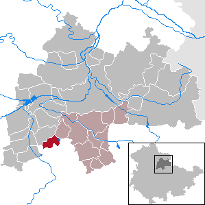
sulzer siedlung
Time Zone
Europe/Berlin
ISP
Language
User-Agent
Latitude
Longitude
Postal
ipdata
Country
Region
City
ASN
Time Zone
ISP
Blacklist
Proxy
Latitude
Longitude
Postal
Route
Popular places and events near this IP address

University of Erfurt
Public university in Thuringia, Germany
Distance: Approx. 4571 meters
Latitude and longitude: 50.99055556,11.01083333
The University of Erfurt (German: Universität Erfurt) is a public university located in Erfurt, the capital city of the German state of Thuringia. It was founded in 1379, and closed in 1816. It was re-established in 1994, three years after German reunification.

Kleinmölsen
Municipality in Thuringia, Germany
Distance: Approx. 5312 meters
Latitude and longitude: 51.03333333,11.11666667
Kleinmölsen is a municipality in the Sömmerda district of Thuringia, Germany.

Nöda
Municipality in Thuringia, Germany
Distance: Approx. 4766 meters
Latitude and longitude: 51.06666667,11.01666667
Nöda is a municipality in the Sömmerda district of Thuringia, Germany.

Principality of Erfurt
Former principality
Distance: Approx. 4872 meters
Latitude and longitude: 50.98333333,11.03333333
The Principality of Erfurt (German: Fürstentum Erfurt; French: Principauté d'Erfurt) was a small state in modern Thuringia, Germany, that existed from 1807 to 1814, comprising the modern city of Erfurt and the surrounding land. It was subordinate directly to Napoleon, the Emperor of the French, rather than being a part of the Confederation of the Rhine. After nearly 3 months of siege, the city fell to Prussian, Austrian and Russian forces.
Maschinenfabrik Christian Hagans
Distance: Approx. 2554 meters
Latitude and longitude: 51.008,11.0206
Maschinenfabrik Christian Hagans (Christian Hagans Engineering Works) was a German locomotive manufacturer founded on 1 July 1857 in Erfurt, Germany, by Christian Hagans. By the mid-1860s, the company had started building locomotive boilers and other components; in 1872 the first locomotive followed, a narrow gauge engine for a rail gauge of 750 mm. As a result of shortages of space, Hagans often had to limit its operations.
Flutgraben
Canal in Germany
Distance: Approx. 4502 meters
Latitude and longitude: 50.98833333,11.02166667
The Flutgraben is a canal in Erfurt, Thuringia, Germany. It is a flood control channel, created between 1890 and 1898 in order to prevent flooding of the river Gera in the city centre of Erfurt.

Erfurter Bahn
Distance: Approx. 2149 meters
Latitude and longitude: 51.0075,11.0418
The Erfurter Bahn (EB, lit. "Erfurt railway") is a railway company and public transit system serving the city of Erfurt, the capital of Thuringia, Germany. Erfurter Bahn is a wholly owned subsidiary of the Erfurt city council, and Süd-Thüringen-Bahn, operating between Erfurt and Meiningen, is a subsidiary of the former.

St. Augustine's Monastery (Erfurt)
Augustinian Complex, Germany, began 1277
Distance: Approx. 5111 meters
Latitude and longitude: 50.98145833,11.03000556
St. Augustine's Monastery (German: Augustinerkloster) in Erfurt, central Germany, is a former church and friary complex dating from the 13th century. The site is almost one hectare (2.5 acres) in size.

Rieth (Erfurt)
District in Erfurt, Germany
Distance: Approx. 3057 meters
Latitude and longitude: 51.0047,11.0156
The Rieth is a district in the north of the Thuringian state capital Erfurt, Germany. Rieth is a prefabricated housing estate with 5650 inhabitants (as of 31 December 2012) on an area of 0.72 km2, built in 1969. Before the fall of communism, however, considerably more people lived in this district.
Erfurt Nord station
Railway station in Erfurt, Germany
Distance: Approx. 2752 meters
Latitude and longitude: 51.0033,11.0293
Erfurt Nord station is a railway station in the northern part of Erfurt, capital city of Thuringia, Germany.

Erfurt Ost station
Railway station in Erfurt, Germany
Distance: Approx. 1402 meters
Latitude and longitude: 51.0143,11.0439
Erfurt Ost station is a railway station in the eastern part of Erfurt, capital city of Thuringia, Germany.

Schottenkirche, Erfurt
Church building in Thuringia, Germany
Distance: Approx. 5276 meters
Latitude and longitude: 50.97972222,11.03277778
The Schottenkirche (pronounced [ˈʃɔtn̩ˌkɪʁçə], 'Scots' Church'; also St. Nicolai und Jacobi 'St Nicholas' and James') in the historical part of the city of Erfurt in Thuringia, Germany, is a Roman Catholic church building dating back to the 12th century. The Romanesque basilica belonged to a former Celtic monastery of St James.
Weather in this IP's area
clear sky
-0 Celsius
-2 Celsius
-0 Celsius
-0 Celsius
1015 hPa
74 %
1015 hPa
985 hPa
10000 meters
1.54 m/s
180 degree


