Country:
 Slovakia
Region:
City:
Latitude and Longitude:
Time Zone:
Postal Code:
IP information under different IP Channel
ip-api
Country
Region
City
ASN
Time Zone
ISP
Blacklist
Proxy
Latitude
Longitude
Postal
Route
IPinfo
Country
Region
City
ASN
Time Zone
ISP
Blacklist
Proxy
Latitude
Longitude
Postal
Route
MaxMind
Country
Region
City
ASN
Time Zone
ISP
Blacklist
Proxy
Latitude
Longitude
Postal
Route
Luminati
Country
SKRegion
ni
City
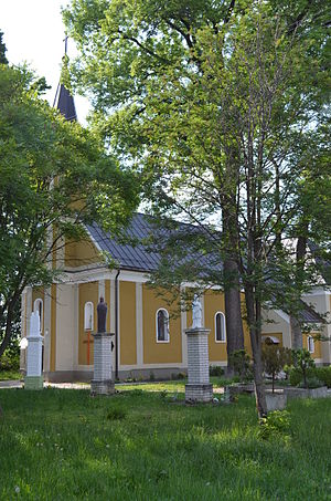
velkykyr
ASN
Time Zone
Europe/Bratislava
ISP
PRESNET s.r.o.
Latitude
Longitude
Postal
db-ip
Country
Region
City
ASN
Time Zone
ISP
Blacklist
Proxy
Latitude
Longitude
Postal
Route
ipdata
Country
Region
City
ASN
Time Zone
ISP
Blacklist
Proxy
Latitude
Longitude
Postal
Route
Popular places and events near this IP address

Komjatice
Village in Slovakia
Distance: Approx. 4466 meters
Latitude and longitude: 48.15,18.18333333
Komjatice (Hungarian: Komját) is a municipality and village in the Nové Zámky District of the south-west of Slovakia, in the Nitra Region.

Branč
Municipality in Nitra Region, Slovakia
Distance: Approx. 3988 meters
Latitude and longitude: 48.22,18.15
Branč (Hungarian: Berencs) is a village and municipality in the Nitra District in western Slovakia, in the Nitra Region.
Čechynce
Village and municipality in Slovakia
Distance: Approx. 7447 meters
Latitude and longitude: 48.25,18.17
Čechynce (Hungarian: Nyitracsehi) is a village and municipality in the Nitra District in western central Slovakia, in the Nitra Region.

Ivanka pri Nitre
Village and municipality in Slovakia
Distance: Approx. 6647 meters
Latitude and longitude: 48.24,18.12
Ivanka pri Nitre (Hungarian: Nyitraivánka) is a village and municipality in the Nitra District in western central Slovakia, in the Nitra Region.
Malý Cetín
Municipality in Nitra Region, Slovakia
Distance: Approx. 5508 meters
Latitude and longitude: 48.23,18.18
Malý Cetín (Hungarian: Kiscétény) is a village and municipality in the Nitra District in western central Slovakia, in the Nitra Region.
Mojmírovce
Village and municipality in Slovakia
Distance: Approx. 7267 meters
Latitude and longitude: 48.22,18.07
Mojmírovce (Hungarian: Ürmény) is a village and municipality in the Nitra District in western central Slovakia, in the Nitra Region.

Poľný Kesov
Municipality in Nitra Region, Slovakia
Distance: Approx. 6282 meters
Latitude and longitude: 48.17,18.07
Poľný Kesov (Hungarian: Mezőkeszi) is a village and municipality in the Nitra District in western central Slovakia, in the Nitra Region.
Štefanovičová
Municipality in Nitra Region, Slovakia
Distance: Approx. 4639 meters
Latitude and longitude: 48.19,18.09
Štefanovičová (Hungarian: Tarány) is a village and municipality in the Nitra District in western central Slovakia, in the Nitra Region. Its mayor is now Jaroslav Bíro.

Veľký Cetín
Village and municipality in Slovakia
Distance: Approx. 5350 meters
Latitude and longitude: 48.22,18.2
Veľký Cetín (Hungarian: Nagycétény) is a village and municipality in the Nitra District in western central Slovakia, in the Nitra Region.

Vinodol, Nitra District
Municipality in Nitra Region, Slovakia
Distance: Approx. 3820 meters
Latitude and longitude: 48.19222222,18.20194444
Vinodol (Hungarian: Nyitraszőlős) is a village and municipality in the Nitra District in western central Slovakia, in the Nitra Region. It is mostly agricultural settlement.
Veľký Kýr
Village and municipality in Slovakia
Distance: Approx. 1100 meters
Latitude and longitude: 48.18333333,18.16666667
Veľký Kýr (Hungarian: Nagykér or Nyitranagykér) is a village and municipality in the Nové Zámky District in the Nitra Region of south-west Slovakia.
Černík, Slovakia
Municipality in Nitra Region, Slovakia
Distance: Approx. 7145 meters
Latitude and longitude: 48.15,18.23333333
Černík (Hungarian: Csornok) is a village and municipality in the Nové Zámky District in the Nitra Region of south-west Slovakia.
Weather in this IP's area
clear sky
11 Celsius
10 Celsius
11 Celsius
11 Celsius
1014 hPa
80 %
1014 hPa
999 hPa
10000 meters
1.86 m/s
2.63 m/s
126 degree
06:55:21
18:14:40