Country:
 Netherlands
Region:
City:
Latitude and Longitude:
Time Zone:
Postal Code:
IP information under different IP Channel
ip-api
Country
Region
City
ASN
Time Zone
ISP
Blacklist
Proxy
Latitude
Longitude
Postal
Route
IPinfo
Country
Region
City
ASN
Time Zone
ISP
Blacklist
Proxy
Latitude
Longitude
Postal
Route
MaxMind
Country
Region
City
ASN
Time Zone
ISP
Blacklist
Proxy
Latitude
Longitude
Postal
Route
Luminati
Country
NLRegion
zh
City
rotterdam
ASN
Time Zone
Europe/Amsterdam
ISP
LeaseWeb Netherlands B.V.
Latitude
Longitude
Postal
db-ip
Country
Region
City
ASN
Time Zone
ISP
Blacklist
Proxy
Latitude
Longitude
Postal
Route
ipdata
Country
Region
City
ASN
Time Zone
ISP
Blacklist
Proxy
Latitude
Longitude
Postal
Route
Popular places and events near this IP address

Oude Noorden
Neighbourhood of Rotterdam in South Holland, Netherlands
Distance: Approx. 573 meters
Latitude and longitude: 51.93583333,4.47777778
Oude Noorden (Old North) is an area of north Rotterdam, Netherlands and is part of the borough Noord. It has approximately 18,000 inhabitants. The district has much pre World War I and World War II architecture still in existence.

Battle of Rotterdam
1940 German attempt to capture Rotterdam
Distance: Approx. 61 meters
Latitude and longitude: 51.93083333,4.47916667
The Battle of Rotterdam was a Second World War battle fought during the Battle of the Netherlands. Fought between 10 and 14 May 1940, it was a German attempt to seize the Dutch city. It ended in a German victory, following the Rotterdam Blitz.

Rotterdam Delftsche Poort railway station
Railway station in Rotterdam, the Netherlands
Distance: Approx. 682 meters
Latitude and longitude: 51.9253,4.47361
Rotterdam Delftsche Poort was a railway station of the Hollandsche IJzeren Spoorweg-Maatschappij in Rotterdam, Netherlands located on the Oude Lijn from Amsterdam Willemspoort station to Rotterdam. The station was located east of the present-day Rotterdam Centraal.

Rotte (river)
River in the Netherlands
Distance: Approx. 592 meters
Latitude and longitude: 51.927,4.4845
The Rotte (Dutch pronunciation: [ˈrɔtə] ) is a river in the Rhine-Maas-delta in the Netherlands.

Rotterdam Hofplein railway station
Former railway station in Rotterdam, the Netherlands
Distance: Approx. 422 meters
Latitude and longitude: 51.92694444,4.47916667
Rotterdam Hofplein railway station in the Netherlands is a former main-line and RandstadRail station. It was the terminus of the former Hofpleinlijn (Hofplein line) which ran trains between Rotterdam and Scheveningen, and were later curtailed to The Hague central station. It was located very close to the railway line between Rotterdam Centraal and Rotterdam Blaak, but never had a direct connection to it.

Provenierskerk
Distance: Approx. 673 meters
Latitude and longitude: 51.92722222,4.47027778
The Our Lady of the Holy Rosary Church, also known as the Provenierskerk or Proveniershuis Singelkerk was a Roman Catholic church on the Proveniershuis canal in Rotterdam, Netherlands. The church was built between 1898 and 1899 by the architectural firm of Albert Margry and Joseph Snickers. Margry designed a three-aisled church in neo-Gothic style, with a tower next to the facade.

Agniesebuurt
Neighborhood of Rotterdam in South Holland, Netherlands
Distance: Approx. 179 meters
Latitude and longitude: 51.92944444,4.47666667
Agniesebuurt is a neighborhood in Rotterdam, Netherlands in Rotterdam-Noord. Agniesebuurt is located next to Rotterdam Centraal station and the Coolsingel.

Liskwartier
Neighborhood of Rotterdam in South Holland, Netherlands
Distance: Approx. 747 meters
Latitude and longitude: 51.93666667,4.47333333
Liskwartier is a neighborhood of Rotterdam, Netherlands.

Crooswijk
Neighborhood of Rotterdam in South Holland, Netherlands
Distance: Approx. 690 meters
Latitude and longitude: 51.93111111,4.48833333
Crooswijk (Dutch pronunciation: [ˈkroːsʋɛik]) is a neighborhood of Rotterdam, Netherlands. Crooswijk lies between the districts Kralingen, Oude Noorden and Centrum. Crooswijk was once known for its Marines barracks.
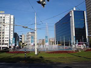
Hofplein
Town square in Rotterdam, the Netherlands
Distance: Approx. 713 meters
Latitude and longitude: 51.92430556,4.47780556
Hofplein is a major public town square in Rotterdam, the Netherlands. The square lies on a crossing of the Weena, the Schiekade and the Coolsingel. In the center of the square a large fountain is situated.

Bergweg
Distance: Approx. 556 meters
Latitude and longitude: 51.93555556,4.47638889
Bergweg is a street in Rotterdam, which connects Rotterdam with Bergschenhoek through Hillegersberg. Nowadays the Bergweg is a road in the neighborhood Oude Noorden between the Schiekade and Gordelweg. The buildings mostly dating from the early twentieth century.
FG Food Labs
Restaurant in Rotterdam, the Netherlands
Distance: Approx. 502 meters
Latitude and longitude: 51.926253,4.479472
FG Food Labs is a restaurant in Rotterdam by chef François Geurds. Since 2015, the restaurant has one Michelin star. GaultMillau awarded the restaurant 16.5 points out of a maximum of 20 points.
Weather in this IP's area
broken clouds
15 Celsius
14 Celsius
14 Celsius
15 Celsius
1019 hPa
89 %
1019 hPa
1019 hPa
10000 meters
6.69 m/s
220 degree
75 %
08:17:29
18:35:31